
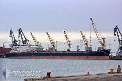
CHAYANEE NAREE
Bulk Carrier
Current Trip
| Time Travelled | 22 h, 27 mins |
|---|---|
| Remaining Time | --- |
| Distance Travelled | 237.56 nm |
| Remaining Distance | 19.96 nm |
| AVG Speed | 11.3 Noeuds |
| MAX Speed | 15 Noeuds |
| AVG Wind | 14.7 knots |
| MAX Wind | 23.8 knots |
| MIN Temp | 23.3°C / 73.94°F |
| MAX Temp | 25.3°C / 77.54°F |
| Tirant d eau | 6.8 m |
| Position reçue | 1 m depuis |
Current Position
| Longitude | -97.00291° |
|---|---|
| Latitude | 26.08657° |
| Etat | At anchor |
| Vitesse | 0.2 Noeuds |
| Parcours | 151° |
| Zone | Gulf of Mexico |
| Station | T-AIS |
| Position reçue | 1 m depuis |
Info
Information
The current position of CHAYANEE NAREE is in Gulf of Mexico with coordinates 26.08657° / -97.00291° as reported on 2024-04-16 20:22 by AIS to our vessel tracker app. The vessel's current speed is 0.2 Noeuds and is heading at the port of BROWNSVILLE. The estimated time of arrival as calculated by MyShipTracking vessel tracking app is 2024-04-16 05:00 LT
The vessel CHAYANEE NAREE (IMO: 9613434, MMSI: 566708000) is a Bulk Carrier that was built in 2012 ( 12 Age ). It's sailing under the flag of [SG] Singapore.
In this page you can find informations about the vessels current position, last detected port calls, and current voyage information. If the vessels is not in coverage by AIS you will find the latest position.
The current position of CHAYANEE NAREE is detected by our AIS receivers and we are not responsible for the reliability of the data. The last position was recorded while the vessel was in Coverage by the Ais receivers of our vessel tracking app.
The current draught of CHAYANEE NAREE as reported by AIS is 6.8 meters
Weather
| Temperature | 23.3°C / 73.94°F |
|---|---|
| Wind Speed | 11 knots |
| Direction | 123° ESE |
| Pressure | 1009.9 hPa |
| Humidity | 92.8 % |
| Cloud Coverage | 100 % |
Featured Company
Last Port Calls
| Port | Arrival | Departure | Time In Port |
|---|---|---|---|
| 2024-04-12 23:22 | 2024-04-15 21:56 | 2 d | |
| 2024-03-03 01:53 | |||
| 2024-02-23 21:33 | 2024-02-28 03:33 | 4 d | |
| 2024-02-16 08:07 | 2024-02-19 00:20 | 2 d | |
| 2024-02-10 09:44 | 2024-02-11 22:42 | 1 d | |
| 2024-02-01 21:58 |
Most Visited Ports (Last year)
| Port | Arrivals | |
|---|---|---|
| 1 | ||
| 1 | ||
| 1 | ||
| 1 | ||
| 1 | ||
| 1 |
Last Trips
| Origin | Departure | Destination | Arrival | Distance | |
|---|---|---|---|---|---|
| 2024-02-28 12:33 | 2024-03-03 10:53 | 323.68 nm | |||
| 2024-02-19 09:20 | 2024-02-24 06:33 | 648.06 nm | |||
| 2024-02-12 06:42 | 2024-02-16 17:07 | 471.81 nm | |||
| 2024-02-02 05:58 | 2024-02-10 17:44 | 870.76 nm |
Events
| Heure | Evenement | Détails | Position/ Destination | Info |
|---|---|---|---|---|
| 2024-04-16 18:16 | Etat Changé | At anchor Under way using engine |
26.08732 / -97.00213
BROWNSVILLE
|
Vitesse: 0.1 kn Parcours: 165° |
| 2024-04-16 16:42 | Arret | 21.26 nm, East of BROWNSVILLE |
26.08743 / -97.00150
BROWNSVILLE
|
Vitesse: 0.3 kn Parcours: 163° |
| 2024-04-16 16:41 | Changement d'ETA | 2024/04/16 06:30 2024/04/16 05:00 |
26.08749 / -97.00140
BROWNSVILLE
|
Vitesse: 0.5 kn Parcours: 165° |
| 2024-04-16 15:48 | Etat Changé | Under way using engine Default |
26.10088 / -96.92503
BROWNSVILLE
|
Vitesse: 10.3 kn Parcours: 324° |
| 2024-04-16 15:43 | Etat Changé | Default Under way using engine |
26.08860 / -96.91472
BROWNSVILLE
|
Vitesse: 9.3 kn Parcours: 326.6° |
| 2024-04-16 15:29 | Etat Changé | Under way using engine Default |
26.05585 / -96.89157
BROWNSVILLE
|
Vitesse: 10.3 kn Parcours: 328° |
| 2024-04-16 15:21 | Etat Changé | Default Under way using engine |
26.03632 / -96.87834
BROWNSVILLE
|
Vitesse: 10.9 kn Parcours: 324.6° |
| 2024-04-16 15:08 | Changement de zone | United States part of the Gulf of Mexico Mexican part of the Gulf of Mexico |
26.00085 / -96.85651
Gulf of Mexico
|
Vitesse: 11.3 kn Parcours: 337.3° |
| 2024-04-16 14:56 | Etat Changé | Under way using engine Default |
25.96695 / -96.84148
BROWNSVILLE
|
Vitesse: 11.4 kn Parcours: 338° |
| 2024-04-16 14:46 | Dans la zone couverte |
25.96695 / -96.84148
Gulf of Mexico
|
Vitesse: 11.4 kn Parcours: 340.4° |