
CHARISMA
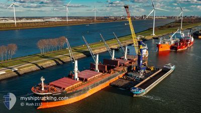
Bulk Carrier
Current Trip
| Time Travelled | 12 days |
|---|---|
| Remaining Time | 9 h, 48 mins |
| Distance Travelled | 2488.54 nm |
| Remaining Distance | 91.78 nm |
| AVG Speed | 9.8 Noeuds |
| MAX Speed | 12.8 Noeuds |
| AVG Wind | 10 knots |
| MAX Wind | 18 knots |
| MIN Temp | 8.9°C / 48.02°F |
| MAX Temp | 22.7°C / 72.86°F |
| Tirant d eau | 12.6 m |
| Position reçue | 1 m depuis |
Current Position
| Longitude | -9.35350° |
|---|---|
| Latitude | 41.04577° |
| Etat | Under way using engine |
| Vitesse | 9.3 Noeuds |
| Parcours | 10° |
| Zone | North Atlantic Ocean |
| Station | T-AIS |
| Position reçue | 1 m depuis |
Info
Information
The current position of CHARISMA is in North Atlantic Ocean with coordinates 41.04577° / -9.35350° as reported on 2024-04-18 09:03 by AIS to our vessel tracker app. The vessel's current speed is 9.3 Noeuds and is heading at the port of MARIN. The estimated time of arrival as calculated by MyShipTracking vessel tracking app is 2024-04-18 18:52 LT
The vessel CHARISMA (IMO: 9409132, MMSI: 538007730) is a Bulk Carrier that was built in 2010 ( 14 Age ). It's sailing under the flag of [MH] Marshall Is.
In this page you can find informations about the vessels current position, last detected port calls, and current voyage information. If the vessels is not in coverage by AIS you will find the latest position.
The current position of CHARISMA is detected by our AIS receivers and we are not responsible for the reliability of the data. The last position was recorded while the vessel was in Coverage by the Ais receivers of our vessel tracking app.
The current draught of CHARISMA as reported by AIS is 12.6 meters
Weather
| Temperature | 15.5°C / 59.9°F |
|---|---|
| Wind Speed | 8 knots |
| Direction | 82° E |
| Pressure | 1014.8 hPa |
| Humidity | 69.9 % |
| Cloud Coverage | 96 % |
Featured Company
Last Trips
| Origin | Departure | Destination | Arrival | Distance | |
|---|---|---|---|---|---|
| 2024-03-23 10:28 | 2024-03-29 15:41 | 229.88 nm | |||
| 2024-02-23 19:27 | 2024-03-19 12:35 | 5589.61 nm | |||
| 2024-02-19 12:05 | 2024-02-22 01:22 | 616.16 nm | |||
| 2024-02-14 23:03 | 2024-02-15 11:13 | 109.01 nm | |||
| 2024-01-18 03:12 | 2024-02-13 00:09 | 4358.39 nm |
Events
| Heure | Evenement | Détails | Position/ Destination | Info |
|---|---|---|---|---|
| 2024-04-17 11:31 | Changement d'ETA | 2024/04/18 19:00 2024/04/19 02:00 |
37.78108 / -9.57448
ESMPG
|
Vitesse: 9.5 kn Parcours: 347° |
| 2024-04-16 20:46 | Changement de zone | Portuguese part of the North Atlantic Ocean Spanish part of the North Atlantic Ocean |
36.29463 / -7.44385
North Atlantic Ocean
ESMPG
|
Vitesse: 10.8 kn Parcours: 289° |
| 2024-04-16 18:34 | Etat Changé | Under way using engine Default |
36.16827 / -6.96580
ESMPG
|
Vitesse: 11 kn Parcours: 287° |
| 2024-04-16 18:29 | Etat Changé | Default Under way using engine |
36.16360 / -6.94837
ESMPG
|
Vitesse: 11 kn Parcours: 287° |
| 2024-04-16 14:07 | Detecté en mer | Spanish part of the North Atlantic Ocean |
35.96803 / -5.98142
North Atlantic Ocean
ESMPG
|
Vitesse: 10.6 kn Parcours: 271° |
| 2024-04-16 13:19 | Etat Changé | Under way using engine Default |
35.96433 / -5.80528
ESMPG
|
Vitesse: 10.3 kn Parcours: 272° |
| 2024-04-16 13:17 | Etat Changé | Default Under way using engine |
35.96413 / -5.80050
ESMPG
|
Vitesse: 10.1 kn Parcours: 270° |
| 2024-04-16 12:32 | Etat Changé | Under way using engine Default |
35.96662 / -5.65198
ESMPG
|
Vitesse: 22.2 kn Parcours: 281.9° |
| 2024-04-16 12:31 | Etat Changé | Default Under way using engine |
35.96652 / -5.64662
ESMPG
|
Vitesse: 9.3 kn Parcours: 271° |
| 2024-04-16 10:49 | Changement de zone | Spanish part of the Strait of Gibraltar Gibraltarian part of the Strait of Gibraltar |
36.01177 / -5.33452
Strait of Gibraltar
ESMPG
|
Vitesse: 9.3 kn Parcours: 262° |