
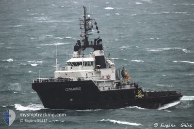
CENTAURUS
Tug
Current Trip
| Time Travelled | 2 days |
|---|---|
| Remaining Time | 4 days |
| Distance Travelled | 381.42 nm |
| Remaining Distance | 915.28 nm |
| AVG Speed | 7.6 Noeuds |
| MAX Speed | 9.3 Noeuds |
| AVG Wind | 12.5 knots |
| MAX Wind | 18.8 knots |
| MIN Temp | 10.4°C / 50.72°F |
| MAX Temp | 12°C / 53.6°F |
| Tirant d eau | 5.4 m |
| Position reçue | 29 m depuis |
Current Position
| Longitude | -4.76465° |
|---|---|
| Latitude | 49.08488° |
| Etat | Restricted manoeuverability |
| Vitesse | 8.3 Noeuds |
| Parcours | 60.1° |
| Zone | English Channel |
| Station | T-AIS |
| Position reçue | 29 m depuis |
Info
Information
The current position of CENTAURUS is in English Channel with coordinates 49.08488° / -4.76465° as reported on 2024-04-24 19:16 by AIS to our vessel tracker app. The vessel's current speed is 8.3 Noeuds and is heading at the port of AALBORG. The estimated time of arrival as calculated by MyShipTracking vessel tracking app is 2024-04-28 22:24 LT
The vessel CENTAURUS (IMO: 9433755, MMSI: 305820000) is a Tug that was built in 2009 ( 15 Age ). It's sailing under the flag of [AG] Antigua Barbuda.
In this page you can find informations about the vessels current position, last detected port calls, and current voyage information. If the vessels is not in coverage by AIS you will find the latest position.
The current position of CENTAURUS is detected by our AIS receivers and we are not responsible for the reliability of the data. The last position was recorded while the vessel was in Coverage by the Ais receivers of our vessel tracking app.
The current draught of CENTAURUS as reported by AIS is 5.4 meters
Weather
| Temperature | 10.9°C / 51.62°F |
|---|---|
| Wind Speed | 11 knots |
| Direction | 325° NW |
| Pressure | 1015.1 hPa |
| Humidity | 74.7 % |
| Cloud Coverage | 19 % |
Featured Company
Events
| Heure | Evenement | Détails | Position/ Destination | Info |
|---|---|---|---|---|
| 2024-04-24 19:26 | Etat Changé | Default Restricted manoeuverability |
49.09614 / -4.73511
DKAAL
|
Vitesse: 8.3 kn Parcours: 60.1° |
| 2024-04-24 19:13 | Changement de zone | French part of the English Channel French part of the Celtic Sea |
49.08071 / -4.77583
English Channel
DKAAL
|
Vitesse: 8.2 kn Parcours: 59.3° |
| 2024-04-24 19:11 | Etat Changé | Restricted manoeuverability Default |
49.07939 / -4.77932
DKAAL
|
Vitesse: 8.3 kn Parcours: 61° |
| 2024-04-24 18:26 | Etat Changé | Default Restricted manoeuverability |
49.02913 / -4.92502
DKAAL
|
Vitesse: 9.2 kn Parcours: 61.6° |
| 2024-04-24 18:09 | Etat Changé | Restricted manoeuverability Default |
49.00876 / -4.98313
DKAAL
|
Vitesse: 9.1 kn Parcours: 62° |
| 2024-04-24 17:57 | Dans la zone couverte |
49.00876 / -4.98313
Celtic Sea
DKAAL
|
Vitesse: 9.1 kn Parcours: 60.7° |
|
| 2024-04-24 17:11 | Etat Changé | Default Restricted manoeuverability |
48.93233 / -5.17422
DKAAL
|
Vitesse: 9.2 kn Parcours: 58.7° |
| 2024-04-24 17:03 | Etat Changé | Restricted manoeuverability Default |
48.92111 / -5.19846
DKAAL
|
Vitesse: 9.2 kn Parcours: 58° |
| 2024-04-24 17:03 | Hors de la zone couverte |
48.92111 / -5.19846
Celtic Sea
DKAAL
|
Vitesse: 9.2 kn Parcours: 58.7° |
|
| 2024-04-24 16:56 | Etat Changé | Default Restricted manoeuverability |
48.91093 / -5.22296
DKAAL
|
Vitesse: 9.3 kn Parcours: 58.1° |