
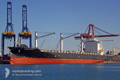
MSC GLORY R
Container Ship
Current Trip
MX ESE
| Time Travelled | 2 days |
|---|---|
| Remaining Time | --- |
| Distance Travelled | 701.78 nm |
| Remaining Distance | --- |
| AVG Speed | 12.9 Noeuds |
| MAX Speed | 13.9 Noeuds |
| AVG Wind | 7.6 knots |
| MAX Wind | 13 knots |
| MIN Temp | 26.1°C / 78.98°F |
| MAX Temp | 30°C / 86°F |
| Tirant d eau | 9.2 m |
| Position reçue | 1 d depuis |
Current Position
| Longitude | -96.55786° |
|---|---|
| Latitude | 15.28352° |
| Etat | Under way using engine |
| Vitesse | 12.2 Noeuds |
| Parcours | 289.3° |
| Zone | North Pacific Ocean |
| Station | T-AIS |
| Position reçue | 1 d depuis |
Info
Information
The current position of MSC GLORY R is in North Pacific Ocean with coordinates 15.28352° / -96.55786° as reported on 2024-04-16 23:15 by AIS to our vessel tracker app. The vessel's current speed is 12.2 Noeuds
The vessel MSC GLORY R (IMO: 9210062, MMSI: 636016417) is a Container Ship that was built in 2000 ( 24 Age ). It's sailing under the flag of [LR] Liberia.
In this page you can find informations about the vessels current position, last detected port calls, and current voyage information. If the vessels is not in coverage by AIS you will find the latest position.
The current position of MSC GLORY R is detected by our AIS receivers and we are not responsible for the reliability of the data. The last position was recorded while the vessel was in Coverage by the Ais receivers of our vessel tracking app.
The current draught of MSC GLORY R as reported by AIS is 9.2 meters
Weather
| Temperature | 26.4°C / 79.52°F |
|---|---|
| Wind Speed | 9 knots |
| Direction | 268° W |
| Pressure | 1009.2 hPa |
| Humidity | 78.3 % |
| Cloud Coverage | 78 % |
Featured Company
Last Port Calls
| Port | Arrival | Departure | Time In Port |
|---|---|---|---|
| 2024-04-15 03:15 | 2024-04-15 16:06 | 12 h | |
| 2024-04-12 04:48 | 2024-04-12 17:00 | 12 h | |
| 2024-04-07 13:14 | 2024-04-08 01:45 | 12 h | |
| 2024-04-01 19:40 | 2024-04-02 20:20 | 1 d | |
| 2024-03-28 09:33 | 2024-03-29 04:14 | 18 h | |
| 2024-03-26 11:39 | 2024-03-26 18:49 | 7 h | |
| 2024-03-18 02:34 | |||
| 2024-03-12 07:02 | 2024-03-12 12:54 | 5 h | |
| 2024-03-10 08:49 | 2024-03-10 22:02 | 13 h | |
| 2024-03-01 12:09 | 2024-03-03 21:41 | 2 d |
Most Visited Ports (Last year)
| Port | Arrivals | |
|---|---|---|
| 17 | ||
| 16 | ||
| 16 | ||
| 13 | ||
| 7 | ||
| 3 |
Last Trips
| Origin | Departure | Destination | Arrival | Distance | |
|---|---|---|---|---|---|
| 2024-04-12 12:00 | 2024-04-14 21:15 | 725.49 nm | |||
| 2024-04-07 18:45 | 2024-04-11 23:48 | 1241.65 nm | |||
| 2024-04-02 14:20 | 2024-04-07 06:14 | 1115.31 nm | |||
| 2024-03-28 22:14 | 2024-04-01 13:40 | 884.68 nm | |||
| 2024-03-26 12:49 | 2024-03-28 03:33 | 7.19 nm | |||
| 2024-03-17 19:34 | 2024-03-26 05:39 | 1988.54 nm | |||
| 2024-03-10 16:02 | 2024-03-12 01:02 | 169.27 nm | |||
| 2024-03-03 15:41 | 2024-03-10 02:49 | 1003.44 nm | |||
| 2024-02-26 13:58 | 2024-03-01 06:09 | 870.18 nm | |||
| 2024-02-17 23:01 | 2024-02-25 09:15 | 332.81 nm |
Events
| Heure | Evenement | Détails | Position/ Destination | Info |
|---|---|---|---|---|
| 2024-04-16 23:15 | Etat Changé | Default Under way using engine |
15.28472 / -96.56119
MX ESE
|
Vitesse: 12.2 kn Parcours: 289.3° |
| 2024-04-16 23:15 | Hors de la zone couverte |
15.28352 / -96.55786
North Pacific Ocean
|
Vitesse: 12.2 kn Parcours: 289.3° |
|
| 2024-04-16 23:10 | Etat Changé | Under way using engine Default |
15.27760 / -96.54109
MX ESE
|
Vitesse: 12.3 kn Parcours: 289° |
| 2024-04-16 23:10 | Dans la zone couverte |
15.27760 / -96.54109
North Pacific Ocean
|
Vitesse: 12.3 kn Parcours: 290.6° |
|
| 2024-04-16 21:58 | Etat Changé | Default Under way using engine |
15.19813 / -96.29831
MX ESE
|
Vitesse: 12.6 kn Parcours: 286.5° |
| 2024-04-16 21:53 | Etat Changé | Under way using engine Default |
15.19340 / -96.28254
MX ESE
|
Vitesse: 12.7 kn Parcours: 286° |
| 2024-04-16 21:53 | Hors de la zone couverte |
15.19340 / -96.28254
North Pacific Ocean
|
Vitesse: 12.6 kn Parcours: 286.5° |
|
| 2024-04-16 21:44 | Etat Changé | Default Under way using engine |
15.18440 / -96.25200
MX ESE
|
Vitesse: 12.7 kn Parcours: 287.6° |
| 2024-04-16 18:48 | Etat Changé | Under way using engine Default |
14.97997 / -95.64464
MX ESE
|
Vitesse: 12.3 kn Parcours: 296° |
| 2024-04-16 18:11 | Etat Changé | Default Under way using engine |
14.92354 / -95.52675
MX ESE
|
Vitesse: 12.5 kn Parcours: 295.8° |