
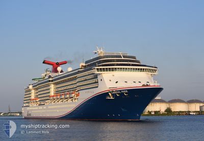
CARNIVAL PRIDE
Passengers Ship
Current Trip
BAHPCS
| Time Travelled | 14 h, 49 mins |
|---|---|
| Remaining Time | --- |
| Distance Travelled | 268.33 nm |
| Remaining Distance | --- |
| AVG Speed | 18.6 Noeuds |
| MAX Speed | 20 Noeuds |
| AVG Wind | 14.4 knots |
| MAX Wind | 18.4 knots |
| MIN Temp | 22.7°C / 72.86°F |
| MAX Temp | 25.8°C / 78.44°F |
| Tirant d eau | 8.2 m |
| Position reçue | 2 h, 31 m depuis |
Current Position
| Longitude | -74.60856° |
|---|---|
| Latitude | 23.32867° |
| Etat | Under way using engine |
| Vitesse | 18.6 Noeuds |
| Parcours | 297.5° |
| Zone | North Atlantic Ocean |
| Station | T-AIS |
| Position reçue | 2 h, 31 m depuis |
Info
Information
The current position of CARNIVAL PRIDE is in North Atlantic Ocean with coordinates 23.32867° / -74.60856° as reported on 2024-04-25 06:22 by AIS to our vessel tracker app. The vessel's current speed is 18.6 Noeuds
The vessel CARNIVAL PRIDE (IMO: 9223954, MMSI: 354215000) is a Passengers Ship that was built in 2001 ( 23 Age ). It's sailing under the flag of [PA] Panama.
In this page you can find informations about the vessels current position, last detected port calls, and current voyage information. If the vessels is not in coverage by AIS you will find the latest position.
The current position of CARNIVAL PRIDE is detected by our AIS receivers and we are not responsible for the reliability of the data. The last position was recorded while the vessel was in Coverage by the Ais receivers of our vessel tracking app.
The current draught of CARNIVAL PRIDE as reported by AIS is 8.2 meters
Weather
| Temperature | 22.7°C / 72.86°F |
|---|---|
| Wind Speed | 11 knots |
| Direction | 67° ENE |
| Pressure | 1017.9 hPa |
| Humidity | 74 % |
| Cloud Coverage | 99 % |
Featured Company
Last Port Calls
| Port | Arrival | Departure | Time In Port |
|---|---|---|---|
| 2024-04-24 10:28 | 2024-04-24 18:05 | 7 h | |
| 2024-04-21 09:12 | 2024-04-21 23:16 | 14 h | |
| 2024-04-17 11:00 | 2024-04-17 21:02 | 10 h | |
| 2024-04-16 13:12 | 2024-04-16 22:28 | 9 h | |
| 2024-04-15 10:18 | 2024-04-15 20:26 | 10 h | |
| 2024-04-13 11:16 | 2024-04-13 21:04 | 9 h | |
| 2024-04-10 11:10 | 2024-04-10 21:31 | 10 h | |
| 2024-04-07 08:51 | 2024-04-07 23:15 | 14 h | |
| 2024-04-05 12:16 | 2024-04-05 21:30 | 9 h | |
| 2024-04-04 12:42 | 2024-04-04 22:29 | 9 h |
Most Visited Ports (Last year)
| Port | Arrivals | |
|---|---|---|
| 22 | ||
| 17 | ||
| 16 | ||
| 11 | ||
| 10 | ||
| 7 |
Last Trips
| Origin | Departure | Destination | Arrival | Distance | |
|---|---|---|---|---|---|
| 2024-04-21 19:16 | 2024-04-24 06:28 | 981.41 nm | |||
| 2024-04-17 17:02 | 2024-04-21 05:12 | 1346.45 nm | |||
| 2024-04-16 18:28 | 2024-04-17 07:00 | 127.15 nm | |||
| 2024-04-15 16:26 | 2024-04-16 09:12 | 308.85 nm | |||
| 2024-04-13 17:04 | 2024-04-15 06:18 | 570.03 nm | |||
| 2024-04-10 16:31 | 2024-04-13 07:16 | 676.08 nm | |||
| 2024-04-07 19:15 | 2024-04-10 06:10 | 967.59 nm | |||
| 2024-04-05 16:30 | 2024-04-07 04:51 | 515.79 nm | |||
| 2024-04-04 16:29 | 2024-04-05 07:16 | 218.35 nm | |||
| 2024-04-03 18:30 | 2024-04-04 06:42 | 131.51 nm |
Events
| Heure | Evenement | Détails | Position/ Destination | Info |
|---|---|---|---|---|
| 2024-04-25 06:28 | Etat Changé | Default Under way using engine |
23.34500 / -74.63666
BAHPCS
|
Vitesse: 18.6 kn Parcours: 297.5° |
| 2024-04-25 06:22 | Hors de la zone couverte |
23.32867 / -74.60856
North Atlantic Ocean
BAHPCS
|
Vitesse: 18.6 kn Parcours: 297.5° |
|
| 2024-04-25 06:20 | Etat Changé | Under way using engine Default |
23.32531 / -74.60083
BAHPCS
|
Vitesse: 18.4 kn Parcours: 294° |
| 2024-04-25 06:20 | Dans la zone couverte |
23.32867 / -74.60856
North Atlantic Ocean
BAHPCS
|
Vitesse: 18.6 kn Parcours: 297.5° |
|
| 2024-04-24 22:57 | Etat Changé | Default Under way using engine |
22.29833 / -72.36667
BAHPCS
|
Vitesse: 18.3 kn Parcours: 298.2° |
| 2024-04-24 22:50 | Hors de la zone couverte |
22.28286 / -72.33451
North Atlantic Ocean
BAHPCS
|
Vitesse: 18.3 kn Parcours: 298.2° |
|
| 2024-04-24 22:43 | Changement de zone | Bahamas part of the North Atlantic Ocean Turks and Caicos part of the North Atlantic Ocean |
22.26547 / -72.29929
North Atlantic Ocean
BAHPCS
|
Vitesse: 18.5 kn Parcours: 298.2° |
| 2024-04-24 21:07 | Changement d'ETA | 2024/04/25 13:00 2024/04/24 13:00 |
22.02714 / -71.83785
BAHPCS
|
Vitesse: 18.2 kn Parcours: 299.3° |
| 2024-04-24 20:08 | Etat Changé | Under way using engine Default |
21.88088 / -71.55609
BAHPCS
|
Vitesse: 19 kn Parcours: 300° |
| 2024-04-24 20:08 | Dans la zone couverte |
21.88088 / -71.55609
North Atlantic Ocean
|
Vitesse: 18.6 kn Parcours: 299.8° |