
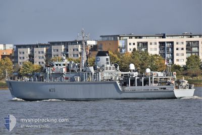
HMS HURWORTH
Tug
Current Trip
| Trip Time | 7 h, 24 mins |
|---|---|
| Trip Distance | 19.63 nm |
| AVG Speed | 5.6 Noeuds |
| MAX Speed | 8.2 Noeuds |
| Tirant d eau | 3.2 m |
| AVG Wind | 5.5 knots |
| MAX Wind | 6.9 knots |
| MIN Temp | 6.1°C / 42.98°F |
| MAX Temp | 9°C / 48.2°F |
| Position reçue | 3 h, 42 m depuis |
Current Position
| Longitude | -4.82067° |
|---|---|
| Latitude | 56.05698° |
| Etat | Under way using engine |
| Vitesse | |
| Parcours | 3° |
| Zone | Inner Seas off the West Coast of Scotland |
| Station | T-AIS |
| Position reçue | 3 h, 42 m depuis |
Info
Information
The current position of HMS HURWORTH is in Inner Seas off the West Coast of Scotland with coordinates 56.05698° / -4.82067° as reported on 2024-04-25 16:14 by AIS to our vessel tracker app. The vessel's current speed is 0 Noeuds and is currently inside the port of FASLANE.
The vessel HMS HURWORTH (IMO: 8401509, MMSI: 234600000) is a Tug that was built in 1986 ( 38 Age ). It's sailing under the flag of [GB] United Kingdom.
In this page you can find informations about the vessels current position, last detected port calls, and current voyage information. If the vessels is not in coverage by AIS you will find the latest position.
The current position of HMS HURWORTH is detected by our AIS receivers and we are not responsible for the reliability of the data. The last position was recorded while the vessel was in Coverage by the Ais receivers of our vessel tracking app.
The current draught of HMS HURWORTH as reported by AIS is 3.2 meters
Weather
| Temperature | 7.4°C / 45.32°F |
|---|---|
| Wind Speed | 5 knots |
| Direction | 76° ENE |
| Pressure | 1003.5 hPa |
| Humidity | 60.2 % |
| Cloud Coverage | 100 % |
Featured Company
Last Port Calls
| Port | Arrival | Departure | Time In Port |
|---|---|---|---|
| 2024-04-25 15:28 | |||
| 2024-04-15 07:58 | 2024-04-25 08:04 | 10 d | |
| 2024-04-10 10:32 | 2024-04-10 11:04 | 32 m | |
| 2024-04-10 07:23 | |||
| 2024-03-07 14:45 | 2024-03-08 08:17 | 17 h | |
| 2024-03-07 09:02 | 2024-03-07 09:25 | 22 m | |
| 2024-03-07 08:33 | 2024-03-07 08:49 | 16 m | |
| 2024-03-07 08:27 | |||
| 2024-03-04 11:13 | 2024-03-04 11:19 | 6 m | |
| 2024-03-02 16:17 |
Most Visited Ports (Last year)
| Port | Arrivals | |
|---|---|---|
| 19 | ||
| 18 | ||
| 12 | ||
| 1 | ||
| 1 | ||
| 1 |
Last Trips
| Origin | Departure | Destination | Arrival | Distance | |
|---|---|---|---|---|---|
| 2024-04-25 09:04 | 2024-04-25 16:28 | 19.63 nm | |||
| 2024-04-10 08:23 | 2024-04-15 08:58 | 667.59 nm | |||
| 2024-04-10 08:23 | 2024-04-10 11:32 | 33.06 nm | |||
| 2024-03-07 09:25 | 2024-03-07 14:45 | 36.10 nm | |||
| 2024-03-07 08:49 | 2024-03-07 09:02 | 0.35 nm | |||
| 2024-03-07 08:27 | 2024-03-07 08:33 | 0.19 nm | |||
| 2024-03-02 16:17 | 2024-03-04 11:13 | 205.12 nm | |||
| 2024-02-11 15:05 | 2024-02-14 15:56 | 219.66 nm | |||
| 2024-01-29 10:53 | 2024-02-05 14:51 | 242.83 nm |
Events
| Heure | Evenement | Détails | Position/ Destination | Info |
|---|---|---|---|---|
| 2024-04-25 16:14 | Hors de la zone couverte |
56.05698 / -4.82067
Inner Seas off the West Coast of Scotland
[GB] FASLANE
|
Vitesse: Parcours: 0° |
|
| 2024-04-25 15:35 | Arret |
56.05681 / -4.82069
[GB] FASLANE
|
Vitesse: Parcours: 14° |
|
| 2024-04-25 15:28 | Port d'arrivée |
|
56.05441 / -4.82245
[GB] FASLANE
|
Vitesse: 3.7 kn Parcours: 21° |
| 2024-04-25 14:28 | Démarrage | 1.42 nm, North East of GOUROCK |
55.97126 / -4.77323
MARITIME SECURITY
|
Vitesse: 3.1 kn Parcours: 359° |
| 2024-04-25 14:05 | Arret | 1.57 nm, North West of GREENOCK |
55.97112 / -4.76764
MARITIME SECURITY
|
Vitesse: Parcours: 336° |
| 2024-04-25 13:50 | Démarrage | 1.49 nm, North East of GOUROCK |
55.97232 / -4.77165
MARITIME SECURITY
|
Vitesse: 3.1 kn Parcours: 199° |
| 2024-04-25 13:18 | Arret | 1.7 nm, North East of GOUROCK |
55.97414 / -4.76638
MARITIME SECURITY
|
Vitesse: Parcours: 133° |
| 2024-04-25 13:08 | Démarrage | 1.57 nm, North East of GOUROCK |
55.97697 / -4.77392
MARITIME SECURITY
|
Vitesse: 3.8 kn Parcours: 122° |
| 2024-04-25 13:02 | Arret | 1.46 nm, North East of GOUROCK |
55.97577 / -4.77640
MARITIME SECURITY
|
Vitesse: Parcours: 306° |
| 2024-04-25 12:48 | Démarrage | 1.26 nm, North East of GOUROCK |
55.97267 / -4.78001
MARITIME SECURITY
|
Vitesse: 3.1 kn Parcours: 72° |