
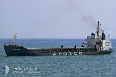
BRAVE WARRIOR
Bulk Carrier
Current Trip
| Time Travelled | 9 h, 33 mins |
|---|---|
| Remaining Time | --- |
| Distance Travelled | 0.44 nm |
| Remaining Distance | --- |
| AVG Speed | --- |
| MAX Speed | --- |
| AVG Wind | 4.7 knots |
| MAX Wind | 4.8 knots |
| MIN Temp | 15.3°C / 59.54°F |
| MAX Temp | 15.5°C / 59.9°F |
| Tirant d eau | 6.9 m |
| Position reçue | 8 d depuis |
Current Position
| Longitude | 29.14925° |
|---|---|
| Latitude | 41.47066° |
| Etat | Under way using engine |
| Vitesse | 9 Noeuds |
| Parcours | 347.2° |
| Zone | Black Sea |
| Station | T-AIS |
| Position reçue | 8 d depuis |
Info
Information
The current position of BRAVE WARRIOR is in Black Sea with coordinates 41.47066° / 29.14925° as reported on 2024-04-17 06:49 by AIS to our vessel tracker app. The vessel's current speed is 9 Noeuds
The vessel BRAVE WARRIOR (IMO: 7208728, MMSI: 450542000) is a Bulk Carrier that was built in 1972 ( 52 Age ). It's sailing under the flag of [LB] Lebanon.
In this page you can find informations about the vessels current position, last detected port calls, and current voyage information. If the vessels is not in coverage by AIS you will find the latest position.
The current position of BRAVE WARRIOR is detected by our AIS receivers and we are not responsible for the reliability of the data. The last position was recorded while the vessel was in Coverage by the Ais receivers of our vessel tracking app.
The current draught of BRAVE WARRIOR as reported by AIS is 6.9 meters
Weather
| Temperature | 21.6°C / 70.88°F |
|---|---|
| Wind Speed | 4 knots |
| Direction | 130° SE |
| Pressure | 1003.8 hPa |
| Humidity | 40.9 % |
| Cloud Coverage | 100 % |
Featured Company
Last Port Calls
| Port | Arrival | Departure | Time In Port |
|---|---|---|---|
| 2024-04-22 11:08 | 2024-04-25 05:38 | 2 d | |
| 2024-04-20 15:38 | 2024-04-20 15:42 | 3 m | |
| 2024-04-20 15:17 | |||
| 2024-04-12 05:13 | 2024-04-12 22:43 | 17 h | |
| 2024-04-06 14:17 | 2024-04-10 12:29 | 3 d | |
| 2024-03-19 04:44 | |||
| 2024-03-11 05:07 | 2024-03-11 14:34 | 9 h | |
| 2024-03-05 04:50 | 2024-03-08 13:51 | 3 d | |
| 2024-03-04 17:45 | 2024-03-05 04:15 | 10 h | |
| 2024-02-22 08:57 |
Last Trips
| Origin | Departure | Destination | Arrival | Distance | |
|---|---|---|---|---|---|
| 2024-04-20 18:42 | 2024-04-22 14:08 | 16.74 nm | |||
| 2024-04-20 18:17 | 2024-04-20 18:38 | 2.71 nm | |||
| 2024-04-10 15:29 | 2024-04-12 08:13 | 310.34 nm | |||
| 2024-03-19 06:44 | 2024-04-06 17:17 | 1329.07 nm | |||
| 2024-03-08 15:51 | 2024-03-11 07:07 | 495.39 nm | |||
| 2024-03-05 06:15 | 2024-03-05 06:50 | 1.92 nm | |||
| 2024-02-22 10:57 | 2024-03-04 19:45 | 1182.79 nm | |||
| 2024-02-10 08:09 | 2024-02-17 16:00 | 364.38 nm | |||
| 2024-01-24 12:25 | 2024-02-08 17:36 | 460.93 nm |
Events
| Heure | Evenement | Détails | Position/ Destination | Info |
|---|---|---|---|---|
| 2024-04-25 05:54 | Arret | 1.26 nm, North West of RENI |
45.45385 / 28.27082
ROGAL
|
Vitesse: Parcours: 299° |
| 2024-04-25 05:38 | PORT DE DEPART |
|
45.44862 / 28.27671
ROGAL
|
Vitesse: 4 kn Parcours: 330° |
| 2024-04-25 05:27 | Démarrage |
45.43807 / 28.28520
[UA] RENI
|
Vitesse: 3.6 kn Parcours: 340° |
|
| 2024-04-22 11:08 | Port d'arrivée |
|
45.43371 / 28.28808
[UA] RENI
|
Vitesse: 0.7 kn Parcours: 10° |
| 2024-04-20 15:42 | PORT DE DEPART |
|
45.42224 / 28.16189
ROGAL
|
Vitesse: 11.5 kn Parcours: 45° |
| 2024-04-20 15:38 | Port d'arrivée |
|
45.41938 / 28.04138
[RO] GALATI
|
Vitesse: 10.5 kn Parcours: 2° |
| 2024-04-20 15:23 | Démarrage | 3.06 nm, South of GALATI |
45.37537 / 28.02677
ROGAL
|
Vitesse: 10.5 kn Parcours: 2° |
| 2024-04-20 15:17 | PORT DE DEPART |
|
45.37537 / 28.02677
ROGAL
|
Vitesse: 0.5 kn Parcours: 133° |
| 2024-04-17 06:51 | Etat Changé | Default Under way using engine |
41.47639 / 29.14748
ROGAL
|
Vitesse: 9 kn Parcours: 347.2° |
| 2024-04-17 06:49 | Hors de la zone couverte |
41.47066 / 29.14925
Black Sea
ROGAL
|
Vitesse: 9 kn Parcours: 347.2° |