
BOYNE
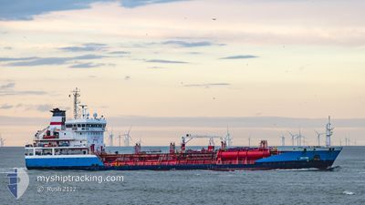
Oil/Chemical Tanker
Current Trip
| Time Travelled | 2 days |
|---|---|
| Remaining Time | 18 h, 30 mins |
| Distance Travelled | 584.50 nm |
| Remaining Distance | 180.71 nm |
| AVG Speed | 10.3 Noeuds |
| MAX Speed | 13.8 Noeuds |
| AVG Wind | 15.6 knots |
| MAX Wind | 22 knots |
| MIN Temp | 8°C / 46.4°F |
| MAX Temp | 11.7°C / 53.06°F |
| Tirant d eau | 6.3 m |
| Position reçue | 1 m depuis |
Current Position
| Longitude | 1.33962° |
|---|---|
| Latitude | 50.68293° |
| Etat | Under way using engine |
| Vitesse | 8.1 Noeuds |
| Parcours | 44° |
| Zone | English Channel |
| Station | T-AIS |
| Position reçue | 1 m depuis |
Info
Information
The current position of BOYNE is in English Channel with coordinates 50.68293° / 1.33962° as reported on 2024-04-19 17:38 by AIS to our vessel tracker app. The vessel's current speed is 8.1 Noeuds and is heading at the port of AMSTERDAM. The estimated time of arrival as calculated by MyShipTracking vessel tracking app is 2024-04-20 12:09 LT
The vessel BOYNE (IMO: 9369928, MMSI: 256247000) is a Oil/Chemical Tanker that was built in 2007 ( 17 Age ). It's sailing under the flag of [MT] Malta.
In this page you can find informations about the vessels current position, last detected port calls, and current voyage information. If the vessels is not in coverage by AIS you will find the latest position.
The current position of BOYNE is detected by our AIS receivers and we are not responsible for the reliability of the data. The last position was recorded while the vessel was in Coverage by the Ais receivers of our vessel tracking app.
The current draught of BOYNE as reported by AIS is 6.3 meters
Weather
| Temperature | 10.3°C / 50.54°F |
|---|---|
| Wind Speed | 21 knots |
| Direction | 9° N |
| Pressure | 1018.5 hPa |
| Humidity | 67.5 % |
| Cloud Coverage | 97 % |
Featured Company
Last Port Calls
| Port | Arrival | Departure | Time In Port |
|---|---|---|---|
| 2024-04-16 17:21 | 2024-04-17 12:24 | 19 h | |
| 2024-04-14 15:38 | 2024-04-15 05:10 | 13 h | |
| 2024-04-11 18:11 | 2024-04-11 18:21 | 10 m | |
| 2024-04-05 12:08 | 2024-04-06 11:50 | 23 h | |
| 2024-03-29 21:14 | 2024-03-31 06:34 | 1 d | |
| 2024-03-22 09:08 | 2024-03-22 17:13 | 8 h | |
| 2024-03-19 21:46 | 2024-03-20 10:59 | 13 h | |
| 2024-03-15 15:17 | 2024-03-16 21:18 | 1 d | |
| 2024-03-12 20:36 | 2024-03-13 23:25 | 1 d | |
| 2024-03-08 11:12 | 2024-03-10 04:59 | 1 d |
Last Trips
| Origin | Departure | Destination | Arrival | Distance | |
|---|---|---|---|---|---|
| 2024-04-15 06:10 | 2024-04-16 18:21 | 239.35 nm | |||
| 2024-04-11 19:21 | 2024-04-14 16:38 | 466.60 nm | |||
| 2024-04-06 12:50 | 2024-04-11 19:11 | 324.15 nm | |||
| 2024-03-31 08:34 | 2024-04-05 13:08 | 806.80 nm | |||
| 2024-03-22 18:13 | 2024-03-29 22:14 | 1215.37 nm | |||
| 2024-03-20 11:59 | 2024-03-22 10:08 | 521.03 nm | |||
| 2024-03-16 22:18 | 2024-03-19 22:46 | 548.61 nm | |||
| 2024-03-13 23:25 | 2024-03-15 16:17 | 284.86 nm | |||
| 2024-03-10 04:59 | 2024-03-12 20:36 | 128.77 nm | |||
| 2024-03-06 15:42 | 2024-03-08 11:12 | 292.32 nm |
Events
| Heure | Evenement | Détails | Position/ Destination | Info |
|---|---|---|---|---|
| 2024-04-19 17:02 | Etat Changé | Under way using engine Default |
50.63163 / 1.23153
NL AMS
|
Vitesse: 9.5 kn Parcours: 50° |
| 2024-04-19 17:00 | Etat Changé | Default Under way using engine |
50.62862 / 1.22560
NL AMS
|
Vitesse: 9.5 kn Parcours: 51° |
| 2024-04-19 17:00 | Etat Changé | Under way using engine Default |
50.62781 / 1.22410
NL AMS
|
Vitesse: 9.3 kn Parcours: 51° |
| 2024-04-19 17:00 | Changement de zone | French part of the English Channel United Kingdom part of the English Channel |
50.62781 / 1.22410
English Channel
NL AMS
|
Vitesse: 9.5 kn Parcours: 51° |
| 2024-04-19 16:56 | Dans la zone couverte |
50.62781 / 1.22410
English Channel
NL AMS
|
Vitesse: 9.5 kn Parcours: 51° |
|
| 2024-04-19 14:46 | Hors de la zone couverte |
50.45143 / .76490
English Channel
NL AMS
|
Vitesse: 10.1 kn Parcours: 75° |
|
| 2024-04-19 08:21 | Detecté en mer | United Kingdom part of the English Channel |
50.16728 / -.90483
English Channel
NL AMS
|
Vitesse: 11.5 kn Parcours: 74° |
| 2024-04-19 08:21 | Etat Changé | Under way using engine Default |
50.16728 / -.90483
NL AMS
|
Vitesse: 12.1 kn Parcours: 75° |
| 2024-04-19 08:21 | Dans la zone couverte |
50.16728 / -.90483
English Channel
NL AMS
|
Vitesse: 11.5 kn Parcours: 74° |
|
| 2024-04-19 04:29 | Hors de la zone couverte |
49.95967 / -2.16240
English Channel
NL AMS
|
Vitesse: 13.6 kn Parcours: 76° |