
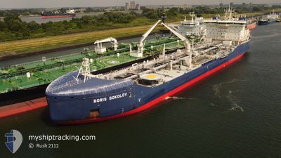
BORIS SOKOLOV
Tanker
Current Trip
FOR ORDERS
| Time Travelled | 8 days |
|---|---|
| Remaining Time | --- |
| Distance Travelled | 1900.05 nm |
| Remaining Distance | --- |
| AVG Speed | 11.7 Noeuds |
| MAX Speed | 15.3 Noeuds |
| AVG Wind | 10 knots |
| MAX Wind | 32.9 knots |
| MIN Temp | -25.2°C / -13.36°F |
| MAX Temp | 4.7°C / 40.46°F |
| Tirant d eau | 12 m |
| Position reçue | 1 m depuis |
Current Position
| Longitude | 4.03004° |
|---|---|
| Latitude | 62.94603° |
| Etat | Under way using engine |
| Vitesse | 13.2 Noeuds |
| Parcours | 202.6° |
| Zone | Norwegian Sea |
| Station | T-AIS |
| Position reçue | 1 m depuis |
Info
Information
The current position of BORIS SOKOLOV is in Norwegian Sea with coordinates 62.94603° / 4.03004° as reported on 2024-04-25 05:35 by AIS to our vessel tracker app. The vessel's current speed is 13.2 Noeuds
The vessel BORIS SOKOLOV (IMO: 9817315, MMSI: 209387000) is a Tanker It's sailing under the flag of [CY] Cyprus.
In this page you can find informations about the vessels current position, last detected port calls, and current voyage information. If the vessels is not in coverage by AIS you will find the latest position.
The current position of BORIS SOKOLOV is detected by our AIS receivers and we are not responsible for the reliability of the data. The last position was recorded while the vessel was in Coverage by the Ais receivers of our vessel tracking app.
The current draught of BORIS SOKOLOV as reported by AIS is 12 meters
Weather
| Temperature | 4.7°C / 40.46°F |
|---|---|
| Wind Speed | 7 knots |
| Direction | 37° NE |
| Pressure | 1006.1 hPa |
| Humidity | 64.8 % |
| Cloud Coverage | 97 % |
Featured Company
Last Port Calls
| Port | Arrival | Departure | Time In Port |
|---|---|---|---|
| 2024-04-15 23:54 | 2024-04-17 01:46 | 1 d | |
| 2024-04-03 08:21 | 2024-04-04 22:56 | 1 d | |
| 2024-03-20 07:07 | |||
| 2024-03-05 02:55 | 2024-03-06 23:20 | 1 d | |
| 2024-02-23 07:34 | 2024-02-24 16:16 | 1 d | |
| 2024-02-07 05:02 | 2024-02-09 04:12 | 1 d |
Last Trips
| Origin | Departure | Destination | Arrival | Distance | |
|---|---|---|---|---|---|
| 2024-04-05 00:56 | 2024-04-16 04:54 | 2643.85 nm | |||
| 2024-03-07 00:20 | 2024-03-20 12:07 | 2652.89 nm | |||
| 2024-02-24 21:16 | 2024-03-05 03:55 | 2630.65 nm | |||
| 2024-02-09 05:12 | 2024-02-23 12:34 | 2640.05 nm | |||
| 2024-01-29 00:14 | 2024-02-07 06:02 | 2666.43 nm |
Events
| Heure | Evenement | Détails | Position/ Destination | Info |
|---|---|---|---|---|
| 2024-04-25 01:46 | Etat Changé | Under way using engine Default |
63.71855 / 4.81758
FOR ORDERS
|
Vitesse: 14 kn Parcours: 205° |
| 2024-04-25 01:27 | Etat Changé | Default Under way using engine |
63.78333 / 4.88500
FOR ORDERS
|
Vitesse: 13.5 kn Parcours: 202.9° |
| 2024-04-25 01:22 | Etat Changé | Under way using engine Default |
63.80101 / 4.90081
FOR ORDERS
|
Vitesse: 13 kn Parcours: 204° |
| 2024-04-25 01:15 | Dans la zone couverte |
63.80101 / 4.90081
Norwegian Sea
FOR ORDERS
|
Vitesse: 13.5 kn Parcours: 202.9° |
|
| 2024-04-24 07:39 | Etat Changé | Default Under way using engine |
67.27834 / 8.74833
FOR ORDERS
|
Vitesse: 13.6 kn Parcours: 203.8° |
| 2024-04-24 07:12 | Hors de la zone couverte |
67.37244 / 8.85838
Norwegian Sea
FOR ORDERS
|
Vitesse: 13.6 kn Parcours: 203.8° |
|
| 2024-04-24 02:06 | Etat Changé | Under way using engine Default |
68.34374 / 10.40993
FOR ORDERS
|
Vitesse: 13.4 kn Parcours: 225° |
| 2024-04-24 01:54 | Etat Changé | Default Under way using engine |
68.37670 / 10.50581
FOR ORDERS
|
Vitesse: 13.4 kn Parcours: 226.8° |
| 2024-04-23 11:03 | Etat Changé | Under way using engine Default |
70.60009 / 17.45128
FOR ORDERS
|
Vitesse: 13.3 kn Parcours: 218° |
| 2024-04-23 10:56 | Etat Changé | Default Under way using engine |
70.62032 / 17.49659
FOR ORDERS
|
Vitesse: 13.2 kn Parcours: 221.2° |