
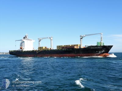
MSC RESILIENT III
Container Ship
Current Trip
| Time Travelled | 1 day |
|---|---|
| Remaining Time | 2 days |
| Distance Travelled | 595.58 nm |
| Remaining Distance | 1255.45 nm |
| AVG Speed | 17.3 Noeuds |
| MAX Speed | 19 Noeuds |
| AVG Wind | 15.9 knots |
| MAX Wind | 25 knots |
| MIN Temp | 14.1°C / 57.38°F |
| MAX Temp | 16.6°C / 61.88°F |
| Tirant d eau | 11.9 m |
| Position reçue | 2023-12-20 08:47 |
Current Position
| Longitude | 17.89068° |
|---|---|
| Latitude | -33.53528° |
| Etat | Under way using engine |
| Vitesse | 17.1 Noeuds |
| Parcours | 303.8° |
| Zone | South Atlantic Ocean |
| Station | T-AIS |
| Position reçue | 2023-12-20 08:47 |
Info
Information
The current position of MSC RESILIENT III is in South Atlantic Ocean with coordinates -33.53528° / 17.89068° as reported on 2023-12-20 08:47 by AIS to our vessel tracker app. The vessel's current speed is 17.1 Noeuds and is heading at the port of LOBITO. The estimated time of arrival as calculated by MyShipTracking vessel tracking app is 2024-04-28 08:53 LT
The vessel MSC RESILIENT III (IMO: 9240873, MMSI: 636019443) is a Container Ship that was built in 2002 ( 22 Age ). It's sailing under the flag of [LR] Liberia.
In this page you can find informations about the vessels current position, last detected port calls, and current voyage information. If the vessels is not in coverage by AIS you will find the latest position.
The current position of MSC RESILIENT III is detected by our AIS receivers and we are not responsible for the reliability of the data. The last position was recorded while the vessel was in Coverage by the Ais receivers of our vessel tracking app.
The current draught of MSC RESILIENT III as reported by AIS is 11.9 meters
Weather
| Temperature | 16.4°C / 61.52°F |
|---|---|
| Wind Speed | 20 knots |
| Direction | 175° S |
| Pressure | 1019.4 hPa |
| Humidity | 88.6 % |
| Cloud Coverage | 39 % |
Featured Company
Last Port Calls
| Port | Arrival | Departure | Time In Port |
|---|---|---|---|
| 2024-04-23 12:27 | 2024-04-24 02:27 | 13 h | |
| 2024-04-16 12:16 | 2024-04-18 09:21 | 1 d | |
| 2024-04-14 05:08 | 2024-04-15 03:44 | 22 h | |
| 2024-04-11 15:13 | 2024-04-13 05:30 | 1 d | |
| 2024-04-05 22:15 | 2024-04-07 15:53 | 1 d | |
| 2024-03-30 06:12 | 2024-03-31 10:48 | 1 d | |
| 2024-03-26 08:03 | 2024-03-28 20:55 | 2 d | |
| 2024-03-23 10:34 | 2024-03-24 16:06 | 1 d | |
| 2024-03-21 08:19 | 2024-03-22 10:19 | 1 d | |
| 2024-03-09 15:14 | 2024-03-11 03:53 | 1 d |
Most Visited Ports (Last year)
| Port | Arrivals | |
|---|---|---|
| 8 | ||
| 5 | ||
| 4 | ||
| 4 | ||
| 4 | ||
| 4 |
Last Trips
| Origin | Departure | Destination | Arrival | Distance | |
|---|---|---|---|---|---|
| 2024-04-18 10:21 | 2024-04-23 14:27 | 535.25 nm | |||
| 2024-04-15 04:44 | 2024-04-16 13:16 | 422.16 nm | |||
| 2024-04-13 06:30 | 2024-04-14 06:08 | 301.92 nm | |||
| 2024-04-07 15:53 | 2024-04-11 16:13 | 1009.01 nm | |||
| 2024-03-31 12:48 | 2024-04-05 22:15 | 1924.25 nm | |||
| 2024-03-28 21:55 | 2024-03-30 08:12 | 527.41 nm | |||
| 2024-03-24 17:06 | 2024-03-26 09:03 | 417.15 nm | |||
| 2024-03-22 11:19 | 2024-03-23 11:34 | 309.23 nm | |||
| 2024-03-11 03:53 | 2024-03-21 09:19 | 1039.43 nm | |||
| 2024-02-29 22:20 | 2024-03-09 15:14 | 1912.20 nm |
Events
| Heure | Evenement | Détails | Position/ Destination | Info |
|---|---|---|---|---|
| 2024-04-24 02:27 | PORT DE DEPART |
|
-22.92954 / 14.49732
AOLOB
|
Vitesse: 8.4 kn Parcours: 1° |
| 2024-04-24 02:15 | Démarrage |
-22.95165 / 14.49016
[NA] WALVIS BAY
|
Vitesse: 4.3 kn Parcours: 72° |
|
| 2024-04-23 13:02 | Arret |
-22.95038 / 14.48598
[NA] WALVIS BAY
|
Vitesse: Parcours: 24° |
|
| 2024-04-23 12:27 | Port d'arrivée |
|
-22.93715 / 14.49709
[NA] WALVIS BAY
|
Vitesse: 4.4 kn Parcours: 185° |
| 2024-04-23 10:43 | Démarrage | 6.74 nm, North of WALVIS BAY |
-22.82681 / 14.49913
AOLOB
|
Vitesse: 5.5 kn Parcours: 241° |
| 2024-04-19 15:51 | Arret | 7.04 nm, North of WALVIS BAY |
-22.82195 / 14.50446
AOLOB
|
Vitesse: 0.2 kn Parcours: 200° |
| 2024-04-18 09:30 | Démarrage | 2.28 nm, North West of NAMIBE |
-15.16562 / 12.10745
AOLOB
|
Vitesse: 13.2 kn Parcours: 294° |
| 2024-04-18 09:21 | PORT DE DEPART |
|
-15.16562 / 12.10745
AOLOB
|
Vitesse: Parcours: 156° |
| 2024-04-16 12:16 | Arret |
-15.19060 / 12.13167
[AO] NAMIBE
|
Vitesse: 0.1 kn Parcours: 159° |
|
| 2024-04-16 12:16 | Port d'arrivée |
|
-15.19060 / 12.13167
[AO] NAMIBE
|
Vitesse: 1.9 kn Parcours: 184° |