
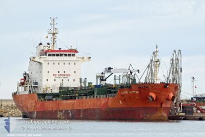
BOMAR JUPITER
Oil/Chemical Tanker
Current Trip
| Time Travelled | 28 days |
|---|---|
| Remaining Time | --- |
| Distance Travelled | 2969.42 nm |
| Remaining Distance | 190.63 nm |
| AVG Speed | 9.9 Noeuds |
| MAX Speed | 13.9 Noeuds |
| AVG Wind | 12.2 knots |
| MAX Wind | 36.2 knots |
| MIN Temp | 4.2°C / 39.56°F |
| MAX Temp | 21.8°C / 71.24°F |
| Tirant d eau | 5.8 m |
| Position reçue | 5 d depuis |
Current Position
| Longitude | 28.76457° |
|---|---|
| Latitude | 40.95410° |
| Etat | At anchor |
| Vitesse | 0.1 Noeuds |
| Parcours | 61° |
| Zone | Sea of Marmara |
| Station | T-AIS |
| Position reçue | 5 d depuis |
Info
Information
The current position of BOMAR JUPITER is in Sea of Marmara with coordinates 40.95410° / 28.76457° as reported on 2024-04-19 14:16 by AIS to our vessel tracker app. The vessel's current speed is 0.1 Noeuds and is heading at the port of CONSTANTA. The estimated time of arrival as calculated by MyShipTracking vessel tracking app is 2024-04-11 17:00 LT
The vessel BOMAR JUPITER (IMO: 9438169, MMSI: 538006367) is a Oil/Chemical Tanker that was built in 2009 ( 15 Age ). It's sailing under the flag of [MH] Marshall Is.
In this page you can find informations about the vessels current position, last detected port calls, and current voyage information. If the vessels is not in coverage by AIS you will find the latest position.
The current position of BOMAR JUPITER is detected by our AIS receivers and we are not responsible for the reliability of the data. The last position was recorded while the vessel was in Coverage by the Ais receivers of our vessel tracking app.
The current draught of BOMAR JUPITER as reported by AIS is 5.8 meters
Weather
| Temperature | 13.5°C / 56.3°F |
|---|---|
| Wind Speed | 13 knots |
| Direction | 40° NE |
| Pressure | 1011 hPa |
| Humidity | 76.7 % |
| Cloud Coverage | 99 % |
Featured Company
Last Port Calls
| Port | Arrival | Departure | Time In Port |
|---|---|---|---|
| 2024-03-27 18:17 | 2024-03-27 18:27 | 9 m | |
| 2024-03-23 13:49 | 2024-03-25 18:57 | 2 d | |
| 2024-03-23 12:51 | 2024-03-23 13:12 | 20 m | |
| 2024-03-19 07:30 | 2024-03-20 13:30 | 1 d | |
| 2024-02-23 00:31 | 2024-02-28 11:26 | 5 d | |
| 2024-02-20 11:05 | |||
| 2024-02-14 07:12 | 2024-02-15 07:05 | 23 h | |
| 2024-02-03 23:27 | 2024-02-05 05:37 | 1 d |
Most Visited Ports (Last year)
| Port | Arrivals | |
|---|---|---|
| 4 | ||
| 4 | ||
| 3 | ||
| 3 | ||
| 3 | ||
| 3 |
Last Trips
| Origin | Departure | Destination | Arrival | Distance | |
|---|---|---|---|---|---|
| 2024-03-25 19:57 | 2024-03-27 18:17 | 404.81 nm | |||
| 2024-03-23 14:12 | 2024-03-23 14:49 | 4.69 nm | |||
| 2024-03-20 14:30 | 2024-03-23 13:51 | 84.41 nm | |||
| 2024-02-28 12:26 | 2024-03-19 08:30 | 2488.66 nm | |||
| 2024-02-20 12:05 | 2024-02-23 01:31 | 725.14 nm | |||
| 2024-02-05 06:37 | 2024-02-14 08:12 | 2106.00 nm | |||
| 2024-01-31 21:48 | 2024-02-04 00:27 | 96.15 nm |
Events
| Heure | Evenement | Détails | Position/ Destination | Info |
|---|---|---|---|---|
| 2024-04-19 14:16 | Etat Changé | Default At anchor |
40.95410 / 28.76457
ROCND
|
Vitesse: 0.1 kn Parcours: 61° |
| 2024-04-19 14:16 | Hors de la zone couverte |
40.95410 / 28.76457
Sea of Marmara
|
Vitesse: 0.1 kn Parcours: 336° |
|
| 2024-04-15 11:33 | Etat Changé | At anchor Default |
40.95512 / 28.76468
ROCND
|
Vitesse: Parcours: 130° |
| 2024-04-15 11:30 | Etat Changé | Default At anchor |
40.95507 / 28.76472
ROCND
|
Vitesse: 0.1 kn Parcours: 130° |