
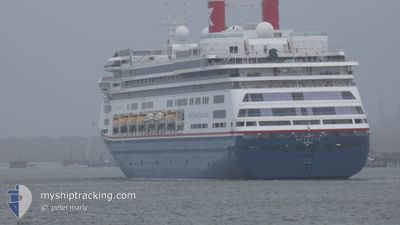
BOLETTE
Passengers Ship
Current Trip
PT PRV
| Time Travelled | 4 days |
|---|---|
| Remaining Time | --- |
| Distance Travelled | 1366.97 nm |
| Remaining Distance | --- |
| AVG Speed | 14.1 Noeuds |
| MAX Speed | 17.8 Noeuds |
| AVG Wind | 12.8 knots |
| MAX Wind | 19 knots |
| MIN Temp | 8.6°C / 47.48°F |
| MAX Temp | 16.1°C / 60.98°F |
| Tirant d eau | 8.1 m |
| Position reçue | 3 d depuis |
Current Position
| Longitude | -9.24550° |
|---|---|
| Latitude | 50.37913° |
| Etat | Under way using engine |
| Vitesse | 15.4 Noeuds |
| Parcours | 227.1° |
| Zone | Celtic Sea |
| Station | T-AIS |
| Position reçue | 3 d depuis |
Info
Information
The current position of BOLETTE is in Celtic Sea with coordinates 50.37913° / -9.24550° as reported on 2024-04-20 14:14 by AIS to our vessel tracker app. The vessel's current speed is 15.4 Noeuds
The vessel BOLETTE (IMO: 9188037, MMSI: 311000986) is a Passengers Ship that was built in 2000 ( 24 Age ). It's sailing under the flag of [BS] Bahamas.
In this page you can find informations about the vessels current position, last detected port calls, and current voyage information. If the vessels is not in coverage by AIS you will find the latest position.
The current position of BOLETTE is detected by our AIS receivers and we are not responsible for the reliability of the data. The last position was recorded while the vessel was in Coverage by the Ais receivers of our vessel tracking app.
The current draught of BOLETTE as reported by AIS is 8.1 meters
Weather
| Temperature | 15.8°C / 60.44°F |
|---|---|
| Wind Speed | 12 knots |
| Direction | 36° NE |
| Pressure | 1028.2 hPa |
| Humidity | 85.9 % |
| Cloud Coverage | 100 % |
Featured Company
Last Port Calls
| Port | Arrival | Departure | Time In Port |
|---|---|---|---|
| 2024-04-19 04:31 | 2024-04-19 16:50 | 12 h | |
| 2024-04-17 05:52 | 2024-04-17 17:41 | 11 h | |
| 2024-04-15 06:37 | 2024-04-15 13:37 | 6 h | |
| 2024-04-13 06:38 | 2024-04-13 16:06 | 9 h | |
| 2024-04-06 06:48 | 2024-04-06 15:02 | 8 h | |
| 2024-04-04 03:55 | 2024-04-04 16:28 | 12 h | |
| 2024-04-02 04:50 | 2024-04-03 14:18 | 1 d | |
| 2024-04-01 04:41 | 2024-04-01 17:19 | 12 h | |
| 2024-03-30 05:51 | 2024-03-31 05:50 | 23 h | |
| 2024-03-28 05:35 | 2024-03-28 20:33 | 14 h |
Last Trips
| Origin | Departure | Destination | Arrival | Distance | |
|---|---|---|---|---|---|
| 2024-04-17 18:41 | 2024-04-19 05:31 | 573.13 nm | |||
| 2024-04-15 14:37 | 2024-04-17 06:52 | 760.90 nm | |||
| 2024-04-13 17:06 | 2024-04-15 07:37 | 649.56 nm | |||
| 2024-04-06 17:02 | 2024-04-13 07:38 | 2029.26 nm | |||
| 2024-04-04 17:28 | 2024-04-06 08:48 | 451.91 nm | |||
| 2024-04-03 16:18 | 2024-04-04 04:55 | 203.97 nm | |||
| 2024-04-01 19:19 | 2024-04-02 06:50 | 140.95 nm | |||
| 2024-03-31 07:50 | 2024-04-01 06:41 | 298.19 nm | |||
| 2024-03-28 20:33 | 2024-03-30 06:51 | 545.03 nm | |||
| 2024-03-25 16:06 | 2024-03-28 05:35 | 945.31 nm |
Events
| Heure | Evenement | Détails | Position/ Destination | Info |
|---|---|---|---|---|
| 2024-04-23 08:33 | Arret |
38.71333 / -27.04833
PT PRV
|
Vitesse: Parcours: -1° |
|
| 2024-04-20 14:21 | Etat Changé | Default Under way using engine |
50.35833 / -9.27833
PT PRV
|
Vitesse: 15.4 kn Parcours: 227.1° |
| 2024-04-20 14:14 | Hors de la zone couverte |
50.37913 / -9.24550
Celtic Sea
PT PRV
|
Vitesse: 15.4 kn Parcours: 227.1° |
|
| 2024-04-20 13:40 | Etat Changé | Under way using engine Default |
50.47730 / -9.07487
PT PRV
|
Vitesse: 15 kn Parcours: 227° |
| 2024-04-20 12:54 | Etat Changé | Default Under way using engine |
50.61167 / -8.84167
PT PRV
|
Vitesse: 15.6 kn Parcours: 227.6° |
| 2024-04-20 04:32 | Changement de zone | Irish part of the Celtic Sea Irish part of the Irish Sea and St. George's Channel |
52.13890 / -6.19822
Celtic Sea
PT PRV
|
Vitesse: 15.2 kn Parcours: 228° |
| 2024-04-20 03:12 | Etat Changé | Under way using engine Default |
52.42562 / -5.89480
PT PRV
|
Vitesse: 16.4 kn Parcours: 210° |
| 2024-04-20 03:06 | Etat Changé | Default Under way using engine |
52.44828 / -5.87345
PT PRV
|
Vitesse: 16.7 kn Parcours: 212° |
| 2024-04-20 01:02 | Changement de zone | Irish part of the Irish Sea and St. George's Channel United Kingdom part of the Irish Sea and St. George's Channel |
52.94825 / -5.35938
Irish Sea and St. George's Channel
PT PRV
|
Vitesse: 17.4 kn Parcours: 211.9° |
| 2024-04-20 00:47 | Etat Changé | Under way using engine Default |
53.00877 / -5.29603
PT PRV
|
Vitesse: 17 kn Parcours: 213° |