
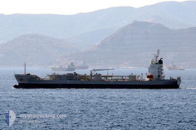
BLUE CIMENT 3
Cement Carrier
Current Trip
| Time Travelled | 2 days |
|---|---|
| Remaining Time | --- |
| Distance Travelled | 278.29 nm |
| Remaining Distance | --- |
| AVG Speed | 11 Noeuds |
| MAX Speed | 11.9 Noeuds |
| AVG Wind | 13.6 knots |
| MAX Wind | 21.3 knots |
| MIN Temp | 18.3°C / 64.94°F |
| MAX Temp | 22.4°C / 72.32°F |
| Tirant d eau | 4.7 m |
| Position reçue | 2 d depuis |
Current Position
| Longitude | --- |
|---|---|
| Latitude | --- |
| Etat | Under way using engine |
| Vitesse | 11.6 Noeuds |
| Parcours | 251.2° |
| Zone | Mediterranean Sea - Eastern Basin |
| Station | T-AIS |
| Position reçue | 2 d depuis |
Info
Information
The current position of BLUE CIMENT 3 is in Mediterranean Sea - Eastern Basin with coordinates 32.83724° / 34.62141° as reported on 2025-12-04 09:21 by AIS to our vessel tracker app. The vessel's current speed is 11.6 Noeuds
The vessel BLUE CIMENT 3 (IMO: 9577276, MMSI: 636020381) is a Cement Carrier that was built in 2010 ( 15 Age ). It's sailing under the flag of [LR] Liberia.
In this page you can find informations about the vessels current position, last detected port calls, and current voyage information. If the vessels is not in coverage by AIS you will find the latest position.
The current position of BLUE CIMENT 3 is detected by our AIS receivers and we are not responsible for the reliability of the data. The last position was recorded while the vessel was in Coverage by the Ais receivers of our vessel tracking app.
The current draught of BLUE CIMENT 3 as reported by AIS is 4.7 meters
Weather
| Temperature | 17.6°C / 63.68°F |
|---|---|
| Wind Speed | 21 knots |
| Direction | 238° WSW |
| Pressure | 1011.7 hPa |
| Humidity | 63.6 % |
| Cloud Coverage | --- |
Featured Company
Last Port Calls
| Port | Arrival | Departure | Time In Port |
|---|---|---|---|
| 2025-12-02 10:49 | 2025-12-04 09:24 | 1 d | |
| 2025-11-21 17:44 | 2025-11-27 12:28 | 5 d | |
| 2025-11-18 20:33 | 2025-11-20 15:50 | 1 d | |
| 2025-11-15 08:25 | |||
| 2025-11-05 06:56 | 2025-11-09 08:29 | 4 d | |
| 2025-10-27 15:17 | 2025-10-30 07:00 | 2 d | |
| 2025-10-23 22:39 | 2025-10-25 15:28 | 1 d | |
| 2025-10-18 14:32 | 2025-10-22 14:21 | 3 d | |
| 2025-10-15 20:26 | 2025-10-17 03:22 | 1 d | |
| 2025-10-10 11:45 | 2025-10-14 13:23 | 4 d |
Last Trips
| Origin | Departure | Destination | Arrival | Distance | |
|---|---|---|---|---|---|
| 2025-11-27 12:28 | 2025-12-02 10:49 | 297.02 nm | |||
| 2025-11-20 15:50 | 2025-11-21 17:44 | 279.35 nm | |||
| 2025-11-15 08:25 | 2025-11-18 20:33 | 681.67 nm | |||
| 2025-10-30 07:00 | 2025-11-05 06:56 | 1425.07 nm | |||
| 2025-10-25 15:28 | 2025-10-27 15:17 | 160.80 nm | |||
| 2025-10-22 14:21 | 2025-10-23 22:39 | 279.39 nm | |||
| 2025-10-17 03:22 | 2025-10-18 14:32 | 295.46 nm | |||
| 2025-10-14 13:23 | 2025-10-15 20:26 | 279.68 nm | |||
| 2025-10-08 18:43 | 2025-10-10 11:45 | 282.98 nm | |||
| 2025-10-03 09:35 | 2025-10-07 01:04 | 667.97 nm |
Events
| Heure | Evenement | Détails | Position/ Destination | Info |
|---|---|---|---|---|
| 2025-12-07 04:18 | Arret | 4.6 nm, North of ABU QIR |
31.39119 / 30.07098
EGAKI
|
Vitesse: 0.3 kn Parcours: 252° |
| 2025-12-07 04:15 | Démarrage | 4.63 nm, North of ABU QIR |
31.39162 / 30.07075
EGAKI
|
Vitesse: 3.1 kn Parcours: 233° |
| 2025-12-05 08:04 | Arret | 4.61 nm, North of ABU QIR |
31.39110 / 30.06853
EGAKI
|
Vitesse: 0.3 kn Parcours: 267° |
| 2025-12-04 09:29 | Etat Changé | Default Under way using engine |
32.82864 / 34.59158
EGAKI
|
Vitesse: 11.6 kn Parcours: 251.2° |
| 2025-12-04 09:21 | Hors de la zone couverte |
32.83724 / 34.62141
Mediterranean Sea - Eastern Basin
EGAKI
|
Vitesse: 11.6 kn Parcours: 251.2° |
|
| 2025-12-04 09:08 | Etat Changé | Under way using engine Default |
32.85053 / 34.66911
EGAKI
|
Vitesse: 11.8 kn Parcours: 251° |
| 2025-12-04 08:49 | Etat Changé | Default Under way using engine |
32.86832 / 34.73887
EGAKI
|
Vitesse: 11.9 kn Parcours: 252.6° |
| 2025-12-04 08:03 | Changement d'ETA | 2025/12/05 09:00 2025/12/05 11:00 |
32.88135 / 34.91600
EGAKI
|
Vitesse: 11.7 kn Parcours: 285.3° |
| 2025-12-04 07:56 | Changement d'ETA | 2025/12/05 11:00 2025/12/05 12:00 |
32.87562 / 34.94079
EGAKI
|
Vitesse: 11.6 kn Parcours: 285.1° |
| 2025-12-04 07:33 | Etat Changé | Under way using engine Moored |
32.85260 / 35.01730
EGAKI
|
Vitesse: 9.3 kn Parcours: 322.4° |