
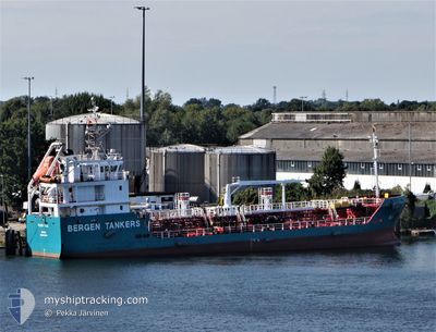
PELAGIA HORDAFOR
Tanker
Current Trip
| Time Travelled | 9 h, 0 mins |
|---|---|
| Remaining Time | 6 h, 40 mins |
| Distance Travelled | 67.30 nm |
| Remaining Distance | 60.18 nm |
| AVG Speed | 8.3 Noeuds |
| MAX Speed | 9.2 Noeuds |
| AVG Wind | 4.9 knots |
| MAX Wind | 8 knots |
| MIN Temp | --- |
| MAX Temp | 4.2°C / 39.56°F |
| Tirant d eau | 4.8 m |
| Position reçue | 2 m depuis |
Current Position
| Longitude | 14.88813° |
|---|---|
| Latitude | 68.22614° |
| Etat | Under way using engine |
| Vitesse | 9.2 Noeuds |
| Parcours | 228° |
| Zone | Norwegian Sea |
| Station | T-AIS |
| Position reçue | 2 m depuis |
Info
Information
The current position of PELAGIA HORDAFOR is in Norwegian Sea with coordinates 68.22614° / 14.88813° as reported on 2024-04-19 21:52 by AIS to our vessel tracker app. The vessel's current speed is 9.2 Noeuds and is heading at the port of BODOE. The estimated time of arrival as calculated by MyShipTracking vessel tracking app is 2024-04-20 04:34 LT
The vessel PELAGIA HORDAFOR (IMO: 9331098, MMSI: 258764000) is a Tanker It's sailing under the flag of [NO] Norway.
In this page you can find informations about the vessels current position, last detected port calls, and current voyage information. If the vessels is not in coverage by AIS you will find the latest position.
The current position of PELAGIA HORDAFOR is detected by our AIS receivers and we are not responsible for the reliability of the data. The last position was recorded while the vessel was in Coverage by the Ais receivers of our vessel tracking app.
The current draught of PELAGIA HORDAFOR as reported by AIS is 4.8 meters
Weather
| Temperature | 1.9°C / 35.42°F |
|---|---|
| Wind Speed | 8 knots |
| Direction | 92° E |
| Pressure | 1015 hPa |
| Humidity | 73.7 % |
| Cloud Coverage | 4 % |
Featured Company
Last Port Calls
| Port | Arrival | Departure | Time In Port |
|---|---|---|---|
| 2024-04-19 09:58 | 2024-04-19 12:54 | 2 h | |
| 2024-04-17 19:30 | 2024-04-17 22:05 | 2 h | |
| 2024-04-11 16:23 | 2024-04-12 02:20 | 9 h | |
| 2024-04-11 05:36 | 2024-04-11 07:20 | 1 h | |
| 2024-04-07 03:10 | 2024-04-08 06:52 | 1 d | |
| 2024-04-04 21:00 | 2024-04-05 01:00 | 4 h | |
| 2024-04-04 00:51 | 2024-04-04 12:14 | 11 h | |
| 2024-04-02 17:48 | 2024-04-03 11:34 | 17 h | |
| 2024-04-01 21:34 | 2024-04-02 04:10 | 6 h | |
| 2024-04-01 09:04 | 2024-04-01 09:24 | 19 m |
Last Trips
| Origin | Departure | Destination | Arrival | Distance | |
|---|---|---|---|---|---|
| 2024-04-18 00:05 | 2024-04-19 11:58 | 246.19 nm | |||
| 2024-04-12 04:20 | 2024-04-17 21:30 | 482.79 nm | |||
| 2024-04-11 09:20 | 2024-04-11 18:23 | 74.03 nm | |||
| 2024-04-08 08:52 | 2024-04-11 07:36 | 342.29 nm | |||
| 2024-04-05 03:00 | 2024-04-07 05:10 | 352.95 nm | |||
| 2024-04-04 14:14 | 2024-04-04 23:00 | 78.21 nm | |||
| 2024-04-03 13:34 | 2024-04-04 02:51 | 85.02 nm | |||
| 2024-04-02 06:10 | 2024-04-02 19:48 | 88.63 nm | |||
| 2024-04-01 11:24 | 2024-04-01 23:34 | 98.94 nm | |||
| 2024-04-01 00:38 | 2024-04-01 11:04 | 78.36 nm |
Events
| Heure | Evenement | Détails | Position/ Destination | Info |
|---|---|---|---|---|
| 2024-04-19 20:59 | Démarrage | 7.13 nm, South East of FISKEBOL |
68.33995 / 15.03312
FINNKERKA
|
Vitesse: 7.3 kn Parcours: 227.2° |
| 2024-04-19 20:12 | Arret | 7.21 nm, South East of FISKEBOL |
68.34082 / 15.04141
FINNKERKA
|
Vitesse: Parcours: 211° |
| 2024-04-19 13:37 | Changement de destination | FINNKERKA MYRE |
68.86017 / 14.83467
FINNKERKA
|
Vitesse: 8.8 kn Parcours: 267.7° |
| 2024-04-19 13:37 | Changement d'ETA | 2024/04/19 22:30 2024/04/19 14:00 |
68.86017 / 14.83467
FINNKERKA
|
Vitesse: 8.8 kn Parcours: 267.7° |
| 2024-04-19 12:54 | PORT DE DEPART |
|
68.91067 / 15.03846
MYRE
|
Vitesse: 5.5 kn Parcours: 242° |
| 2024-04-19 12:52 | Démarrage |
68.91242 / 15.04848
[NO] MYRE
|
Vitesse: 5.5 kn Parcours: 242° |
|
| 2024-04-19 10:02 | Arret |
68.91269 / 15.05376
[NO] MYRE
|
Vitesse: Parcours: 76° |
|
| 2024-04-19 09:58 | Port d'arrivée |
|
68.91269 / 15.05244
[NO] MYRE
|
Vitesse: 3.8 kn Parcours: 63° |
| 2024-04-18 20:32 | Changement de destination | MYRE TORTENNESET |
68.48953 / 17.34287
MYRE
|
Vitesse: 5.8 kn Parcours: 70.5° |
| 2024-04-18 20:32 | Changement d'ETA | 2024/04/19 14:00 2024/04/18 20:30 |
68.48953 / 17.34287
MYRE
|
Vitesse: 5.8 kn Parcours: 70.5° |