
BBC ECHO
General Cargo
Current Trip
PH SFS
| Time Travelled | 10 days |
|---|---|
| Remaining Time | --- |
| Distance Travelled | 1421.64 nm |
| Remaining Distance | --- |
| AVG Speed | 12.1 Noeuds |
| MAX Speed | 15.2 Noeuds |
| AVG Wind | 10.3 knots |
| MAX Wind | 24.8 knots |
| MIN Temp | 7.8°C / 46.04°F |
| MAX Temp | 22.6°C / 72.68°F |
| Tirant d eau | 7.2 m |
| Position reçue | 6 h, 45 m depuis |
Current Position
| Longitude | 118.20029° |
|---|---|
| Latitude | 38.79799° |
| Etat | Under way using engine |
| Vitesse | 13.7 Noeuds |
| Parcours | 285.3° |
| Zone | Yellow Sea |
| Station | T-AIS |
| Position reçue | 6 h, 45 m depuis |
Info
Information
The current position of BBC ECHO is in Yellow Sea with coordinates 38.79799° / 118.20029° as reported on 2024-04-16 12:49 by AIS to our vessel tracker app. The vessel's current speed is 13.7 Noeuds
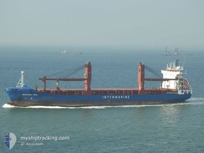
The vessel BBC ECHO (IMO: 9407603, MMSI: 305536000) is a General Cargo that was built in 2010 ( 14 Age ). It's sailing under the flag of [AG] Antigua Barbuda.
In this page you can find informations about the vessels current position, last detected port calls, and current voyage information. If the vessels is not in coverage by AIS you will find the latest position.
The current position of BBC ECHO is detected by our AIS receivers and we are not responsible for the reliability of the data. The last position was recorded while the vessel was in Coverage by the Ais receivers of our vessel tracking app.
The current draught of BBC ECHO as reported by AIS is 7.2 meters
Weather
| Temperature | 11.5°C / 52.7°F |
|---|---|
| Wind Speed | 10 knots |
| Direction | 181° S |
| Pressure | 1013.1 hPa |
| Humidity | 64.2 % |
| Cloud Coverage | 100 % |
Featured Company
Most Visited Ports (Last year)
| Port | Arrivals | |
|---|---|---|
| 2 | ||
| 2 | ||
| 2 | ||
| 2 | ||
| 2 | ||
| 1 |
Last Trips
| Origin | Departure | Destination | Arrival | Distance | |
|---|---|---|---|---|---|
| 2024-03-24 07:59 | 2024-04-05 11:04 | 4007.57 nm | |||
| 2024-01-18 22:51 | 2024-03-23 06:07 | 9588.88 nm |
Events
| Heure | Evenement | Détails | Position/ Destination | Info |
|---|---|---|---|---|
| 2024-04-16 13:31 | Arret | 16.8 nm, South East of TIANJIN |
38.85881 / 118.07023
PH SFS
|
Vitesse: 0.3 kn Parcours: 332° |
| 2024-04-16 13:07 | Etat Changé | Default Under way using engine |
38.84241 / 118.09741
PH SFS
|
Vitesse: 13.7 kn Parcours: 285.3° |
| 2024-04-16 12:49 | Etat Changé | Under way using engine Default |
38.79799 / 118.20029
PH SFS
|
Vitesse: 13.7 kn Parcours: 285° |
| 2024-04-16 12:49 | Hors de la zone couverte |
38.79799 / 118.20029
Yellow Sea
|
Vitesse: 13.7 kn Parcours: 285.3° |
|
| 2024-04-16 12:43 | Etat Changé | Default Under way using engine |
38.79934 / 118.19399
PH SFS
|
Vitesse: 13.7 kn Parcours: 285.2° |
| 2024-04-16 12:32 | Changement de zone | Chinese part of the Yellow Sea Philippines part of the South China Sea |
38.79114 / 118.24635
Yellow Sea
|
Vitesse: 13.3 kn Parcours: 262.3° |
| 2024-04-16 12:28 | Etat Changé | Under way using engine Default |
38.79830 / 118.26189
PH SFS
|
Vitesse: 13.5 kn Parcours: 229° |
| 2024-04-16 12:19 | Dans la zone couverte |
38.79114 / 118.24635
Yellow Sea
|
Vitesse: 13.3 kn Parcours: 262.3° |
|
| 2024-04-14 03:25 | Démarrage | 17.62 nm, South West of SHANGHAI |
31.09732 / 121.46055
PH SFS
|
Vitesse: 5.2 kn Parcours: 346° |
| 2024-04-11 11:09 | Arret | 17.71 nm, South West of SHANGHAI |
31.09554 / 121.46054
PH SFS
|
Vitesse: Parcours: 151° |