
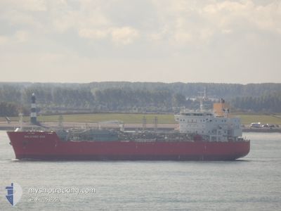
BALEARIC GAS
Tanker D
Current Trip
WESTHINDER ANCH.
| Time Travelled | 7 h, 34 mins |
|---|---|
| Remaining Time | --- |
| Distance Travelled | 44.15 nm |
| Remaining Distance | --- |
| AVG Speed | 9.4 Noeuds |
| MAX Speed | 12.4 Noeuds |
| AVG Wind | 20.4 knots |
| MAX Wind | 21 knots |
| MIN Temp | 7.8°C / 46.04°F |
| MAX Temp | 8.8°C / 47.84°F |
| Tirant d eau | 8.4 m |
| Position reçue | 1 m depuis |
Current Position
| Longitude | 2.60525° |
|---|---|
| Latitude | 51.44617° |
| Etat | At anchor |
| Vitesse | 0.2 Noeuds |
| Parcours | 10° |
| Zone | North Sea |
| Station | T-AIS |
| Position reçue | 1 m depuis |
Info
Information
The current position of BALEARIC GAS is in North Sea with coordinates 51.44617° / 2.60525° as reported on 2024-04-24 18:39 by AIS to our vessel tracker app. The vessel's current speed is 0.2 Noeuds
The vessel BALEARIC GAS (IMO: 9682253, MMSI: 219674000) is a Tanker D It's sailing under the flag of [DK] Denmark.
In this page you can find informations about the vessels current position, last detected port calls, and current voyage information. If the vessels is not in coverage by AIS you will find the latest position.
The current position of BALEARIC GAS is detected by our AIS receivers and we are not responsible for the reliability of the data. The last position was recorded while the vessel was in Coverage by the Ais receivers of our vessel tracking app.
The current draught of BALEARIC GAS as reported by AIS is 8.4 meters
Weather
| Temperature | 8.1°C / 46.58°F |
|---|---|
| Wind Speed | 19 knots |
| Direction | 343° NNW |
| Pressure | 1012.1 hPa |
| Humidity | 65 % |
| Cloud Coverage | 83 % |
Featured Company
Last Port Calls
| Port | Arrival | Departure | Time In Port |
|---|---|---|---|
| 2024-04-20 22:09 | 2024-04-24 11:06 | 3 d | |
| 2024-02-01 15:48 | 2024-02-06 14:00 | 4 d |
Last Trips
| Origin | Departure | Destination | Arrival | Distance | |
|---|---|---|---|---|---|
| 2024-02-06 07:00 | 2024-04-21 00:09 | 6679.57 nm | |||
| 2023-12-10 13:34 | 2024-02-01 08:48 | 4523.02 nm |
Events
| Heure | Evenement | Détails | Position/ Destination | Info |
|---|---|---|---|---|
| 2024-04-24 15:24 | Etat Changé | At anchor Under way using engine |
51.44852 / 2.60797
WESTHINDER ANCH.
|
Vitesse: Parcours: 0° |
| 2024-04-24 15:24 | Etat Changé | Under way using engine At anchor |
51.44853 / 2.60790
WESTHINDER ANCH.
|
Vitesse: 0.7 kn Parcours: 261° |
| 2024-04-24 15:24 | Etat Changé | At anchor Under way using engine |
51.44853 / 2.60790
WESTHINDER ANCH.
|
Vitesse: 0.8 kn Parcours: 262° |
| 2024-04-24 15:21 | Arret | 18.38 nm, North West of OOSTENDE |
51.44841 / 2.60722
WESTHINDER ANCH.
|
Vitesse: 0.1 kn Parcours: 297° |
| 2024-04-24 15:04 | Démarrage | 17.46 nm, North West of OOSTENDE |
51.44187 / 2.63204
WESTHINDER ANCH.
|
Vitesse: 7.4 kn Parcours: 305.4° |
| 2024-04-24 15:03 | Arret | 17.34 nm, North West of OOSTENDE |
51.44078 / 2.63477
WESTHINDER ANCH.
|
Vitesse: Parcours: 0° |
| 2024-04-24 15:02 | Démarrage | 17.17 nm, North West of OOSTENDE |
51.43906 / 2.63872
WESTHINDER ANCH.
|
Vitesse: 7.1 kn Parcours: 305.8° |
| 2024-04-24 15:01 | Arret | 17.05 nm, North West of OOSTENDE |
51.43786 / 2.64134
WESTHINDER ANCH.
|
Vitesse: Parcours: 0° |
| 2024-04-24 15:00 | Démarrage | 16.95 nm, North West of OOSTENDE |
51.43686 / 2.64356
WESTHINDER ANCH.
|
Vitesse: 7.9 kn Parcours: 307.4° |
| 2024-04-24 14:59 | Arret | 16.8 nm, North West of OOSTENDE |
51.43534 / 2.64664
WESTHINDER ANCH.
|
Vitesse: Parcours: 0° |