
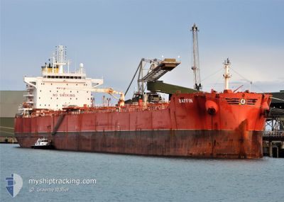
BAFFIN
Cargo
Current Trip
| Time Travelled | 21 days |
|---|---|
| Remaining Time | --- |
| Distance Travelled | 4546.81 nm |
| Remaining Distance | 594.49 nm |
| AVG Speed | 10.2 Noeuds |
| MAX Speed | 15 Noeuds |
| AVG Wind | 12.4 knots |
| MAX Wind | 28 knots |
| MIN Temp | 17.5°C / 63.5°F |
| MAX Temp | 29.4°C / 84.92°F |
| Tirant d eau | 8 m |
| Position reçue | 3 d depuis |
Current Position
| Longitude | 151.56321° |
|---|---|
| Latitude | -23.90451° |
| Etat | Under way using engine |
| Vitesse | 9.6 Noeuds |
| Parcours | 130.2° |
| Zone | Coral Sea |
| Station | T-AIS |
| Position reçue | 3 d depuis |
Info
Information
The current position of BAFFIN is in Coral Sea with coordinates -23.90451° / 151.56321° as reported on 2024-04-21 23:16 by AIS to our vessel tracker app. The vessel's current speed is 9.6 Noeuds and is heading at the port of PORT LATTA. The estimated time of arrival as calculated by MyShipTracking vessel tracking app is 2024-04-29 08:00 LT
The vessel BAFFIN (IMO: 9739496, MMSI: 538007098) is a Cargo It's sailing under the flag of [MH] Marshall Is.
In this page you can find informations about the vessels current position, last detected port calls, and current voyage information. If the vessels is not in coverage by AIS you will find the latest position.
The current position of BAFFIN is detected by our AIS receivers and we are not responsible for the reliability of the data. The last position was recorded while the vessel was in Coverage by the Ais receivers of our vessel tracking app.
The current draught of BAFFIN as reported by AIS is 8 meters
Weather
| Temperature | 17.6°C / 63.68°F |
|---|---|
| Wind Speed | 24 knots |
| Direction | 205° SSW |
| Pressure | 1021 hPa |
| Humidity | 73 % |
| Cloud Coverage | 100 % |
Featured Company
Last Port Calls
| Port | Arrival | Departure | Time In Port |
|---|---|---|---|
| 2024-04-02 01:16 | 2024-04-04 07:59 | 2 d | |
| 2024-02-29 20:41 | 2024-03-02 11:56 | 1 d | |
| 2024-02-18 19:30 | 2024-02-21 17:32 | 2 d |
Most Visited Ports (Last year)
| Port | Arrivals | |
|---|---|---|
| 3 | ||
| 2 | ||
| 2 | ||
| 1 | ||
| 1 | ||
| 1 |
Last Trips
| Origin | Departure | Destination | Arrival | Distance | |
|---|---|---|---|---|---|
| 2024-03-02 22:56 | 2024-04-02 09:16 | 5999.92 nm | |||
| 2024-02-22 03:32 | 2024-03-01 07:41 | 1286.52 nm | |||
| 2024-01-18 16:35 | 2024-02-19 05:30 | 5524.28 nm |
Events
| Heure | Evenement | Détails | Position/ Destination | Info |
|---|---|---|---|---|
| 2024-04-21 23:24 | Etat Changé | Default Under way using engine |
-23.91124 / 151.58195
AUPLA
|
Vitesse: 9.6 kn Parcours: 130.2° |
| 2024-04-21 23:16 | Hors de la zone couverte |
-23.90452 / 151.56321
Coral Sea
AUPLA
|
Vitesse: 9.6 kn Parcours: 130.2° |
|
| 2024-04-21 21:43 | Démarrage | 3.98 nm, South East of GLADSTONE |
-23.85075 / 151.31447
AUPLA
|
Vitesse: 3.4 kn Parcours: 79° |
| 2024-04-21 21:34 | Etat Changé | Under way using engine Moored |
-23.85187 / 151.31245
AUPLA
|
Vitesse: Parcours: 81° |
| 2024-04-21 21:26 | Etat Changé | Moored Default |
-23.85187 / 151.31245
AUPLA
|
Vitesse: Parcours: 81° |
| 2024-04-21 21:23 | Etat Changé | Default Moored |
-23.85187 / 151.31245
AUPLA
|
Vitesse: Parcours: 81° |
| 2024-04-21 21:16 | Etat Changé | Moored Default |
-23.85187 / 151.31245
AUPLA
|
Vitesse: Parcours: -1° |
| 2024-04-21 21:14 | Etat Changé | Default Moored |
-23.85167 / 151.31166
AUPLA
|
Vitesse: Parcours: 81° |
| 2024-04-21 21:05 | Etat Changé | Moored Default |
-23.85187 / 151.31244
AUPLA
|
Vitesse: Parcours: 81° |
| 2024-04-21 21:02 | Etat Changé | Default Moored |
-23.85187 / 151.31244
AUPLA
|
Vitesse: Parcours: 81° |