
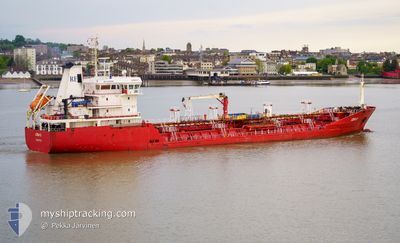
AZRA THERESA
Oil/Chemical Tanker
Current Trip
| Time Travelled | 3 days |
|---|---|
| Remaining Time | 6 h, 58 mins |
| Distance Travelled | 803.62 nm |
| Remaining Distance | 94.21 nm |
| AVG Speed | 10 Noeuds |
| MAX Speed | 12.1 Noeuds |
| AVG Wind | 17.7 knots |
| MAX Wind | 30 knots |
| MIN Temp | 3.6°C / 38.48°F |
| MAX Temp | 7.8°C / 46.04°F |
| Tirant d eau | 5.2 m |
| Position reçue | 1 h, 42 m depuis |
Current Position
| Longitude | 3.76757° |
|---|---|
| Latitude | 52.38993° |
| Etat | Under way using engine |
| Vitesse | 10.6 Noeuds |
| Parcours | 232° |
| Zone | North Sea |
| Station | T-AIS |
| Position reçue | 1 h, 42 m depuis |
Info
Information
The current position of AZRA THERESA is in North Sea with coordinates 52.38993° / 3.76757° as reported on 2024-04-25 10:18 by AIS to our vessel tracker app. The vessel's current speed is 10.6 Noeuds and is heading at the port of ANTWERP. The estimated time of arrival as calculated by MyShipTracking vessel tracking app is 2024-04-25 18:59 LT
The vessel AZRA THERESA (IMO: 9403918, MMSI: 215241000) is a Oil/Chemical Tanker that was built in 2007 ( 17 Age ). It's sailing under the flag of [MT] Malta.
In this page you can find informations about the vessels current position, last detected port calls, and current voyage information. If the vessels is not in coverage by AIS you will find the latest position.
The current position of AZRA THERESA is detected by our AIS receivers and we are not responsible for the reliability of the data. The last position was recorded while the vessel was in Coverage by the Ais receivers of our vessel tracking app.
The current draught of AZRA THERESA as reported by AIS is 5.2 meters
Weather
| Temperature | 7.5°C / 45.5°F |
|---|---|
| Wind Speed | 22 knots |
| Direction | 232° SW |
| Pressure | 1003.7 hPa |
| Humidity | 75 % |
| Cloud Coverage | 100 % |
Featured Company
Last Port Calls
| Port | Arrival | Departure | Time In Port |
|---|---|---|---|
| 2024-04-21 16:54 | 2024-04-22 00:55 | 8 h | |
| 2024-04-20 11:09 | 2024-04-20 17:04 | 5 h | |
| 2024-04-19 01:13 | 2024-04-19 14:48 | 13 h | |
| 2024-04-15 01:44 | 2024-04-16 02:31 | 1 d | |
| 2024-04-12 03:14 | 2024-04-13 09:57 | 1 d | |
| 2024-04-04 08:42 | 2024-04-05 18:46 | 1 d | |
| 2024-03-30 06:31 | 2024-03-31 10:12 | 1 d | |
| 2024-03-21 06:36 | 2024-03-21 09:46 | 3 h | |
| 2024-03-18 11:17 | 2024-03-19 14:20 | 1 d | |
| 2024-03-14 18:33 | 2024-03-15 17:43 | 23 h |
Most Visited Ports (Last year)
| Port | Arrivals | |
|---|---|---|
| 5 | ||
| 3 | ||
| 3 | ||
| 3 | ||
| 3 | ||
| 3 |
Last Trips
| Origin | Departure | Destination | Arrival | Distance | |
|---|---|---|---|---|---|
| 2024-04-20 19:04 | 2024-04-21 18:54 | 244.65 nm | |||
| 2024-04-19 16:48 | 2024-04-20 13:09 | 166.65 nm | |||
| 2024-04-16 04:31 | 2024-04-19 03:13 | 684.99 nm | |||
| 2024-04-13 10:57 | 2024-04-15 03:44 | 451.10 nm | |||
| 2024-04-05 20:46 | 2024-04-12 04:14 | 301.35 nm | |||
| 2024-03-31 12:12 | 2024-04-04 10:42 | 77.96 nm | |||
| 2024-03-21 10:46 | 2024-03-30 07:31 | 1430.28 nm | |||
| 2024-03-19 15:20 | 2024-03-21 07:36 | 404.46 nm | |||
| 2024-03-15 18:43 | 2024-03-18 12:17 | 351.78 nm | |||
| 2024-03-08 12:29 | 2024-03-14 19:33 | 1459.10 nm |
Events
| Heure | Evenement | Détails | Position/ Destination | Info |
|---|---|---|---|---|
| 2024-04-25 10:26 | Etat Changé | Default Under way using engine |
52.37499 / 3.73487
NLAMS>BEANR
|
Vitesse: 10.6 kn Parcours: 232° |
| 2024-04-25 10:18 | Etat Changé | Under way using engine Default |
52.38993 / 3.76757
NLAMS>BEANR
|
Vitesse: 11.2 kn Parcours: 266° |
| 2024-04-25 10:18 | Hors de la zone couverte |
52.38993 / 3.76757
North Sea
NLAMS>BEANR
|
Vitesse: 10.6 kn Parcours: 232° |
|
| 2024-04-25 09:47 | Etat Changé | Default Under way using engine |
52.39753 / 3.92683
NLAMS>BEANR
|
Vitesse: 11.2 kn Parcours: 254° |
| 2024-04-25 09:28 | Démarrage | 20.25 nm, North West of KATWIJK |
52.42988 / 4.00482
NLAMS>BEANR
|
Vitesse: 4.1 kn Parcours: 246° |
| 2024-04-25 09:19 | Changement de destination | NLAMS>BEANR NOKSU>NLAMS |
52.43003 / 4.00660
NLAMS>BEANR
|
Vitesse: 0.1 kn Parcours: 35° |
| 2024-04-25 09:19 | Changement d'ETA | 2024/04/25 22:00 2024/04/25 06:00 |
52.43003 / 4.00660
NLAMS>BEANR
|
Vitesse: 0.1 kn Parcours: 35° |
| 2024-04-25 09:16 | Etat Changé | Under way using engine At anchor |
52.43012 / 4.00667
NOKSU>NLAMS
|
Vitesse: 0.7 kn Parcours: 345° |
| 2024-04-25 09:13 | Etat Changé | At anchor Default |
52.42990 / 4.00715
NOKSU>NLAMS
|
Vitesse: 0.1 kn Parcours: 338° |
| 2024-04-25 09:01 | Etat Changé | Default At anchor |
52.42898 / 4.00830
NOKSU>NLAMS
|
Vitesse: 0.2 kn Parcours: 332° |