
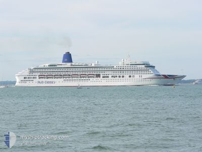
AURORA
Passengers Ship
Current Trip
| Time Travelled | 9 h, 33 mins |
|---|---|
| Remaining Time | 1 day |
| Distance Travelled | 136.30 nm |
| Remaining Distance | 913.09 nm |
| AVG Speed | 17 Noeuds |
| MAX Speed | 19.8 Noeuds |
| AVG Wind | 9.5 knots |
| MAX Wind | 22.3 knots |
| MIN Temp | 8.5°C / 47.3°F |
| MAX Temp | 14.6°C / 58.28°F |
| Tirant d eau | 8.4 m |
| Position reçue | 2 h, 11 m depuis |
Current Position
| Longitude | 6.69681° |
|---|---|
| Latitude | 42.84081° |
| Etat | Under way using engine |
| Vitesse | 18.4 Noeuds |
| Parcours | 228.4° |
| Zone | Mediterranean Sea - Western Basin |
| Station | T-AIS |
| Position reçue | 2 h, 11 m depuis |
Info
Information
The current position of AURORA is in Mediterranean Sea - Western Basin with coordinates 42.84081° / 6.69681° as reported on 2024-04-18 23:46 by AIS to our vessel tracker app. The vessel's current speed is 18.4 Noeuds and is heading at the port of CASABLANCA. The estimated time of arrival as calculated by MyShipTracking vessel tracking app is 2024-04-21 00:29 LT
The vessel AURORA (IMO: 9169524, MMSI: 310556000) is a Passengers Ship that was built in 2000 ( 24 Age ). It's sailing under the flag of [BM] Bermuda.
In this page you can find informations about the vessels current position, last detected port calls, and current voyage information. If the vessels is not in coverage by AIS you will find the latest position.
The current position of AURORA is detected by our AIS receivers and we are not responsible for the reliability of the data. The last position was recorded while the vessel was in Coverage by the Ais receivers of our vessel tracking app.
The current draught of AURORA as reported by AIS is 8.4 meters
Weather
| Temperature | 13.5°C / 56.3°F |
|---|---|
| Wind Speed | 15 knots |
| Direction | 322° NW |
| Pressure | 1015.3 hPa |
| Humidity | 56.1 % |
| Cloud Coverage | 58 % |
Featured Company
Last Port Calls
| Port | Arrival | Departure | Time In Port |
|---|---|---|---|
| 2024-04-18 05:14 | 2024-04-18 16:24 | 11 h | |
| 2024-04-17 05:10 | 2024-04-17 17:21 | 12 h | |
| 2024-04-14 04:29 | 2024-04-14 19:37 | 15 h | |
| 2024-04-11 06:32 | 2024-04-11 17:19 | 10 h | |
| 2024-04-11 05:59 | 2024-04-11 06:13 | 13 m | |
| 2024-04-08 04:21 | 2024-04-08 16:17 | 11 h | |
| 2024-04-06 04:19 | 2024-04-06 15:00 | 10 h | |
| 2024-04-05 03:32 | 2024-04-05 15:25 | 11 h | |
| 2024-04-04 05:20 | 2024-04-04 16:12 | 10 h | |
| 2024-04-03 04:56 | 2024-04-03 16:22 | 11 h |
Last Trips
| Origin | Departure | Destination | Arrival | Distance | |
|---|---|---|---|---|---|
| 2024-04-17 19:21 | 2024-04-18 07:14 | 222.70 nm | |||
| 2024-04-14 21:37 | 2024-04-17 07:10 | 736.37 nm | |||
| 2024-04-11 18:19 | 2024-04-14 06:29 | 863.72 nm | |||
| 2024-04-11 07:13 | 2024-04-11 07:32 | 0.44 nm | |||
| 2024-04-08 17:17 | 2024-04-11 06:59 | 963.33 nm | |||
| 2024-04-06 17:00 | 2024-04-08 05:21 | 497.12 nm | |||
| 2024-04-05 17:25 | 2024-04-06 06:19 | 196.26 nm | |||
| 2024-04-04 18:12 | 2024-04-05 05:32 | 127.76 nm | |||
| 2024-04-03 18:22 | 2024-04-04 07:20 | 157.61 nm | |||
| 2024-04-01 17:07 | 2024-04-03 06:56 | 579.19 nm |
Events
| Heure | Evenement | Détails | Position/ Destination | Info |
|---|---|---|---|---|
| 2024-04-18 23:46 | Hors de la zone couverte |
42.84081 / 6.69682
Mediterranean Sea - Western Basin
IT GOA > MA CAS
|
Vitesse: 18.4 kn Parcours: 228.4° |
|
| 2024-04-18 21:05 | Changement de zone | French part of the Mediterranean Sea - Western Basin Mon�gasque part of the Mediterranean Sea - Western Basin |
43.41036 / 7.54115
Mediterranean Sea - Western Basin
IT GOA > MA CAS
|
Vitesse: 18.7 kn Parcours: 226.6° |
| 2024-04-18 21:02 | Changement de zone | Mon�gasque part of the Mediterranean Sea - Western Basin French part of the Mediterranean Sea - Western Basin |
43.41995 / 7.55521
Mediterranean Sea - Western Basin
IT GOA > MA CAS
|
Vitesse: 18.6 kn Parcours: 227.1° |
| 2024-04-18 20:43 | Changement de zone | French part of the Mediterranean Sea - Western Basin Italian part of the Mediterranean Sea - Western Basin |
43.48638 / 7.65597
Mediterranean Sea - Western Basin
IT GOA > MA CAS
|
Vitesse: 18.9 kn Parcours: 228.8° |
| 2024-04-18 20:02 | Changement de zone | Italian part of the Mediterranean Sea - Western Basin Italian part of the Ligurian Sea |
43.63224 / 7.87937
Mediterranean Sea - Western Basin
IT GOA > MA CAS
|
Vitesse: 19.2 kn Parcours: 228.4° |
| 2024-04-18 16:24 | PORT DE DEPART |
|
44.38420 / 8.94381
IT GOA > MA CAS
|
Vitesse: 7.2 kn Parcours: 168° |
| 2024-04-18 16:03 | Démarrage |
44.41002 / 8.91700
[IT] GENOVA
|
Vitesse: 3.2 kn Parcours: 183° |
|
| 2024-04-18 15:56 | Etat Changé | Under way using engine Moored |
44.41179 / 8.91762
[IT] GENOVA
|
Vitesse: Parcours: 179° |
| 2024-04-18 15:46 | Changement de destination | IT GOA > MA CAS ITGOA > MA CAS |
44.41179 / 8.91763
[IT] GENOVA
|
Vitesse: Parcours: 179° |
| 2024-04-18 13:48 | Changement de destination | ITGOA > MA CAS IT CVV > IT GOA |
44.41179 / 8.91761
[IT] GENOVA
|
Vitesse: Parcours: 179° |