
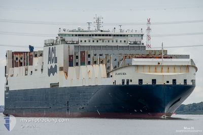
ATLANTIC SEA
Cargo A
Current Trip
| Time Travelled | 1 day |
|---|---|
| Remaining Time | 4 days |
| Distance Travelled | 582.06 nm |
| Remaining Distance | 1936.87 nm |
| AVG Speed | 15.8 Noeuds |
| MAX Speed | 20.3 Noeuds |
| AVG Wind | 11.7 knots |
| MAX Wind | 19.5 knots |
| MIN Temp | 7.1°C / 44.78°F |
| MAX Temp | 12.3°C / 54.14°F |
| Tirant d eau | 10.8 m |
| Position reçue | 16 h, 26 m depuis |
Current Position
| Longitude | -9.94971° |
|---|---|
| Latitude | 51.28538° |
| Etat | Under way using engine |
| Vitesse | 16.6 Noeuds |
| Parcours | 258.2° |
| Zone | Celtic Sea |
| Station | T-AIS |
| Position reçue | 16 h, 26 m depuis |
Info
Information
The current position of ATLANTIC SEA is in Celtic Sea with coordinates 51.28538° / -9.94971° as reported on 2024-04-23 04:25 by AIS to our vessel tracker app. The vessel's current speed is 16.6 Noeuds and is heading at the port of HALIFAX. The estimated time of arrival as calculated by MyShipTracking vessel tracking app is 2024-04-28 19:42 LT
The vessel ATLANTIC SEA (IMO: 9670597, MMSI: 215800000) is a Cargo A It's sailing under the flag of [MT] Malta.
In this page you can find informations about the vessels current position, last detected port calls, and current voyage information. If the vessels is not in coverage by AIS you will find the latest position.
The current position of ATLANTIC SEA is detected by our AIS receivers and we are not responsible for the reliability of the data. The last position was recorded while the vessel was in Coverage by the Ais receivers of our vessel tracking app.
The current draught of ATLANTIC SEA as reported by AIS is 10.8 meters
Weather
| Temperature | 11.7°C / 53.06°F |
|---|---|
| Wind Speed | 8 knots |
| Direction | 189° S |
| Pressure | 1029.4 hPa |
| Humidity | 84.2 % |
| Cloud Coverage | 100 % |
Featured Company
Last Port Calls
| Port | Arrival | Departure | Time In Port |
|---|---|---|---|
| 2024-04-20 20:15 | 2024-04-22 09:46 | 1 d | |
| 2024-04-17 06:06 | 2024-04-18 15:57 | 1 d | |
| 2024-04-15 10:51 | 2024-04-16 03:14 | 16 h | |
| 2024-04-11 22:47 | 2024-04-13 01:38 | 1 d | |
| 2024-04-03 18:00 | 2024-04-04 03:20 | 9 h | |
| 2024-04-01 05:11 | 2024-04-01 21:37 | 16 h | |
| 2024-03-28 10:02 | 2024-03-31 03:30 | 2 d | |
| 2024-03-26 08:35 | 2024-03-26 21:31 | 12 h | |
| 2024-03-17 14:06 | 2024-03-19 06:20 | 1 d | |
| 2024-03-14 11:04 | 2024-03-15 15:59 | 1 d |
Last Trips
| Origin | Departure | Destination | Arrival | Distance | |
|---|---|---|---|---|---|
| 2024-04-18 17:57 | 2024-04-20 21:15 | 706.52 nm | |||
| 2024-04-16 05:14 | 2024-04-17 08:06 | 403.15 nm | |||
| 2024-04-13 02:38 | 2024-04-15 12:51 | 988.84 nm | |||
| 2024-04-04 00:20 | 2024-04-11 23:47 | 2620.64 nm | |||
| 2024-04-01 17:37 | 2024-04-03 15:00 | 775.83 nm | |||
| 2024-03-30 23:30 | 2024-04-01 01:11 | 299.41 nm | |||
| 2024-03-26 18:31 | 2024-03-28 06:02 | 585.39 nm | |||
| 2024-03-19 06:20 | 2024-03-26 05:35 | 2530.62 nm | |||
| 2024-03-15 16:59 | 2024-03-17 14:06 | 704.62 nm | |||
| 2024-03-13 04:48 | 2024-03-14 12:04 | 406.74 nm |
Events
| Heure | Evenement | Détails | Position/ Destination | Info |
|---|---|---|---|---|
| 2024-04-23 04:28 | Etat Changé | Default Under way using engine |
51.28167 / -9.96833
GBLIV > CAHAL
|
Vitesse: 16.6 kn Parcours: 258.2° |
| 2024-04-23 04:25 | Hors de la zone couverte |
51.28538 / -9.94971
Celtic Sea
GBLIV > CAHAL
|
Vitesse: 16.6 kn Parcours: 258.2° |
|
| 2024-04-22 19:35 | Changement de zone | Irish part of the Celtic Sea Irish part of the Irish Sea and St. George's Channel |
52.13352 / -6.20598
Celtic Sea
GBLIV > CAHAL
|
Vitesse: 15.1 kn Parcours: 238.6° |
| 2024-04-22 15:56 | Changement de zone | Irish part of the Irish Sea and St. George's Channel United Kingdom part of the Irish Sea and St. George's Channel |
52.96154 / -5.35844
Irish Sea and St. George's Channel
GBLIV > CAHAL
|
Vitesse: 17.9 kn Parcours: 213.1° |
| 2024-04-22 13:44 | Etat Changé | Under way using engine Default |
53.54230 / -4.71392
GBLIV > CAHAL
|
Vitesse: 19.6 kn Parcours: 253° |
| 2024-04-22 13:42 | Etat Changé | Default Under way using engine |
53.54595 / -4.69577
GBLIV > CAHAL
|
Vitesse: 19.4 kn Parcours: 259° |
| 2024-04-22 13:29 | Etat Changé | Under way using engine Default |
53.56063 / -4.57468
GBLIV > CAHAL
|
Vitesse: 19.4 kn Parcours: 264° |
| 2024-04-22 13:26 | Etat Changé | Default Under way using engine |
53.56202 / -4.55412
GBLIV > CAHAL
|
Vitesse: 19.1 kn Parcours: 268.8° |
| 2024-04-22 13:04 | Etat Changé | Under way using engine Default |
53.56506 / -4.35474
GBLIV > CAHAL
|
Vitesse: 19 kn Parcours: 270° |
| 2024-04-22 13:02 | Etat Changé | Default Under way using engine |
53.56488 / -4.33873
GBLIV > CAHAL
|
Vitesse: 18.8 kn Parcours: 271.1° |