
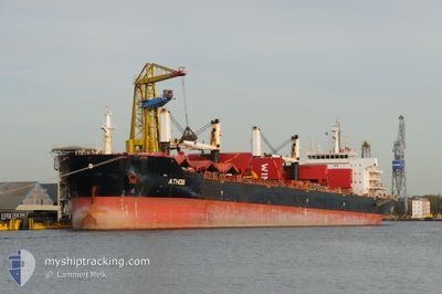
ATHOS
Bulk Carrier
Current Trip
| Time Travelled | 4 h, 39 mins |
|---|---|
| Remaining Time | 2 h, 27 mins |
| Distance Travelled | 49.75 nm |
| Remaining Distance | 33.45 nm |
| AVG Speed | 11.4 Noeuds |
| MAX Speed | 13.7 Noeuds |
| AVG Wind | 9.8 knots |
| MAX Wind | 13 knots |
| MIN Temp | 26.8°C / 80.24°F |
| MAX Temp | 28.4°C / 83.12°F |
| Tirant d eau | 6.1 m |
| Position reçue | 18 d depuis |
Current Position
| Longitude | -92.82867° |
|---|---|
| Latitude | 28.14875° |
| Etat | Under way using engine |
| Vitesse | 12.2 Noeuds |
| Parcours | 140.7° |
| Zone | Gulf of Mexico |
| Station | T-AIS |
| Position reçue | 18 d depuis |
Info
Information
The current position of ATHOS is in Gulf of Mexico with coordinates 28.14875° / -92.82867° as reported on 2024-04-06 02:05 by AIS to our vessel tracker app. The vessel's current speed is 12.2 Noeuds and is heading at the port of PORT OF SPAIN. The estimated time of arrival as calculated by MyShipTracking vessel tracking app is 2024-04-24 18:20 LT
The vessel ATHOS (IMO: 9320336, MMSI: 308876000) is a Bulk Carrier that was built in 2007 ( 17 Age ). It's sailing under the flag of [BS] Bahamas.
In this page you can find informations about the vessels current position, last detected port calls, and current voyage information. If the vessels is not in coverage by AIS you will find the latest position.
The current position of ATHOS is detected by our AIS receivers and we are not responsible for the reliability of the data. The last position was recorded while the vessel was in Coverage by the Ais receivers of our vessel tracking app.
The current draught of ATHOS as reported by AIS is 6.1 meters
Weather
| Temperature | 27.6°C / 81.68°F |
|---|---|
| Wind Speed | 13 knots |
| Direction | 94° E |
| Pressure | 1015.2 hPa |
| Humidity | 74.7 % |
| Cloud Coverage | 32 % |
Featured Company
Last Port Calls
| Port | Arrival | Departure | Time In Port |
|---|---|---|---|
| 2024-04-20 06:05 | 2024-04-24 11:14 | 4 d | |
| 2024-03-25 06:56 | 2024-04-02 17:48 | 8 d | |
| 2024-02-21 11:03 | 2024-02-23 22:43 | 2 d | |
| 2024-02-18 08:41 |
Most Visited Ports (Last year)
| Port | Arrivals | |
|---|---|---|
| 3 | ||
| 3 | ||
| 3 | ||
| 2 | ||
| 1 | ||
| 1 |
Events
| Heure | Evenement | Détails | Position/ Destination | Info |
|---|---|---|---|---|
| 2024-04-24 11:14 | PORT DE DEPART |
|
10.38690 / -61.51499
TRINIDAD
|
Vitesse: 3.9 kn Parcours: 232° |
| 2024-04-24 11:02 | Démarrage |
10.40151 / -61.49581
[TT] POINT LISAS
|
Vitesse: 3.9 kn Parcours: 232° |
|
| 2024-04-20 06:25 | Arret |
10.40470 / -61.49374
[TT] POINT LISAS
|
Vitesse: Parcours: 241° |
|
| 2024-04-20 06:05 | Port d'arrivée |
|
10.40470 / -61.49374
[TT] POINT LISAS
|
Vitesse: 7.2 kn Parcours: 51° |
| 2024-04-19 01:57 | Arret |
12.71833 / -62.98167
TRINIDAD
|
Vitesse: Parcours: -1° |
|
| 2024-04-18 08:36 | Arret |
12.83833 / -62.79333
TRINIDAD
|
Vitesse: Parcours: -1° |
|
| 2024-04-17 21:26 | Démarrage |
12.72310 / -63.25910
TRINIDAD
|
Vitesse: 3.8 kn Parcours: 111° |
|
| 2024-04-16 15:03 | Arret |
12.90667 / -62.68500
TRINIDAD
|
Vitesse: Parcours: -1° |
|
| 2024-04-16 11:50 | Démarrage |
12.88341 / -62.87252
TRINIDAD
|
Vitesse: 4 kn Parcours: 94° |
|
| 2024-04-16 07:39 | Arret |
12.80166 / -62.83500
TRINIDAD
|
Vitesse: Parcours: -1° |