
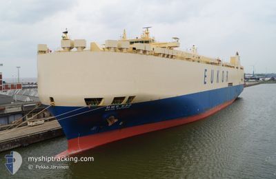
ASIAN EMPEROR
Vehicles Carrier
Current Trip
| Time Travelled | 6 days |
|---|---|
| Remaining Time | --- |
| Distance Travelled | 2576.10 nm |
| Remaining Distance | --- |
| AVG Speed | 15.7 Noeuds |
| MAX Speed | 17.7 Noeuds |
| AVG Wind | 14.5 knots |
| MAX Wind | 23.7 knots |
| MIN Temp | 9.2°C / 48.56°F |
| MAX Temp | 25.3°C / 77.54°F |
| Tirant d eau | 7 m |
| Position reçue | 2 d depuis |
Current Position
| Longitude | -127.53184° |
|---|---|
| Latitude | 35.51673° |
| Etat | Under way using engine |
| Vitesse | 15.1 Noeuds |
| Parcours | 318.8° |
| Zone | North Pacific Ocean |
| Station | T-AIS |
| Position reçue | 2 d depuis |
Info
Information
The current position of ASIAN EMPEROR is in North Pacific Ocean with coordinates 35.51673° / -127.53184° as reported on 2024-04-22 19:09 by AIS to our vessel tracker app. The vessel's current speed is 15.1 Noeuds and is heading at the port of YEOSU. The estimated time of arrival as calculated by MyShipTracking vessel tracking app is 2024-05-07 03:00 LT
The vessel ASIAN EMPEROR (IMO: 9176632, MMSI: 441722000) is a Vehicles Carrier that was built in 1999 ( 25 Age ). It's sailing under the flag of [KR] Korea.
In this page you can find informations about the vessels current position, last detected port calls, and current voyage information. If the vessels is not in coverage by AIS you will find the latest position.
The current position of ASIAN EMPEROR is detected by our AIS receivers and we are not responsible for the reliability of the data. The last position was recorded while the vessel was in Coverage by the Ais receivers of our vessel tracking app.
The current draught of ASIAN EMPEROR as reported by AIS is 7 meters
Weather
| Temperature | 9.3°C / 48.74°F |
|---|---|
| Wind Speed | 20 knots |
| Direction | 271° W |
| Pressure | 1012.3 hPa |
| Humidity | 97.2 % |
| Cloud Coverage | 100 % |
Featured Company
Last Port Calls
| Port | Arrival | Departure | Time In Port |
|---|---|---|---|
| 2024-04-17 21:15 | 2024-04-18 05:39 | 8 h | |
| 2024-04-13 10:08 | 2024-04-13 23:43 | 13 h | |
| 2024-04-12 11:19 | 2024-04-12 11:26 | 7 m | |
| 2024-04-07 11:14 | 2024-04-10 10:41 | 2 d | |
| 2024-03-10 17:25 | 2024-03-11 10:17 | 16 h | |
| 2024-03-08 14:51 | 2024-03-09 08:47 | 17 h | |
| 2024-03-05 00:42 | 2024-03-07 08:07 | 2 d | |
| 2024-03-03 08:16 | 2024-03-03 20:35 | 12 h |
Most Visited Ports (Last year)
| Port | Arrivals | |
|---|---|---|
| 4 | ||
| 4 | ||
| 2 | ||
| 2 | ||
| 2 | ||
| 2 |
Last Trips
| Origin | Departure | Destination | Arrival | Distance | |
|---|---|---|---|---|---|
| 2024-04-13 18:43 | 2024-04-17 16:15 | 1719.82 nm | |||
| 2024-04-12 06:26 | 2024-04-13 05:08 | 388.47 nm | |||
| 2024-04-10 05:41 | 2024-04-12 06:19 | 785.47 nm | |||
| 2024-03-11 19:17 | 2024-04-07 06:14 | 9989.97 nm | |||
| 2024-03-09 16:47 | 2024-03-11 02:25 | 472.68 nm | |||
| 2024-03-07 17:07 | 2024-03-08 22:51 | 455.46 nm | |||
| 2024-03-04 04:35 | 2024-03-05 09:42 | 493.36 nm | |||
| 2024-01-30 13:22 | 2024-03-03 16:16 | 11925.14 nm |
Events
| Heure | Evenement | Détails | Position/ Destination | Info |
|---|---|---|---|---|
| 2024-04-22 19:13 | Etat Changé | Default Under way using engine |
35.52798 / -127.54433
KRYOS
|
Vitesse: 15.1 kn Parcours: 318.8° |
| 2024-04-22 19:09 | Hors de la zone couverte |
35.51673 / -127.53184
North Pacific Ocean
KRYOS
|
Vitesse: 15.1 kn Parcours: 318.8° |
|
| 2024-04-22 18:16 | Etat Changé | Under way using engine Default |
35.35472 / -127.34849
KRYOS
|
Vitesse: 15 kn Parcours: 318° |
| 2024-04-22 18:14 | Etat Changé | Default Under way using engine |
35.34913 / -127.34251
KRYOS
|
Vitesse: 14.7 kn Parcours: 316.7° |
| 2024-04-22 16:07 | Etat Changé | Under way using engine Default |
34.95473 / -126.92577
KRYOS
|
Vitesse: 15.1 kn Parcours: 318° |
| 2024-04-22 16:06 | Etat Changé | Default Under way using engine |
34.94882 / -126.91924
KRYOS
|
Vitesse: 15.2 kn Parcours: 318.5° |
| 2024-04-22 16:00 | Etat Changé | Under way using engine Default |
34.93166 / -126.90013
KRYOS
|
Vitesse: 14.6 kn Parcours: 319° |
| 2024-04-22 15:18 | Etat Changé | Default Under way using engine |
34.80225 / -126.75819
KRYOS
|
Vitesse: 15 kn Parcours: 318.4° |
| 2024-04-22 15:10 | Etat Changé | Under way using engine Default |
34.78151 / -126.73519
KRYOS
|
Vitesse: 13 kn Parcours: 315° |
| 2024-04-22 15:02 | Dans la zone couverte |
34.78151 / -126.73519
North Pacific Ocean
KRYOS
|
Vitesse: 15 kn Parcours: 318.4° |