
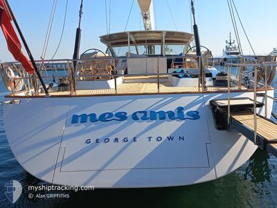
MES AMIS
Sailing Vessel
Current Trip
| Time Travelled | 6 days |
|---|---|
| Remaining Time | --- |
| Distance Travelled | 23.25 nm |
| Remaining Distance | --- |
| AVG Speed | 7.9 Noeuds |
| MAX Speed | 9.8 Noeuds |
| AVG Wind | 4.2 knots |
| MAX Wind | 6.9 knots |
| MIN Temp | 26.8°C / 80.24°F |
| MAX Temp | 27.3°C / 81.14°F |
| Tirant d eau | 4.8 m |
| Position reçue | 5 d depuis |
Current Position
| Longitude | -63.18672° |
|---|---|
| Latitude | 18.33078° |
| Etat | Under way using engine |
| Vitesse | 9.3 Noeuds |
| Parcours | 18.5° |
| Zone | Caribbean Sea |
| Station | T-AIS |
| Position reçue | 5 d depuis |
Info
Information
The current position of MES AMIS is in Caribbean Sea with coordinates 18.33078° / -63.18672° as reported on 2024-04-17 23:59 by AIS to our vessel tracker app. The vessel's current speed is 9.3 Noeuds and is heading at the port of FALMOUTH. The estimated time of arrival as calculated by MyShipTracking vessel tracking app is 2024-05-02 12:00 LT
The vessel MES AMIS (IMO: 1009273, MMSI: 319629000) is a Sailing Vessel that was built in 2007 ( 17 Age ). It's sailing under the flag of [KY] Cayman Is.
In this page you can find informations about the vessels current position, last detected port calls, and current voyage information. If the vessels is not in coverage by AIS you will find the latest position.
The current position of MES AMIS is detected by our AIS receivers and we are not responsible for the reliability of the data. The last position was recorded while the vessel was in Coverage by the Ais receivers of our vessel tracking app.
The current draught of MES AMIS as reported by AIS is 4.8 meters
Weather
| Temperature | 26.8°C / 80.24°F |
|---|---|
| Wind Speed | 5 knots |
| Direction | 30° NNE |
| Pressure | 1013.6 hPa |
| Humidity | 74.5 % |
| Cloud Coverage | 21 % |
Featured Company
Last Port Calls
| Port | Arrival | Departure | Time In Port |
|---|---|---|---|
| 2024-04-11 19:15 | 2024-04-17 14:36 | 5 d | |
| 2024-04-06 20:57 | 2024-04-07 14:35 | 17 h | |
| 2024-04-05 20:52 | 2024-04-06 13:32 | 16 h | |
| 2024-03-29 18:20 | 2024-04-04 14:34 | 5 d | |
| 2024-03-29 17:31 | 2024-03-29 18:19 | 47 m | |
| 2024-03-29 12:56 | 2024-03-29 17:29 | 4 h | |
| 2024-03-21 19:19 | 2024-03-29 12:46 | 7 d | |
| 2024-03-09 20:56 | 2024-03-10 13:41 | 16 h | |
| 2024-03-08 15:41 | 2024-03-09 14:38 | 22 h | |
| 2024-02-22 19:12 | 2024-03-03 14:36 | 9 d |
Most Visited Ports (Last year)
| Port | Arrivals | |
|---|---|---|
| 7 | ||
| 7 | ||
| 5 | ||
| 3 | ||
| 3 | ||
| 2 |
Last Trips
| Origin | Departure | Destination | Arrival | Distance | |
|---|---|---|---|---|---|
| 2024-04-07 10:35 | 2024-04-11 15:15 | 223.45 nm | |||
| 2024-04-06 09:32 | 2024-04-06 16:57 | 27.93 nm | |||
| 2024-04-04 10:34 | 2024-04-05 16:52 | 46.24 nm | |||
| 2024-03-29 14:19 | 2024-03-29 14:20 | 0.43 nm | |||
| 2024-03-29 13:29 | 2024-03-29 13:31 | 0.78 nm | |||
| 2024-03-29 08:46 | 2024-03-29 08:56 | 14.77 nm | |||
| 2024-03-10 09:41 | 2024-03-21 15:19 | 605.34 nm | |||
| 2024-03-09 10:38 | 2024-03-09 16:56 | 4.16 nm | |||
| 2024-03-03 10:36 | 2024-03-08 11:41 | 110.89 nm | |||
| 2024-02-22 11:44 | 2024-02-22 15:12 | 18.29 nm |
Events
| Heure | Evenement | Détails | Position/ Destination | Info |
|---|---|---|---|---|
| 2024-04-17 23:59 | Hors de la zone couverte |
18.33078 / -63.18672
Caribbean Sea
FALMOUTH UK
|
Vitesse: 9.3 kn Parcours: 18.5° |
|
| 2024-04-17 22:56 | Changement d'ETA | 2024/05/02 12:00 2024/05/03 12:00 |
18.17214 / -63.20248
FALMOUTH UK
|
Vitesse: 9.5 kn Parcours: 349.3° |
| 2024-04-17 22:32 | Changement de zone | Anguilla part of the Caribbean Sea Saint-Martin part of the Caribbean Sea |
18.11233 / -63.19253
Caribbean Sea
FALMOUTH UK
|
Vitesse: 9.3 kn Parcours: 352.6° |
| 2024-04-17 22:02 | Changement de zone | Saint-Martin part of the Caribbean Sea Sint-Maarten part of the Caribbean Sea |
18.04834 / -63.15936
Caribbean Sea
FALMOUTH UK
|
Vitesse: 9.3 kn Parcours: 309.4° |
| 2024-04-17 21:49 | Etat Changé | Under way using engine At anchor |
18.02778 / -63.13040
FALMOUTH UK
|
Vitesse: 9.7 kn Parcours: 307.3° |
| 2024-04-17 21:31 | Démarrage | 0.94 nm, West of ST MAARTEN |
18.03317 / -63.10806
FALMOUTH UK
|
Vitesse: 3.4 kn Parcours: 203° |
| 2024-04-17 15:56 | Changement de destination | FALMOUTH UK ST MARTIN |
18.03593 / -63.10711
FALMOUTH UK
|
Vitesse: 0.3 kn Parcours: 157° |
| 2024-04-17 15:56 | Changement d'ETA | 2024/05/03 12:00 2024/04/11 15:30 |
18.03593 / -63.10711
FALMOUTH UK
|
Vitesse: 0.3 kn Parcours: 157° |
| 2024-04-17 15:14 | Etat Changé | At anchor Under way using engine |
18.03595 / -63.10704
ST MARTIN
|
Vitesse: 0.4 kn Parcours: 130° |
| 2024-04-17 14:52 | Arret | 0.82 nm, West of ST MAARTEN |
18.03635 / -63.10657
ST MARTIN
|
Vitesse: 0.3 kn Parcours: 142° |