
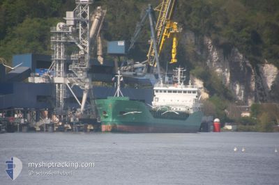
ARKLOW RAIDER
General Cargo
Current Trip
| Time Travelled | 3 days |
|---|---|
| Remaining Time | --- |
| Distance Travelled | 565.55 nm |
| Remaining Distance | --- |
| AVG Speed | 12 Noeuds |
| MAX Speed | 14.7 Noeuds |
| AVG Wind | 22.3 knots |
| MAX Wind | 27.6 knots |
| MIN Temp | 6.5°C / 43.7°F |
| MAX Temp | 12.3°C / 54.14°F |
| Tirant d eau | 4 m |
| Position reçue | 1 d depuis |
Current Position
| Longitude | -0.78833° |
|---|---|
| Latitude | 45.33467° |
| Etat | Under way using engine |
| Vitesse | 12.9 Noeuds |
| Parcours | 157° |
| Zone | Bay of Biscay |
| Station | T-AIS |
| Position reçue | 1 d depuis |
Info
Information
The current position of ARKLOW RAIDER is in Bay of Biscay with coordinates 45.33467° / -0.78833° as reported on 2024-04-17 20:28 by AIS to our vessel tracker app. The vessel's current speed is 12.9 Noeuds
The vessel ARKLOW RAIDER (IMO: 9344540, MMSI: 250001268) is a General Cargo that was built in 2007 ( 17 Age ). It's sailing under the flag of [IE] Ireland.
In this page you can find informations about the vessels current position, last detected port calls, and current voyage information. If the vessels is not in coverage by AIS you will find the latest position.
The current position of ARKLOW RAIDER is detected by our AIS receivers and we are not responsible for the reliability of the data. The last position was recorded while the vessel was in Coverage by the Ais receivers of our vessel tracking app.
The current draught of ARKLOW RAIDER as reported by AIS is 4 meters
Weather
| Temperature | 5°C / 41°F |
|---|---|
| Wind Speed | 5 knots |
| Direction | 103° ESE |
| Pressure | 1025.2 hPa |
| Humidity | 76.1 % |
| Cloud Coverage | 15 % |
Featured Company
Last Port Calls
| Port | Arrival | Departure | Time In Port |
|---|---|---|---|
| 2024-04-14 11:23 | 2024-04-15 19:15 | 1 d | |
| 2024-04-12 10:58 | 2024-04-13 15:33 | 1 d | |
| 2024-04-11 21:54 | 2024-04-11 22:32 | 38 m | |
| 2024-04-08 13:57 | 2024-04-11 21:29 | 3 d | |
| 2024-04-08 12:45 | 2024-04-08 13:29 | 43 m | |
| 2024-04-03 00:30 | 2024-04-05 13:31 | 2 d | |
| 2024-03-30 22:47 | 2024-03-30 23:39 | 51 m | |
| 2024-03-30 22:11 | 2024-03-30 22:29 | 17 m | |
| 2024-03-29 17:14 | 2024-03-30 21:29 | 1 d | |
| 2024-03-29 15:29 | 2024-03-29 15:51 | 21 m |
Last Trips
| Origin | Departure | Destination | Arrival | Distance | |
|---|---|---|---|---|---|
| 2024-04-13 16:33 | 2024-04-14 12:23 | 216.78 nm | |||
| 2024-04-11 23:32 | 2024-04-12 11:58 | 147.08 nm | |||
| 2024-04-11 22:29 | 2024-04-11 22:54 | 1.90 nm | |||
| 2024-04-08 14:29 | 2024-04-08 14:57 | 1.91 nm | |||
| 2024-04-05 15:31 | 2024-04-08 13:45 | 713.35 nm | |||
| 2024-03-30 23:39 | 2024-04-03 02:30 | 741.34 nm | |||
| 2024-03-30 22:29 | 2024-03-30 22:47 | 2.00 nm | |||
| 2024-03-30 21:29 | 2024-03-30 22:11 | 4.59 nm | |||
| 2024-03-29 15:51 | 2024-03-29 17:14 | 6.27 nm | |||
| 2024-03-29 15:09 | 2024-03-29 15:29 | 2.09 nm |
Events
| Heure | Evenement | Détails | Position/ Destination | Info |
|---|---|---|---|---|
| 2024-04-17 22:47 | Arret | 4.24 nm, North of BORDEAUX |
44.91600 / -.54433
FRBOD
|
Vitesse: 0.1 kn Parcours: 338° |
| 2024-04-17 20:45 | Etat Changé | Default Under way using engine |
45.27500 / -.75450
FRBOD
|
Vitesse: 12.9 kn Parcours: 157° |
| 2024-04-17 20:28 | Hors de la zone couverte |
45.33467 / -.78833
Bay of Biscay
FRBOD
|
Vitesse: 12.9 kn Parcours: 157° |
|
| 2024-04-17 17:20 | Changement de zone | French part of the Bay of Biscay Irish part of the Celtic Sea |
45.61200 / -1.45617
Bay of Biscay
FRBOD
|
Vitesse: 13.1 kn Parcours: 107° |
| 2024-04-17 17:19 | Dans la zone couverte |
45.61200 / -1.45617
Bay of Biscay
FRBOD
|
Vitesse: 13.1 kn Parcours: 107° |
|
| 2024-04-15 22:26 | Hors de la zone couverte |
51.70367 / -6.90500
Celtic Sea
FRBOD
|
Vitesse: 12.1 kn Parcours: 177° |
|
| 2024-04-15 19:15 | PORT DE DEPART |
|
52.27000 / -7.02450
FRBOD
|
Vitesse: 8 kn Parcours: 56° |
| 2024-04-15 19:11 | Démarrage |
52.26450 / -7.03150
[IE] WATERFORD
|
Vitesse: 3.3 kn Parcours: 30° |
|
| 2024-04-15 18:57 | Etat Changé | Under way using engine Moored |
52.26883 / -7.02817
[IE] WATERFORD
|
Vitesse: Parcours: 219° |
| 2024-04-15 18:34 | Tirant d'eau modifié | 4 6 |
52.26883 / -7.02817
[IE] WATERFORD
|
Vitesse: Parcours: 221° |