
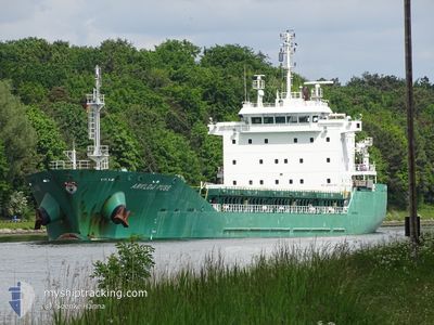
ARKLOW MUSE
General Cargo
Current Trip
| Time Travelled | 1 day |
|---|---|
| Remaining Time | 15 h, 49 mins |
| Distance Travelled | 518.14 nm |
| Remaining Distance | 225.30 nm |
| AVG Speed | 11.8 Noeuds |
| MAX Speed | 14.8 Noeuds |
| AVG Wind | 8 knots |
| MAX Wind | 13.9 knots |
| MIN Temp | 2.8°C / 37.04°F |
| MAX Temp | 11.6°C / 52.88°F |
| Tirant d eau | 7.7 m |
| Position reçue | 4 h, 2 m depuis |
Current Position
| Longitude | -2.22755° |
|---|---|
| Latitude | 49.91902° |
| Etat | Under way using engine |
| Vitesse | 12.5 Noeuds |
| Parcours | 73.6° |
| Zone | English Channel |
| Station | T-AIS |
| Position reçue | 4 h, 2 m depuis |
Info
Information
The current position of ARKLOW MUSE is in English Channel with coordinates 49.91902° / -2.22755° as reported on 2024-04-24 17:33 by AIS to our vessel tracker app. The vessel's current speed is 12.5 Noeuds and is heading at the port of ANTWERP. The estimated time of arrival as calculated by MyShipTracking vessel tracking app is 2024-04-25 13:24 LT
The vessel ARKLOW MUSE (IMO: 9509487, MMSI: 250002821) is a General Cargo that was built in 2013 ( 11 Age ). It's sailing under the flag of [IE] Ireland.
In this page you can find informations about the vessels current position, last detected port calls, and current voyage information. If the vessels is not in coverage by AIS you will find the latest position.
The current position of ARKLOW MUSE is detected by our AIS receivers and we are not responsible for the reliability of the data. The last position was recorded while the vessel was in Coverage by the Ais receivers of our vessel tracking app.
The current draught of ARKLOW MUSE as reported by AIS is 7.7 meters
Weather
| Temperature | 9.5°C / 49.1°F |
|---|---|
| Wind Speed | 7 knots |
| Direction | 26° NNE |
| Pressure | 1014 hPa |
| Humidity | 55.1 % |
| Cloud Coverage | 76 % |
Featured Company
Last Port Calls
| Port | Arrival | Departure | Time In Port |
|---|---|---|---|
| 2024-04-21 10:27 | 2024-04-23 01:12 | 1 d | |
| 2024-04-17 01:32 | 2024-04-19 00:35 | 1 d | |
| 2024-04-02 12:11 | 2024-04-03 13:16 | 1 d | |
| 2024-03-30 02:37 | 2024-03-30 03:15 | 38 m | |
| 2024-03-29 01:59 | 2024-03-30 01:18 | 23 h | |
| 2024-03-23 16:38 | 2024-03-26 22:18 | 3 d | |
| 2024-03-19 01:22 | 2024-03-20 03:23 | 1 d | |
| 2024-03-13 20:03 | 2024-03-15 19:52 | 1 d | |
| 2024-02-24 04:46 | 2024-02-26 10:51 | 2 d | |
| 2024-02-16 14:31 | 2024-02-17 12:51 | 22 h |
Most Visited Ports (Last year)
| Port | Arrivals | |
|---|---|---|
| 5 | ||
| 4 | ||
| 3 | ||
| 2 | ||
| 2 | ||
| 2 |
Last Trips
| Origin | Departure | Destination | Arrival | Distance | |
|---|---|---|---|---|---|
| 2024-04-19 01:35 | 2024-04-21 12:27 | 687.02 nm | |||
| 2024-04-03 15:16 | 2024-04-17 02:32 | 1241.27 nm | |||
| 2024-03-30 04:15 | 2024-04-02 14:11 | 786.61 nm | |||
| 2024-03-30 02:18 | 2024-03-30 03:37 | 4.59 nm | |||
| 2024-03-26 23:18 | 2024-03-29 02:59 | 147.75 nm | |||
| 2024-03-20 04:23 | 2024-03-23 17:38 | 752.93 nm | |||
| 2024-03-15 20:52 | 2024-03-19 02:22 | 146.12 nm | |||
| 2024-02-26 10:51 | 2024-03-13 21:03 | 2743.06 nm | |||
| 2024-02-17 13:51 | 2024-02-24 04:46 | 1702.27 nm | |||
| 2024-02-14 17:19 | 2024-02-16 15:31 | 225.27 nm |
Events
| Heure | Evenement | Détails | Position/ Destination | Info |
|---|---|---|---|---|
| 2024-04-24 17:38 | Etat Changé | Default Under way using engine |
49.92437 / -2.19990
BEANR
|
Vitesse: 12.5 kn Parcours: 73.6° |
| 2024-04-24 17:33 | Hors de la zone couverte |
49.91902 / -2.22755
English Channel
BEANR
|
Vitesse: 12.5 kn Parcours: 73.6° |
|
| 2024-04-24 15:19 | Changement d'ETA | 2024/04/25 13:00 2024/04/25 14:00 |
49.80630 / -2.86343
BEANR
|
Vitesse: 10.6 kn Parcours: 74.1° |
| 2024-04-24 15:09 | Etat Changé | Under way using engine Default |
49.79978 / -2.89890
BEANR
|
Vitesse: 10.5 kn Parcours: 76° |
| 2024-04-24 15:06 | Etat Changé | Default Under way using engine |
49.79752 / -2.91127
BEANR
|
Vitesse: 10.3 kn Parcours: 78.7° |
| 2024-04-24 14:57 | Etat Changé | Under way using engine Default |
49.79125 / -2.95150
BEANR
|
Vitesse: 10.2 kn Parcours: 62° |
| 2024-04-24 14:50 | Etat Changé | Default Under way using engine |
49.78203 / -2.97782
BEANR
|
Vitesse: 10.2 kn Parcours: 54.4° |
| 2024-04-24 14:45 | Etat Changé | Under way using engine Default |
49.77305 / -2.99837
BEANR
|
Vitesse: 10.2 kn Parcours: 54° |
| 2024-04-24 14:42 | Etat Changé | Default Under way using engine |
49.76945 / -3.00608
BEANR
|
Vitesse: 10.2 kn Parcours: 62.5° |
| 2024-04-24 14:38 | Detecté en mer | Guernsey part of the English Channel |
49.76205 / -3.02392
English Channel
BEANR
|
Vitesse: 10.2 kn Parcours: 62.5° |