
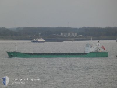
ARKLOW MOOR
General Cargo
Current Trip
| Time Travelled | 1 day |
|---|---|
| Remaining Time | 23 h, 58 mins |
| Distance Travelled | 419.89 nm |
| Remaining Distance | 250.18 nm |
| AVG Speed | 9.2 Noeuds |
| MAX Speed | 13 Noeuds |
| AVG Wind | 13.6 knots |
| MAX Wind | 27.7 knots |
| MIN Temp | 2.8°C / 37.04°F |
| MAX Temp | 8.2°C / 46.76°F |
| Tirant d eau | 9.1 m |
| Position reçue | 1 m depuis |
Current Position
| Longitude | 4.22598° |
|---|---|
| Latitude | 58.48544° |
| Etat | Under way using engine |
| Vitesse | 10.8 Noeuds |
| Parcours | 355° |
| Zone | North Sea |
| Station | T-AIS |
| Position reçue | 1 m depuis |
Info
Information
The current position of ARKLOW MOOR is in North Sea with coordinates 58.48544° / 4.22598° as reported on 2024-04-25 03:59 by AIS to our vessel tracker app. The vessel's current speed is 10.8 Noeuds and is heading at the port of ARDALSTANGEN. The estimated time of arrival as calculated by MyShipTracking vessel tracking app is 2024-04-26 03:59 LT
The vessel ARKLOW MOOR (IMO: 9509475, MMSI: 250002434) is a General Cargo that was built in 2011 ( 13 Age ). It's sailing under the flag of [IE] Ireland.
In this page you can find informations about the vessels current position, last detected port calls, and current voyage information. If the vessels is not in coverage by AIS you will find the latest position.
The current position of ARKLOW MOOR is detected by our AIS receivers and we are not responsible for the reliability of the data. The last position was recorded while the vessel was in Coverage by the Ais receivers of our vessel tracking app.
The current draught of ARKLOW MOOR as reported by AIS is 9.1 meters
Weather
| Temperature | 3.7°C / 38.66°F |
|---|---|
| Wind Speed | 4 knots |
| Direction | 107° ESE |
| Pressure | 1003.4 hPa |
| Humidity | 81.2 % |
| Cloud Coverage | 97 % |
Featured Company
Last Port Calls
| Port | Arrival | Departure | Time In Port |
|---|---|---|---|
| 2024-04-19 11:18 | 2024-04-23 08:08 | 3 d | |
| 2024-04-15 09:18 | 2024-04-18 12:58 | 3 d | |
| 2024-04-13 05:13 | 2024-04-13 06:04 | 50 m | |
| 2024-04-07 12:56 | 2024-04-12 19:50 | 5 d | |
| 2024-04-06 11:11 | 2024-04-07 12:52 | 1 d | |
| 2024-04-02 22:50 | 2024-04-04 14:37 | 1 d | |
| 2024-04-02 21:35 | 2024-04-02 21:49 | 13 m | |
| 2024-03-28 11:54 | 2024-03-28 12:45 | 50 m | |
| 2024-03-24 13:45 | 2024-03-27 00:53 | 2 d | |
| 2024-03-16 16:53 | 2024-03-16 17:08 | 15 m |
Last Trips
| Origin | Departure | Destination | Arrival | Distance | |
|---|---|---|---|---|---|
| 2024-04-18 13:58 | 2024-04-19 13:18 | 228.15 nm | |||
| 2024-04-13 08:04 | 2024-04-15 10:18 | 404.47 nm | |||
| 2024-04-12 21:50 | 2024-04-13 07:13 | 83.75 nm | |||
| 2024-04-07 14:52 | 2024-04-07 14:56 | 1.66 nm | |||
| 2024-04-04 16:37 | 2024-04-06 13:11 | 460.90 nm | |||
| 2024-04-02 23:49 | 2024-04-03 00:50 | 7.15 nm | |||
| 2024-03-28 13:45 | 2024-04-02 23:35 | 385.07 nm | |||
| 2024-03-27 02:53 | 2024-03-28 12:54 | 411.29 nm | |||
| 2024-03-16 18:08 | 2024-03-24 15:45 | 876.10 nm | |||
| 2024-03-13 13:58 | 2024-03-16 17:53 | 759.97 nm |
Events
| Heure | Evenement | Détails | Position/ Destination | Info |
|---|---|---|---|---|
| 2024-04-24 23:44 | Changement d'ETA | 2024/04/25 18:30 2024/04/25 15:30 |
57.74634 / 4.27839
NOARD
|
Vitesse: 11.2 kn Parcours: 356° |
| 2024-04-24 23:11 | Changement de zone | Norwegian part of the North Sea Danish part of the North Sea |
57.65623 / 4.28706
North Sea
NOARD
|
Vitesse: 10 kn Parcours: 357° |
| 2024-04-24 23:11 | Etat Changé | Under way using engine Default |
57.65623 / 4.28706
NOARD
|
Vitesse: 10 kn Parcours: 357° |
| 2024-04-24 23:11 | Dans la zone couverte |
57.65623 / 4.28706
North Sea
NOARD
|
Vitesse: 10 kn Parcours: 357° |
|
| 2024-04-24 12:20 | Etat Changé | Default Under way using engine |
55.92455 / 4.41268
NOARD
|
Vitesse: 8 kn Parcours: 359° |
| 2024-04-24 12:13 | Hors de la zone couverte |
55.90877 / 4.41345
North Sea
NOARD
|
Vitesse: 8 kn Parcours: 359° |
|
| 2024-04-24 10:17 | Changement de zone | Danish part of the North Sea German part of the North Sea |
55.64586 / 4.42612
North Sea
NOARD
|
Vitesse: 8.2 kn Parcours: 359° |
| 2024-04-24 07:45 | Changement d'ETA | 2024/04/25 15:30 2024/04/25 10:00 |
55.32512 / 4.59182
NOARD
|
Vitesse: 7.7 kn Parcours: 344° |
| 2024-04-24 06:38 | Changement de zone | German part of the North Sea Dutch part of the North Sea |
55.17806 / 4.64493
North Sea
NOARD
|
Vitesse: 8.6 kn Parcours: 349° |
| 2024-04-24 05:57 | Etat Changé | Under way using engine Default |
55.08706 / 4.67753
NOARD
|
Vitesse: 8 kn Parcours: 347° |