
ARC INTEGRITY
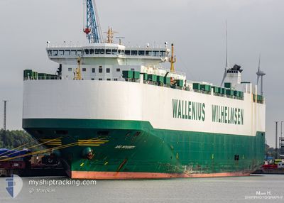
Vehicles Carrier
Current Trip
| Time Travelled | 10 days |
|---|---|
| Remaining Time | 3 h, 2 mins |
| Distance Travelled | 4261.81 nm |
| Remaining Distance | 52.87 nm |
| AVG Speed | 16.1 Noeuds |
| MAX Speed | 20.4 Noeuds |
| AVG Wind | 18.5 knots |
| MAX Wind | 32 knots |
| MIN Temp | 0.8°C / 33.44°F |
| MAX Temp | 22.3°C / 72.14°F |
| Tirant d eau | 9.1 m |
| Position reçue | 1 m depuis |
Current Position
| Longitude | 15.35517° |
|---|---|
| Latitude | 68.15605° |
| Etat | Under way using engine |
| Vitesse | 10.6 Noeuds |
| Parcours | 58° |
| Zone | Norwegian Sea |
| Station | T-AIS |
| Position reçue | 1 m depuis |
Info
Information
The current position of ARC INTEGRITY is in Norwegian Sea with coordinates 68.15605° / 15.35517° as reported on 2024-04-24 02:21 by AIS to our vessel tracker app. The vessel's current speed is 10.6 Noeuds and is heading at the port of NARVIK. The estimated time of arrival as calculated by MyShipTracking vessel tracking app is 2024-04-24 05:25 LT
The vessel ARC INTEGRITY (IMO: 9332949, MMSI: 338058000) is a Vehicles Carrier that was built in 2008 ( 16 Age ). It's sailing under the flag of [US] USA.
In this page you can find informations about the vessels current position, last detected port calls, and current voyage information. If the vessels is not in coverage by AIS you will find the latest position.
The current position of ARC INTEGRITY is detected by our AIS receivers and we are not responsible for the reliability of the data. The last position was recorded while the vessel was in Coverage by the Ais receivers of our vessel tracking app.
The current draught of ARC INTEGRITY as reported by AIS is 9.1 meters
Weather
| Temperature | 0.8°C / 33.44°F |
|---|---|
| Wind Speed | 7 knots |
| Direction | 78° ENE |
| Pressure | 1009.4 hPa |
| Humidity | 70.9 % |
| Cloud Coverage | 100 % |
Featured Company
Last Port Calls
| Port | Arrival | Departure | Time In Port |
|---|---|---|---|
| 2024-04-12 16:07 | 2024-04-13 04:18 | 12 h | |
| 2024-04-06 15:19 | 2024-04-07 21:39 | 1 d | |
| 2024-04-02 17:08 | 2024-04-05 11:59 | 2 d | |
| 2024-03-31 09:43 | 2024-04-02 04:39 | 1 d | |
| 2024-03-26 08:09 | 2024-03-26 16:07 | 7 h | |
| 2024-03-23 20:31 | 2024-03-24 23:36 | 1 d | |
| 2024-03-21 19:22 | 2024-03-22 05:40 | 10 h | |
| 2024-03-20 07:49 | 2024-03-21 19:15 | 1 d | |
| 2024-03-09 06:00 | 2024-03-10 12:19 | 1 d | |
| 2024-03-03 07:51 | 2024-03-07 17:50 | 4 d |
Most Visited Ports (Last year)
| Port | Arrivals | |
|---|---|---|
| 10 | ||
| 10 | ||
| 6 | ||
| 5 | ||
| 5 | ||
| 5 |
Last Trips
| Origin | Departure | Destination | Arrival | Distance | |
|---|---|---|---|---|---|
| 2024-04-07 16:39 | 2024-04-12 12:07 | 1577.97 nm | |||
| 2024-04-05 06:59 | 2024-04-06 10:19 | 281.34 nm | |||
| 2024-04-01 23:39 | 2024-04-02 12:08 | 121.69 nm | |||
| 2024-03-26 12:07 | 2024-03-31 04:43 | 1363.93 nm | |||
| 2024-03-24 19:36 | 2024-03-26 04:09 | 260.37 nm | |||
| 2024-03-22 01:40 | 2024-03-23 16:31 | 558.49 nm | |||
| 2024-03-21 15:15 | 2024-03-21 15:22 | 0.59 nm | |||
| 2024-03-10 12:19 | 2024-03-20 03:49 | 3500.27 nm | |||
| 2024-03-07 18:50 | 2024-03-09 06:00 | 466.54 nm | |||
| 2024-03-02 04:51 | 2024-03-03 08:51 | 339.07 nm |
Events
| Heure | Evenement | Détails | Position/ Destination | Info |
|---|---|---|---|---|
| 2024-04-23 16:59 | Etat Changé | Under way using engine Default |
66.75314 / 9.58682
NONVK
|
Vitesse: 14 kn Parcours: 68° |
| 2024-04-23 16:46 | Etat Changé | Default Under way using engine |
66.73333 / 9.46167
NONVK
|
Vitesse: 3.9 kn Parcours: 49° |
| 2024-04-23 16:29 | Tirant d'eau modifié | 9.1 9 |
66.71417 / 9.32712
NONVK
|
Vitesse: 3.9 kn Parcours: 49° |
| 2024-04-23 16:29 | Changement de destination | NONVK US SSI |
66.71417 / 9.32712
NONVK
|
Vitesse: 3.9 kn Parcours: 49° |
| 2024-04-23 16:29 | Changement d'ETA | 2024/04/24 05:00 |
66.71417 / 9.32712
NONVK
|
Vitesse: 3.9 kn Parcours: 49° |
| 2024-04-23 15:18 | Detecté en mer | Norwegian part of the Norwegian Sea |
66.59581 / 8.83989
Norwegian Sea
|
Vitesse: 13.7 kn Parcours: 54.2° |
| 2024-04-23 15:18 | Etat Changé | Under way using engine Default |
66.59581 / 8.83989
US SSI
|
Vitesse: 11 kn Parcours: 57° |
| 2024-04-23 15:05 | Dans la zone couverte |
66.59581 / 8.83989
Norwegian Sea
|
Vitesse: 13.7 kn Parcours: 54.2° |
|
| 2024-04-14 04:07 | Etat Changé | Default Under way using engine |
34.14834 / -75.89500
US SSI
|
Vitesse: 16.1 kn Parcours: 49.3° |
| 2024-04-14 03:52 | Hors de la zone couverte |
34.10537 / -75.95811
North Atlantic Ocean
|
Vitesse: 16.1 kn Parcours: 49.3° |