
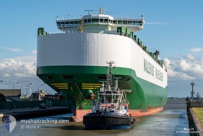
ARC INDEPENDENCE
Vehicles Carrier
Current Trip
| Time Travelled | 7 h, 3 mins |
|---|---|
| Remaining Time | 6 h, 24 mins |
| Distance Travelled | 96.19 nm |
| Remaining Distance | 95.33 nm |
| AVG Speed | 13.2 Noeuds |
| MAX Speed | 14.7 Noeuds |
| AVG Wind | 14.3 knots |
| MAX Wind | 15 knots |
| MIN Temp | 22.1°C / 71.78°F |
| MAX Temp | 22.7°C / 72.86°F |
| Tirant d eau | 8.7 m |
| Position reçue | 5 h, 0 m depuis |
Current Position
| Longitude | -94.48967° |
|---|---|
| Latitude | 29.09700° |
| Etat | Under way using engine |
| Vitesse | 14.1 Noeuds |
| Parcours | 235° |
| Zone | Gulf of Mexico |
| Station | T-AIS |
| Position reçue | 5 h, 0 m depuis |
Info
Information
The current position of ARC INDEPENDENCE is in Gulf of Mexico with coordinates 29.09700° / -94.48967° as reported on 2024-04-25 06:35 by AIS to our vessel tracker app. The vessel's current speed is 14.1 Noeuds and is heading at the port of CORPUS CHRISTI. The estimated time of arrival as calculated by MyShipTracking vessel tracking app is 2024-04-25 18:00 LT
The vessel ARC INDEPENDENCE (IMO: 9332925, MMSI: 338794000) is a Vehicles Carrier that was built in 2007 ( 17 Age ). It's sailing under the flag of [US] USA.
In this page you can find informations about the vessels current position, last detected port calls, and current voyage information. If the vessels is not in coverage by AIS you will find the latest position.
The current position of ARC INDEPENDENCE is detected by our AIS receivers and we are not responsible for the reliability of the data. The last position was recorded while the vessel was in Coverage by the Ais receivers of our vessel tracking app.
The current draught of ARC INDEPENDENCE as reported by AIS is 8.7 meters
Weather
| Temperature | 22.7°C / 72.86°F |
|---|---|
| Wind Speed | 15 knots |
| Direction | 139° SE |
| Pressure | 1015.8 hPa |
| Humidity | 93.1 % |
| Cloud Coverage | 63 % |
Featured Company
Last Port Calls
| Port | Arrival | Departure | Time In Port |
|---|---|---|---|
| 2024-04-24 10:10 | 2024-04-25 04:33 | 18 h | |
| 2024-04-19 10:07 | 2024-04-20 05:26 | 19 h | |
| 2024-04-16 11:23 | 2024-04-16 18:15 | 6 h | |
| 2024-04-01 04:46 | 2024-04-05 07:55 | 4 d | |
| 2024-03-28 02:47 | 2024-03-30 13:32 | 2 d | |
| 2024-03-25 18:55 | 2024-03-26 19:01 | 1 d | |
| 2024-03-15 06:09 | 2024-03-17 07:51 | 2 d | |
| 2024-02-29 12:01 | 2024-02-29 23:24 | 11 h | |
| 2024-02-26 11:15 | 2024-02-26 23:30 | 12 h | |
| 2024-02-16 17:43 | 2024-02-21 13:08 | 4 d |
Most Visited Ports (Last year)
| Port | Arrivals | |
|---|---|---|
| 10 | ||
| 10 | ||
| 6 | ||
| 6 | ||
| 6 | ||
| 6 |
Last Trips
| Origin | Departure | Destination | Arrival | Distance | |
|---|---|---|---|---|---|
| 2024-04-20 01:26 | 2024-04-24 05:10 | 1423.17 nm | |||
| 2024-04-16 14:15 | 2024-04-19 06:07 | 847.64 nm | |||
| 2024-04-05 08:55 | 2024-04-16 07:23 | 3557.47 nm | |||
| 2024-03-30 14:32 | 2024-04-01 05:46 | 466.25 nm | |||
| 2024-03-26 20:01 | 2024-03-28 03:47 | 345.85 nm | |||
| 2024-03-17 09:51 | 2024-03-25 19:55 | 3120.07 nm | |||
| 2024-02-29 18:24 | 2024-03-15 08:09 | 5313.43 nm | |||
| 2024-02-26 18:30 | 2024-02-29 07:01 | 684.26 nm | |||
| 2024-02-21 07:08 | 2024-02-26 06:15 | 1413.11 nm | |||
| 2024-02-14 12:47 | 2024-02-16 11:43 | 625.53 nm |
Events
| Heure | Evenement | Détails | Position/ Destination | Info |
|---|---|---|---|---|
| 2024-04-25 06:42 | Etat Changé | Default Under way using engine |
29.08083 / -94.51600
US CRP
|
Vitesse: 14.1 kn Parcours: 235° |
| 2024-04-25 06:35 | Etat Changé | Under way using engine Default |
29.09700 / -94.48967
US CRP
|
Vitesse: 14.1 kn Parcours: 235° |
| 2024-04-25 06:35 | Hors de la zone couverte |
29.09700 / -94.48967
Gulf of Mexico
US CRP
|
Vitesse: 14.1 kn Parcours: 235° |
|
| 2024-04-25 06:30 | Etat Changé | Default Under way using engine |
29.10805 / -94.47271
US CRP
|
Vitesse: 14 kn Parcours: 209.8° |
| 2024-04-25 06:24 | Etat Changé | Under way using engine Default |
29.12407 / -94.45309
US CRP
|
Vitesse: 13.9 kn Parcours: 190° |
| 2024-04-25 05:42 | Etat Changé | Default Under way using engine |
29.24427 / -94.56329
US CRP
|
Vitesse: 13.4 kn Parcours: 133.8° |
| 2024-04-25 05:35 | Etat Changé | Under way using engine Default |
29.26267 / -94.58533
US CRP
|
Vitesse: 13.1 kn Parcours: 133° |
| 2024-04-25 05:34 | Etat Changé | Default Under way using engine |
29.26517 / -94.58833
US CRP
|
Vitesse: 13.2 kn Parcours: 151.2° |
| 2024-04-25 04:59 | Tirant d'eau modifié | 8.7 8.9 |
29.34008 / -94.68977
US CRP
|
Vitesse: 14.3 kn Parcours: 113.8° |
| 2024-04-25 04:59 | Changement de destination | US CRP GALVESTON |
29.34008 / -94.68977
US CRP
|
Vitesse: 14.3 kn Parcours: 113.8° |