
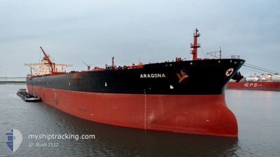
ARAGONA
Tanker
Current Trip
| Time Travelled | 14 days |
|---|---|
| Remaining Time | --- |
| Distance Travelled | 2823.78 nm |
| Remaining Distance | --- |
| AVG Speed | 6.8 Noeuds |
| MAX Speed | 19.5 Noeuds |
| AVG Wind | 11.4 knots |
| MAX Wind | 32.5 knots |
| MIN Temp | 10.1°C / 50.18°F |
| MAX Temp | 23°C / 73.4°F |
| Tirant d eau | 21.9 m |
| Position reçue | 1 d depuis |
Current Position
| Longitude | 25.63336° |
|---|---|
| Latitude | 32.96198° |
| Etat | Under way using engine |
| Vitesse | 11.9 Noeuds |
| Parcours | 291.5° |
| Zone | Mediterranean Sea - Eastern Basin |
| Station | T-AIS |
| Position reçue | 1 d depuis |
Info
Information
The current position of ARAGONA is in Mediterranean Sea - Eastern Basin with coordinates 32.96198° / 25.63336° as reported on 2024-04-17 09:24 by AIS to our vessel tracker app. The vessel's current speed is 11.9 Noeuds and is heading at the port of ROTTERDAM. The estimated time of arrival as calculated by MyShipTracking vessel tracking app is 2024-04-27 19:00 LT
The vessel ARAGONA (IMO: 9513115, MMSI: 241162000) is a Tanker It's sailing under the flag of [GR] Greece.
In this page you can find informations about the vessels current position, last detected port calls, and current voyage information. If the vessels is not in coverage by AIS you will find the latest position.
The current position of ARAGONA is detected by our AIS receivers and we are not responsible for the reliability of the data. The last position was recorded while the vessel was in Coverage by the Ais receivers of our vessel tracking app.
The current draught of ARAGONA as reported by AIS is 21.9 meters
Weather
| Temperature | 17°C / 62.6°F |
|---|---|
| Wind Speed | 20 knots |
| Direction | 277° W |
| Pressure | 1010.2 hPa |
| Humidity | 78.9 % |
| Cloud Coverage | 2 % |
Featured Company
Events
| Heure | Evenement | Détails | Position/ Destination | Info |
|---|---|---|---|---|
| 2024-04-17 09:32 | Etat Changé | Default Under way using engine |
32.97100 / 25.60663
ROTTERDAM
|
Vitesse: 11.9 kn Parcours: 291.5° |
| 2024-04-17 09:24 | Hors de la zone couverte |
32.96198 / 25.63336
Mediterranean Sea - Eastern Basin
ROTTERDAM
|
Vitesse: 11.9 kn Parcours: 291.5° |
|
| 2024-04-17 07:53 | Changement de zone | Libyan part of the Mediterranean Sea - Eastern Basin Egyptian part of the Mediterranean Sea - Eastern Basin |
32.84329 / 25.97609
Mediterranean Sea - Eastern Basin
ROTTERDAM
|
Vitesse: 12.4 kn Parcours: 289.7° |
| 2024-04-17 06:44 | Etat Changé | Under way using engine Default |
32.76680 / 26.24590
ROTTERDAM
|
Vitesse: 12.6 kn Parcours: 291° |
| 2024-04-17 06:27 | Etat Changé | Default Under way using engine |
32.74605 / 26.30975
ROTTERDAM
|
Vitesse: 12.6 kn Parcours: 291.5° |
| 2024-04-17 06:23 | Etat Changé | Under way using engine Default |
32.73965 / 26.32922
ROTTERDAM
|
Vitesse: 12.6 kn Parcours: 291° |
| 2024-04-17 06:17 | Dans la zone couverte |
32.73965 / 26.32922
Mediterranean Sea - Eastern Basin
ROTTERDAM
|
Vitesse: 12.6 kn Parcours: 291° |
|
| 2024-04-17 02:40 | Etat Changé | Default Under way using engine |
32.46405 / 27.20694
ROTTERDAM
|
Vitesse: 12.6 kn Parcours: 289.7° |
| 2024-04-17 02:39 | Hors de la zone couverte |
32.46269 / 27.21148
Mediterranean Sea - Eastern Basin
ROTTERDAM
|
Vitesse: 12.6 kn Parcours: 289.7° |
|
| 2024-04-16 20:13 | Etat Changé | Under way using engine Default |
31.69662 / 28.55927
ROTTERDAM
|
Vitesse: 13.1 kn Parcours: 308° |