
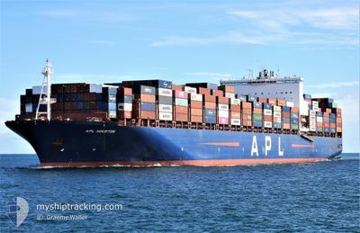
APL HOUSTON
Container Ship
Current Trip
ZADUR
| Time Travelled | 18 days |
|---|---|
| Remaining Time | --- |
| Distance Travelled | 2571.47 nm |
| Remaining Distance | --- |
| AVG Speed | 9.1 Noeuds |
| MAX Speed | 19.3 Noeuds |
| AVG Wind | 18.1 knots |
| MAX Wind | 36.7 knots |
| MIN Temp | 19.7°C / 67.46°F |
| MAX Temp | 27.1°C / 80.78°F |
| Tirant d eau | 12.1 m |
| Position reçue | 1 m depuis |
Current Position
| Longitude | 31.48104° |
|---|---|
| Latitude | -29.78898° |
| Etat | Under way using engine |
| Vitesse | 1.5 Noeuds |
| Parcours | 123° |
| Zone | Indian Ocean |
| Station | T-AIS |
| Position reçue | 1 m depuis |
Info
Information
The current position of APL HOUSTON is in Indian Ocean with coordinates -29.78898° / 31.48104° as reported on 2024-04-20 15:56 by AIS to our vessel tracker app. The vessel's current speed is 1.5 Noeuds
The vessel APL HOUSTON (IMO: 9597537, MMSI: 566956000) is a Container Ship that was built in 2014 ( 10 Age ). It's sailing under the flag of [SG] Singapore.
In this page you can find informations about the vessels current position, last detected port calls, and current voyage information. If the vessels is not in coverage by AIS you will find the latest position.
The current position of APL HOUSTON is detected by our AIS receivers and we are not responsible for the reliability of the data. The last position was recorded while the vessel was in Coverage by the Ais receivers of our vessel tracking app.
The current draught of APL HOUSTON as reported by AIS is 12.1 meters
Weather
| Temperature | 24.7°C / 76.46°F |
|---|---|
| Wind Speed | 10 knots |
| Direction | 57° ENE |
| Pressure | 1011.9 hPa |
| Humidity | 79 % |
| Cloud Coverage | 11 % |
Featured Company
Last Port Calls
| Port | Arrival | Departure | Time In Port |
|---|---|---|---|
| 2024-03-31 09:13 | 2024-04-02 07:53 | 1 d | |
| 2024-03-21 12:00 | 2024-03-23 05:49 | 1 d | |
| 2024-03-11 06:16 | 2024-03-12 09:50 | 1 d | |
| 2024-03-04 22:45 | 2024-03-05 21:26 | 22 h | |
| 2024-02-14 07:01 | 2024-02-22 14:17 | 8 d |
Most Visited Ports (Last year)
| Port | Arrivals | |
|---|---|---|
| 5 | ||
| 5 | ||
| 4 | ||
| 4 | ||
| 3 | ||
| 2 |
Last Trips
| Origin | Departure | Destination | Arrival | Distance | |
|---|---|---|---|---|---|
| 2024-03-23 13:49 | 2024-03-31 13:13 | 3340.08 nm | |||
| 2024-03-12 17:50 | 2024-03-21 20:00 | 2427.85 nm | |||
| 2024-03-06 05:26 | 2024-03-11 14:16 | 2184.59 nm | |||
| 2024-02-22 16:17 | 2024-03-05 06:45 | 4875.76 nm | |||
| 2024-01-29 22:47 | 2024-02-14 09:01 | 2521.50 nm |
Events
| Heure | Evenement | Détails | Position/ Destination | Info |
|---|---|---|---|---|
| 2024-04-20 13:27 | Etat Changé | Under way using engine Default |
-30.06170 / 31.62819
ZADUR
|
Vitesse: 6.4 kn Parcours: 30° |
| 2024-04-20 13:11 | Dans la zone couverte |
-30.06042 / 31.62909
Indian Ocean
|
Vitesse: 6.3 kn Parcours: 31.1° |
|
| 2024-04-20 12:07 | Etat Changé | Default Under way using engine |
-30.19378 / 31.54765
ZADUR
|
Vitesse: 6.7 kn Parcours: 25.2° |
| 2024-04-20 12:02 | Hors de la zone couverte |
-30.20350 / 31.54243
Indian Ocean
|
Vitesse: 6.7 kn Parcours: 25.2° |
|
| 2024-04-20 11:28 | Etat Changé | Under way using engine Default |
-30.26098 / 31.51111
ZADUR
|
Vitesse: 6.6 kn Parcours: 26° |
| 2024-04-20 10:55 | Etat Changé | Default Under way using engine |
-30.31500 / 31.48167
ZADUR
|
Vitesse: 6.3 kn Parcours: 25.2° |
| 2024-04-20 10:40 | Etat Changé | Under way using engine Default |
-30.33945 / 31.46878
ZADUR
|
Vitesse: 6.3 kn Parcours: 22° |
| 2024-04-20 10:39 | Etat Changé | Default Under way using engine |
-30.34054 / 31.46825
ZADUR
|
Vitesse: 6.3 kn Parcours: 21.9° |
| 2024-04-20 10:30 | Etat Changé | Under way using engine Default |
-30.35521 / 31.46121
ZADUR
|
Vitesse: 6.4 kn Parcours: 20° |
| 2024-04-20 10:01 | Etat Changé | Default Under way using engine |
-30.40368 / 31.43773
ZADUR
|
Vitesse: 6.3 kn Parcours: 22.7° |