
MY ANYA
Pleasure Craft
Current Trip
| Time Travelled | 4 h, 38 mins |
|---|---|
| Remaining Time | 3 h, 9 mins |
| Distance Travelled | 43.14 nm |
| Remaining Distance | 55.96 nm |
| AVG Speed | 12.9 Noeuds |
| MAX Speed | 14.6 Noeuds |
| AVG Wind | 9.5 knots |
| MAX Wind | 18.7 knots |
| MIN Temp | 13.6°C / 56.48°F |
| MAX Temp | 14.7°C / 58.46°F |
| Tirant d eau | 2.7 m |
| Position reçue | 1 h, 7 m depuis |
Current Position
| Longitude | 7.85788° |
|---|---|
| Latitude | 43.79410° |
| Etat | Under way using engine |
| Vitesse | 13.4 Noeuds |
| Parcours | 72.5° |
| Zone | Ligurian Sea |
| Station | T-AIS |
| Position reçue | 1 h, 7 m depuis |
Info
Information
The current position of MY ANYA is in Ligurian Sea with coordinates 43.79410° / 7.85788° as reported on 2024-04-18 11:27 by AIS to our vessel tracker app. The vessel's current speed is 13.4 Noeuds and is heading at the port of GENOVA. The estimated time of arrival as calculated by MyShipTracking vessel tracking app is 2024-04-18 15:44 LT
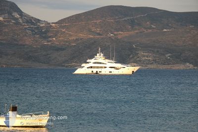
The vessel MY ANYA (IMO: 8565111, MMSI: 215702000) is a Pleasure Craft It's sailing under the flag of [MT] Malta.
In this page you can find informations about the vessels current position, last detected port calls, and current voyage information. If the vessels is not in coverage by AIS you will find the latest position.
The current position of MY ANYA is detected by our AIS receivers and we are not responsible for the reliability of the data. The last position was recorded while the vessel was in Coverage by the Ais receivers of our vessel tracking app.
The current draught of MY ANYA as reported by AIS is 2.7 meters
Weather
| Temperature | 14.9°C / 58.82°F |
|---|---|
| Wind Speed | 18 knots |
| Direction | 20° NNE |
| Pressure | 1006.4 hPa |
| Humidity | 45.2 % |
| Cloud Coverage | 63 % |
Featured Company
Last Port Calls
| Port | Arrival | Departure | Time In Port |
|---|---|---|---|
| 2024-02-13 10:45 | 2024-04-18 07:57 | ||
| 2024-02-13 09:59 |
Most Visited Ports (Last year)
| Port | Arrivals | |
|---|---|---|
| 6 | ||
| 5 | ||
| 3 | ||
| 2 | ||
| 2 | ||
| 2 |
Last Trips
| Origin | Departure | Destination | Arrival | Distance | |
|---|---|---|---|---|---|
| 2024-02-13 10:59 | 2024-02-13 11:45 | 9.06 nm |
Events
| Heure | Evenement | Détails | Position/ Destination | Info |
|---|---|---|---|---|
| 2024-04-18 11:27 | Hors de la zone couverte |
43.79410 / 7.85788
Ligurian Sea
GENOVA
|
Vitesse: 13.4 kn Parcours: 72.5° |
|
| 2024-04-18 10:47 | Detecté en mer | Italian part of the Ligurian Sea |
43.72917 / 7.67604
Ligurian Sea
GENOVA
|
Vitesse: 12.3 kn Parcours: 64.6° |
| 2024-04-18 10:26 | Changement de zone | Italian part of the Mediterranean Sea - Western Basin French part of the Mediterranean Sea - Western Basin |
43.69529 / 7.58056
Mediterranean Sea - Western Basin
GENOVA
|
Vitesse: 12.2 kn Parcours: 67.8° |
| 2024-04-18 10:05 | Detecté en mer | French part of the Mediterranean Sea - Western Basin |
43.66049 / 7.48712
Mediterranean Sea - Western Basin
GENOVA
|
Vitesse: 14.1 kn Parcours: 58.4° |
| 2024-04-18 09:59 | Changement de zone | Mon�gasque part of the Mediterranean Sea - Western Basin French part of the Mediterranean Sea - Western Basin |
43.64887 / 7.46117
Mediterranean Sea - Western Basin
GENOVA
|
Vitesse: 13.6 kn Parcours: 59.3° |
| 2024-04-18 08:14 | Démarrage | 0.49 nm, South of CANNES |
43.53540 / 7.02353
GENOVA
|
Vitesse: 9.9 kn Parcours: 177° |
| 2024-04-18 08:13 | Arret | 0.38 nm, South of CANNES |
43.53722 / 7.02383
GENOVA
|
Vitesse: 0.3 kn Parcours: 192° |
| 2024-04-18 08:12 | Changement de destination | GENOVA CANNES |
43.53735 / 7.02370
GENOVA
|
Vitesse: 0.6 kn Parcours: 108° |
| 2024-04-18 08:10 | Changement d'ETA | 2024/04/18 17:00 2025/02/13 11:45 |
43.53744 / 7.02349
CANNES
|
Vitesse: 0.6 kn Parcours: 112° |
| 2024-04-18 08:10 | Etat Changé | Under way using engine Moored |
43.53746 / 7.02346
CANNES
|
Vitesse: 0.5 kn Parcours: 197° |