
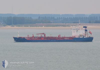
AMUR STAR
Oil/Chemical Tanker
Current Trip
| Time Travelled | 2 days |
|---|---|
| Remaining Time | --- |
| Distance Travelled | 353.15 nm |
| Remaining Distance | --- |
| AVG Speed | 9.3 Noeuds |
| MAX Speed | 13.2 Noeuds |
| AVG Wind | 11 knots |
| MAX Wind | 25 knots |
| MIN Temp | -3°C / 26.6°F |
| MAX Temp | 13.5°C / 56.3°F |
| Tirant d eau | 7.6 m |
| Position reçue | 3 m depuis |
Current Position
| Longitude | -79.60285° |
|---|---|
| Latitude | 43.49367° |
| Etat | Moored |
| Vitesse | |
| Parcours | 158° |
| Zone | Gulf of St-Lawrence |
| Station | T-AIS |
| Position reçue | 3 m depuis |
Info
Information
The current position of AMUR STAR is in Gulf of St-Lawrence with coordinates 43.49367° / -79.60285° as reported on 2024-04-25 04:10 by AIS to our vessel tracker app. The vessel's current speed is 0 Noeuds
The vessel AMUR STAR (IMO: 9480368, MMSI: 248043000) is a Oil/Chemical Tanker that was built in 2010 ( 14 Age ). It's sailing under the flag of [MT] Malta.
In this page you can find informations about the vessels current position, last detected port calls, and current voyage information. If the vessels is not in coverage by AIS you will find the latest position.
The current position of AMUR STAR is detected by our AIS receivers and we are not responsible for the reliability of the data. The last position was recorded while the vessel was in Coverage by the Ais receivers of our vessel tracking app.
The current draught of AMUR STAR as reported by AIS is 7.6 meters
Weather
| Temperature | 4.6°C / 40.28°F |
|---|---|
| Wind Speed | 12 knots |
| Direction | 74° ENE |
| Pressure | 1026.7 hPa |
| Humidity | 57.1 % |
| Cloud Coverage | --- |
Featured Company
Last Port Calls
| Port | Arrival | Departure | Time In Port |
|---|---|---|---|
| 2024-04-22 02:12 | 2024-04-22 04:19 | 2 h | |
| 2024-04-14 16:30 | 2024-04-15 13:08 | 20 h | |
| 2024-04-08 05:33 | 2024-04-08 07:28 | 1 h | |
| 2024-03-30 18:29 | 2024-03-30 19:09 | 40 m | |
| 2024-03-16 12:21 | 2024-03-17 10:54 | 22 h | |
| 2024-03-11 22:35 | 2024-03-13 23:00 | 2 d | |
| 2024-03-05 01:10 | 2024-03-05 14:50 | 13 h | |
| 2024-03-03 08:51 | 2024-03-03 23:07 | 14 h | |
| 2024-02-27 13:12 | 2024-03-01 03:25 | 2 d | |
| 2024-02-23 01:52 | 2024-02-23 04:00 | 2 h |
Last Trips
| Origin | Departure | Destination | Arrival | Distance | |
|---|---|---|---|---|---|
| 2024-04-15 09:08 | 2024-04-21 22:12 | 1598.24 nm | |||
| 2024-04-08 03:28 | 2024-04-14 12:30 | 1552.48 nm | |||
| 2024-03-30 15:09 | 2024-04-08 01:33 | 719.93 nm | |||
| 2024-03-17 11:54 | 2024-03-30 14:29 | 3303.17 nm | |||
| 2024-03-14 00:00 | 2024-03-16 13:21 | 307.23 nm | |||
| 2024-03-05 15:50 | 2024-03-11 23:35 | 893.58 nm | |||
| 2024-03-04 00:07 | 2024-03-05 02:10 | 240.84 nm | |||
| 2024-03-01 04:25 | 2024-03-03 09:51 | 523.00 nm | |||
| 2024-02-23 05:00 | 2024-02-27 14:12 | 429.86 nm | |||
| 2024-02-23 02:52 | 2024-02-23 02:52 | 0.02 nm |
Events
| Heure | Evenement | Détails | Position/ Destination | Info |
|---|---|---|---|---|
| 2024-04-25 03:07 | Etat Changé | Moored Default |
43.49361 / -79.60276
CA CSN > PR SJU
|
Vitesse: Parcours: -1° |
| 2024-04-25 03:05 | Etat Changé | Default Moored |
43.49333 / -79.60167
CA CSN > PR SJU
|
Vitesse: Parcours: 158° |
| 2024-04-24 20:44 | Tirant d'eau modifié | 7.6 6.7 |
43.49361 / -79.60283
CA CSN > PR SJU
|
Vitesse: Parcours: 158° |
| 2024-04-24 20:44 | Changement de destination | CA CSN > PR SJU US NYC>CA CSN |
43.49361 / -79.60283
CA CSN > PR SJU
|
Vitesse: Parcours: 158° |
| 2024-04-24 20:44 | Changement d'ETA | 2024/05/06 15:00 2024/04/24 15:00 |
43.49361 / -79.60283
CA CSN > PR SJU
|
Vitesse: Parcours: 158° |
| 2024-04-24 19:19 | Etat Changé | Moored Default |
43.49363 / -79.60284
US NYC>CA CSN
|
Vitesse: Parcours: -1° |
| 2024-04-24 19:17 | Etat Changé | Default Moored |
43.49333 / -79.60167
US NYC>CA CSN
|
Vitesse: Parcours: 158° |
| 2024-04-24 12:34 | Etat Changé | Moored Under way using engine |
43.49363 / -79.60285
US NYC>CA CSN
|
Vitesse: Parcours: 158° |
| 2024-04-24 11:58 | Arret | 3.62 nm, South of PORT CREDIT |
43.48853 / -79.59993
US NYC>CA CSN
|
Vitesse: 0.2 kn Parcours: 202° |
| 2024-04-24 09:50 | Démarrage | 2.17 nm, North West of PORT WELLER |
43.24077 / -79.25491
US NYC>CA CSN
|
Vitesse: 3.2 kn Parcours: 311° |