
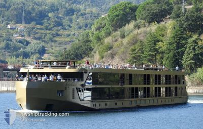
AMADOURO
Passenger
Current Trip
PTDOU
| Time Travelled | --- |
|---|---|
| Remaining Time | --- |
| Distance Travelled | 1.30 nm |
| Remaining Distance | --- |
| AVG Speed | --- |
| MAX Speed | --- |
| AVG Wind | 8.5 knots |
| MAX Wind | 20 knots |
| MIN Temp | 7.6°C / 45.68°F |
| MAX Temp | 17.3°C / 63.14°F |
| Tirant d eau | 1.6 m |
| Position reçue | 2 d depuis |
Current Position
| Longitude | -8.45632° |
|---|---|
| Latitude | 41.05992° |
| Etat | At anchor |
| Vitesse | 8.7 Noeuds |
| Parcours | 135.9° |
| Zone | North Atlantic Ocean |
| Station | T-AIS |
| Position reçue | 2 d depuis |
Info
Information
The current position of AMADOURO is in North Atlantic Ocean with coordinates 41.05992° / -8.45632° as reported on 2024-04-14 08:03 by AIS to our vessel tracker app. The vessel's current speed is 8.7 Noeuds
The vessel AMADOURO (MMSI: 263752970) is a Passenger It's sailing under the flag of [PT] Portugal.
In this page you can find informations about the vessels current position, last detected port calls, and current voyage information. If the vessels is not in coverage by AIS you will find the latest position.
The current position of AMADOURO is detected by our AIS receivers and we are not responsible for the reliability of the data. The last position was recorded while the vessel was in Coverage by the Ais receivers of our vessel tracking app.
The current draught of AMADOURO as reported by AIS is 1.6 meters
Weather
| Temperature | 17.9°C / 64.22°F |
|---|---|
| Wind Speed | 2 knots |
| Direction | 30° NNE |
| Pressure | 1022.1 hPa |
| Humidity | 61.4 % |
| Cloud Coverage | --- |
Featured Company
Last Port Calls
Most Visited Ports (Last year)
| Port | Arrivals | |
|---|---|---|
| 12 |
Last Trips
| Origin | Departure | Destination | Arrival | Distance |
|---|
Events
| Heure | Evenement | Détails | Position/ Destination | Info |
|---|---|---|---|---|
| 2024-04-15 06:47 | Démarrage |
41.15500 / -7.78167
PTDOU
|
Vitesse: 4 kn Parcours: -1° |
|
| 2024-04-14 13:41 | Arret |
41.16000 / -7.79833
PTDOU
|
Vitesse: Parcours: -1° |
|
| 2024-04-14 08:26 | Etat Changé | Default At anchor |
41.05667 / -8.41833
PTDOU
|
Vitesse: 8.7 kn Parcours: 135.9° |
| 2024-04-14 08:03 | Hors de la zone couverte |
41.05992 / -8.45632
North Atlantic Ocean
|
Vitesse: 8.7 kn Parcours: 135.9° |
|
| 2024-04-14 08:03 | Etat Changé | At anchor Default |
41.06020 / -8.45669
PTDOU
|
Vitesse: 8 kn Parcours: 149° |
| 2024-04-14 07:59 | Etat Changé | Default At anchor |
41.06667 / -8.46167
PTDOU
|
Vitesse: 7.8 kn Parcours: 104.4° |
| 2024-04-14 06:05 | Démarrage | 1.92 nm, East of PORTO |
41.13890 / -8.61477
PTDOU
|
Vitesse: 4.2 kn Parcours: 76.7° |
| 2024-04-14 06:04 | Etat Changé | At anchor Default |
41.13867 / -8.61606
PTDOU
|
Vitesse: Parcours: -1° |
| 2024-04-14 05:56 | Etat Changé | Default At anchor |
41.13833 / -8.61667
PTDOU
|
Vitesse: Parcours: 511° |
| 2024-04-14 03:21 | Etat Changé | At anchor Default |
41.13797 / -8.61718
PTDOU
|
Vitesse: Parcours: -1° |