
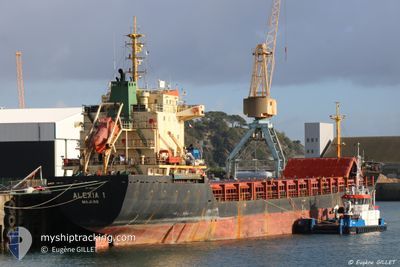
ALEXIA I
General Cargo
Current Trip
| Trip Time | --- |
|---|---|
| Trip Distance | --- |
| AVG Speed | --- |
| MAX Speed | --- |
| Tirant d eau | --- |
| AVG Wind | --- |
| MAX Wind | --- |
| MIN Temp | --- |
| MAX Temp | --- |
| Position reçue | 5 d depuis |
Current Position
| Longitude | 17.46330° |
|---|---|
| Latitude | 42.06355° |
| Etat | Under way using engine |
| Vitesse | 7.6 Noeuds |
| Parcours | 316° |
| Zone | Adriatic Sea |
| Station | T-AIS |
| Position reçue | 5 d depuis |
Info
Information
The current position of ALEXIA I is in Adriatic Sea with coordinates 42.06355° / 17.46330° as reported on 2024-04-12 16:09 by AIS to our vessel tracker app. The vessel's current speed is 7.6 Noeuds and is currently inside the port of PLOCE.
The vessel ALEXIA I (IMO: 9365049, MMSI: 538009439) is a General Cargo that was built in 2005 ( 19 Age ). It's sailing under the flag of [MH] Marshall Is.
In this page you can find informations about the vessels current position, last detected port calls, and current voyage information. If the vessels is not in coverage by AIS you will find the latest position.
The current position of ALEXIA I is detected by our AIS receivers and we are not responsible for the reliability of the data. The last position was recorded while the vessel was in Coverage by the Ais receivers of our vessel tracking app.
The current draught of ALEXIA I as reported by AIS is 7.7 meters
Weather
| Temperature | 15.9°C / 60.62°F |
|---|---|
| Wind Speed | 7 knots |
| Direction | 118° ESE |
| Pressure | 1010.1 hPa |
| Humidity | 71.7 % |
| Cloud Coverage | 6 % |
Featured Company
Last Port Calls
| Port | Arrival | Departure | Time In Port |
|---|---|---|---|
| 2024-04-04 08:02 | 2024-04-09 01:47 | 4 d | |
| 2024-03-25 05:23 | |||
| 2024-03-14 16:56 | |||
| 2024-02-28 08:44 | 2024-03-02 11:44 | 3 d | |
| 2024-02-17 11:30 | 2024-02-21 18:52 | 4 d | |
| 2024-02-08 07:27 | 2024-02-10 09:00 | 2 d | |
| 2024-02-05 11:55 |
Events
| Heure | Evenement | Détails | Position/ Destination | Info |
|---|---|---|---|---|
| 2024-04-12 16:14 | Etat Changé | Default Under way using engine |
42.07122 / 17.45325
HR PLE
|
Vitesse: 7.6 kn Parcours: 316° |
| 2024-04-12 16:09 | Etat Changé | Under way using engine Default |
42.06355 / 17.46330
HR PLE
|
Vitesse: 7.5 kn Parcours: 316° |
| 2024-04-12 16:09 | Hors de la zone couverte |
42.06355 / 17.46330
Adriatic Sea
HR PLE
|
Vitesse: 7.6 kn Parcours: 316° |
|
| 2024-04-12 15:50 | Etat Changé | Default Under way using engine |
42.03409 / 17.50041
HR PLE
|
Vitesse: 7.5 kn Parcours: 318° |
| 2024-04-12 11:55 | Changement de zone | Croatian part of the Adriatic Sea Italian part of the Adriatic Sea |
41.67839 / 17.93010
Adriatic Sea
HR PLE
|
Vitesse: 7.5 kn Parcours: 319° |
| 2024-04-12 07:37 | Detecté en mer | Italian part of the Adriatic Sea |
41.28075 / 18.40299
Adriatic Sea
HR PLE
|
Vitesse: 7.9 kn Parcours: 318° |
| 2024-04-12 07:36 | Etat Changé | Under way using engine Default |
41.27964 / 18.40428
HR PLE
|
Vitesse: 7.9 kn Parcours: 318° |
| 2024-04-12 07:19 | Dans la zone couverte |
41.28075 / 18.40299
Adriatic Sea
HR PLE
|
Vitesse: 7.9 kn Parcours: 318° |
|
| 2024-04-12 06:12 | Etat Changé | Default Under way using engine |
41.14058 / 18.56542
HR PLE
|
Vitesse: 7.7 kn Parcours: 320° |
| 2024-04-12 06:08 | Hors de la zone couverte |
41.13402 / 18.57274
Adriatic Sea
HR PLE
|
Vitesse: 7.7 kn Parcours: 320° |