
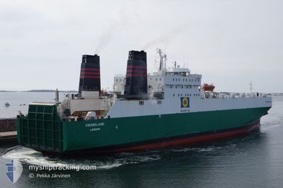
AKRITAS
Ro-Ro Cargo
Current Trip
| Time Travelled | 1 day |
|---|---|
| Remaining Time | --- |
| Distance Travelled | 163.94 nm |
| Remaining Distance | --- |
| AVG Speed | 13.6 Noeuds |
| MAX Speed | 14.3 Noeuds |
| AVG Wind | 8.7 knots |
| MAX Wind | 14 knots |
| MIN Temp | 21.7°C / 71.06°F |
| MAX Temp | 32.9°C / 91.22°F |
| Tirant d eau | 6.4 m |
| Position reçue | 2 h, 39 m depuis |
Current Position
| Longitude | 35.49079° |
|---|---|
| Latitude | 33.81827° |
| Etat | Under way using engine |
| Vitesse | 0.1 Noeuds |
| Parcours | --- |
| Zone | Mediterranean Sea - Eastern Basin |
| Station | T-AIS |
| Position reçue | 2 h, 39 m depuis |
Info
Information
The current position of AKRITAS is in Mediterranean Sea - Eastern Basin with coordinates 33.81827° / 35.49079° as reported on 2024-04-25 17:10 by AIS to our vessel tracker app. The vessel's current speed is 0.1 Noeuds
The vessel AKRITAS (IMO: 8020599, MMSI: 209511000) is a Ro-Ro Cargo that was built in 1982 ( 42 Age ). It's sailing under the flag of [CY] Cyprus.
In this page you can find informations about the vessels current position, last detected port calls, and current voyage information. If the vessels is not in coverage by AIS you will find the latest position.
The current position of AKRITAS is detected by our AIS receivers and we are not responsible for the reliability of the data. The last position was recorded while the vessel was in Coverage by the Ais receivers of our vessel tracking app.
The current draught of AKRITAS as reported by AIS is 6.4 meters
Weather
| Temperature | 22.9°C / 73.22°F |
|---|---|
| Wind Speed | 9 knots |
| Direction | 24° NNE |
| Pressure | 1005.5 hPa |
| Humidity | 71.6 % |
| Cloud Coverage | 100 % |
Featured Company
Last Port Calls
| Port | Arrival | Departure | Time In Port |
|---|---|---|---|
| 2024-04-24 09:34 | 2024-04-24 15:21 | 5 h | |
| 2024-04-21 05:38 | 2024-04-22 21:52 | 1 d | |
| 2024-04-19 05:07 | 2024-04-19 15:42 | 10 h | |
| 2024-04-17 07:57 | 2024-04-17 14:53 | 6 h | |
| 2024-04-14 05:40 | 2024-04-15 21:32 | 1 d | |
| 2024-04-12 05:00 | 2024-04-12 15:31 | 10 h | |
| 2024-04-10 08:10 | 2024-04-10 15:11 | 7 h | |
| 2024-04-07 05:42 | 2024-04-08 21:26 | 1 d | |
| 2024-04-05 07:48 | 2024-04-05 15:19 | 7 h | |
| 2024-04-03 07:26 | 2024-04-03 16:22 | 8 h |
Most Visited Ports (Last year)
| Port | Arrivals | |
|---|---|---|
| 92 | ||
| 39 | ||
| 33 | ||
| 19 |
Last Trips
| Origin | Departure | Destination | Arrival | Distance | |
|---|---|---|---|---|---|
| 2024-04-23 00:52 | 2024-04-24 12:34 | 491.56 nm | |||
| 2024-04-19 18:42 | 2024-04-21 08:38 | 493.11 nm | |||
| 2024-04-17 17:53 | 2024-04-19 08:07 | 333.14 nm | |||
| 2024-04-16 00:32 | 2024-04-17 10:57 | 491.62 nm | |||
| 2024-04-12 18:31 | 2024-04-14 08:40 | 493.11 nm | |||
| 2024-04-10 18:11 | 2024-04-12 08:00 | 359.79 nm | |||
| 2024-04-09 00:26 | 2024-04-10 11:10 | 493.41 nm | |||
| 2024-04-05 18:19 | 2024-04-07 08:42 | 494.20 nm | |||
| 2024-04-03 19:22 | 2024-04-05 10:48 | 254.47 nm | |||
| 2024-04-02 00:22 | 2024-04-03 10:26 | 487.80 nm |
Events
| Heure | Evenement | Détails | Position/ Destination | Info |
|---|---|---|---|---|
| 2024-04-25 17:10 | Hors de la zone couverte |
33.81827 / 35.49079
Mediterranean Sea - Eastern Basin
CYLMS
|
Vitesse: 0.1 kn Parcours: 511° |
|
| 2024-04-25 14:04 | Tirant d'eau modifié | 6.4 6.5 |
33.81822 / 35.49081
CYLMS
|
Vitesse: Parcours: 511° |
| 2024-04-25 14:04 | Changement de destination | CYLMS ILHFA |
33.81822 / 35.49081
CYLMS
|
Vitesse: Parcours: 511° |
| 2024-04-25 14:04 | Changement d'ETA | 2024/04/26 05:00 2024/04/25 02:30 |
33.81822 / 35.49081
CYLMS
|
Vitesse: Parcours: 511° |
| 2024-04-25 14:04 | Etat Changé | Under way using engine Moored |
33.81822 / 35.49081
ILHFA
|
Vitesse: Parcours: 511° |
| 2024-04-25 04:39 | Etat Changé | Moored Under way using engine |
33.81826 / 35.49080
ILHFA
|
Vitesse: Parcours: 511° |
| 2024-04-25 00:31 | Dans la zone couverte |
33.81827 / 35.49080
Mediterranean Sea - Eastern Basin
ILHFA
|
Vitesse: Parcours: 511° |
|
| 2024-04-24 23:01 | Hors de la zone couverte |
33.35011 / 34.43418
Mediterranean Sea - Eastern Basin
ILHFA
|
Vitesse: 13.7 kn Parcours: 132.8° |
|
| 2024-04-24 22:40 | Etat Changé | Under way using engine Default |
33.40583 / 34.36303
ILHFA
|
Vitesse: 13.7 kn Parcours: 132° |
| 2024-04-24 22:30 | Etat Changé | Default Under way using engine |
33.43216 / 34.32917
ILHFA
|
Vitesse: 13.6 kn Parcours: 133° |