
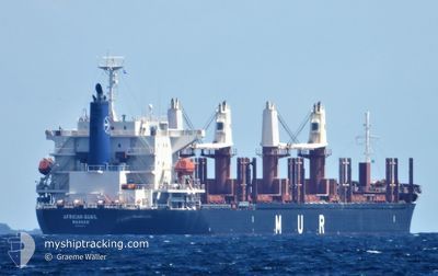
AFRICAN QUAIL
Cargo
Current Trip
| Time Travelled | 16 h, 21 mins |
|---|---|
| Remaining Time | --- |
| Distance Travelled | 178.70 nm |
| Remaining Distance | --- |
| AVG Speed | 11.1 Noeuds |
| MAX Speed | 13 Noeuds |
| AVG Wind | 6.2 knots |
| MAX Wind | 14 knots |
| MIN Temp | 7°C / 44.6°F |
| MAX Temp | 11.2°C / 52.16°F |
| Tirant d eau | 10.9 m |
| Position reçue | Maintenant |
Current Position
| Longitude | -125.66849° |
|---|---|
| Latitude | 48.42774° |
| Etat | Under way using engine |
| Vitesse | 10.9 Noeuds |
| Parcours | 246.2° |
| Zone | North Pacific Ocean |
| Station | T-AIS |
| Position reçue | Maintenant |
Info
Information
The current position of AFRICAN QUAIL is in North Pacific Ocean with coordinates 48.42774° / -125.66849° as reported on 2024-04-23 12:56 by AIS to our vessel tracker app. The vessel's current speed is 10.9 Noeuds and is heading at the port of TOWNSVILLE. The estimated time of arrival as calculated by MyShipTracking vessel tracking app is 2024-05-17 21:00 LT
The vessel AFRICAN QUAIL (IMO: 9738741, MMSI: 311000909) is a Cargo It's sailing under the flag of [BS] Bahamas.
In this page you can find informations about the vessels current position, last detected port calls, and current voyage information. If the vessels is not in coverage by AIS you will find the latest position.
The current position of AFRICAN QUAIL is detected by our AIS receivers and we are not responsible for the reliability of the data. The last position was recorded while the vessel was in Coverage by the Ais receivers of our vessel tracking app.
The current draught of AFRICAN QUAIL as reported by AIS is 10.9 meters
Weather
| Temperature | 9.3°C / 48.74°F |
|---|---|
| Wind Speed | 14 knots |
| Direction | 321° NW |
| Pressure | 1016 hPa |
| Humidity | 72.3 % |
| Cloud Coverage | 100 % |
Featured Company
Last Port Calls
| Port | Arrival | Departure | Time In Port |
|---|---|---|---|
| 2024-04-22 13:17 | 2024-04-22 20:36 | 7 h | |
| 2024-04-21 07:03 | 2024-04-21 18:45 | 11 h | |
| 2024-04-17 14:21 | 2024-04-19 15:47 | 2 d | |
| 2024-03-23 22:08 | 2024-03-27 07:11 | 3 d | |
| 2024-02-18 01:35 | 2024-02-19 20:45 | 1 d | |
| 2024-02-14 22:22 | 2024-02-17 22:46 | 3 d |
Most Visited Ports (Last year)
| Port | Arrivals | |
|---|---|---|
| 5 | ||
| 2 | ||
| 1 | ||
| 1 | ||
| 1 | ||
| 1 |
Last Trips
| Origin | Departure | Destination | Arrival | Distance | |
|---|---|---|---|---|---|
| 2024-04-21 11:45 | 2024-04-22 06:17 | 15.19 nm | |||
| 2024-04-19 08:47 | 2024-04-21 00:03 | 435.36 nm | |||
| 2024-03-27 15:11 | 2024-04-17 07:21 | 5265.24 nm | |||
| 2024-02-19 12:45 | 2024-03-24 06:08 | 5306.79 nm | |||
| 2024-02-17 14:46 | 2024-02-17 17:35 | 34.31 nm | |||
| 2024-01-30 16:45 | 2024-02-14 14:22 | 4737.67 nm |
Events
| Heure | Evenement | Détails | Position/ Destination | Info |
|---|---|---|---|---|
| 2024-04-23 09:49 | Changement de zone | Canadian part of the North Pacific Ocean Canadian part of the The Coastal Waters of Southeast Alaska and British Columbia |
48.52218 / -124.85597
North Pacific Ocean
AU TSV
|
Vitesse: 11 kn Parcours: 270.1° |
| 2024-04-23 09:49 | Etat Changé | Under way using engine Default |
48.52218 / -124.85597
AU TSV
|
Vitesse: 10.9 kn Parcours: 270° |
| 2024-04-23 09:22 | Etat Changé | Default Under way using engine |
48.50881 / -124.73781
AU TSV
|
Vitesse: 11.1 kn Parcours: 290.7° |
| 2024-04-23 09:02 | Etat Changé | Under way using engine Default |
48.48702 / -124.64863
AU TSV
|
Vitesse: 11 kn Parcours: 292° |
| 2024-04-23 08:50 | Etat Changé | Default Under way using engine |
48.47365 / -124.59995
AU TSV
|
Vitesse: 10.7 kn Parcours: 295.4° |
| 2024-04-23 08:44 | Etat Changé | Under way using engine Default |
48.46612 / -124.57628
AU TSV
|
Vitesse: 10.7 kn Parcours: 294° |
| 2024-04-23 08:38 | Etat Changé | Default Under way using engine |
48.45821 / -124.55188
AU TSV
|
Vitesse: 11 kn Parcours: 294.4° |
| 2024-04-23 08:23 | Etat Changé | Under way using engine Default |
48.43954 / -124.48785
AU TSV
|
Vitesse: 10.7 kn Parcours: 294° |
| 2024-04-23 08:19 | Etat Changé | Default Under way using engine |
48.43428 / -124.46934
AU TSV
|
Vitesse: 10.8 kn Parcours: 292.7° |
| 2024-04-23 04:24 | Changement d'ETA | 2024/05/17 21:00 2024/04/22 20:28 |
48.30434 / -123.47265
AU TSV
|
Vitesse: 9.8 kn Parcours: 210.6° |