
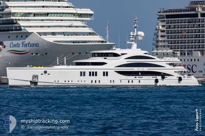
SOUNDWAVE
Pleasure Craft
Current Trip
| Time Travelled | 17 days |
|---|---|
| Remaining Time | 5 h, 22 mins |
| Distance Travelled | 5423.50 nm |
| Remaining Distance | 170.75 nm |
| AVG Speed | 11.5 Noeuds |
| MAX Speed | 14.6 Noeuds |
| AVG Wind | 11.9 knots |
| MAX Wind | 23.6 knots |
| MIN Temp | 9.2°C / 48.56°F |
| MAX Temp | 20.9°C / 69.62°F |
| Tirant d eau | 3.5 m |
| Position reçue | 3 h, 34 m depuis |
Current Position
| Longitude | -7.57383° |
|---|---|
| Latitude | 35.70983° |
| Etat | Under way using engine |
| Vitesse | 13.4 Noeuds |
| Parcours | 82° |
| Zone | North Atlantic Ocean |
| Station | T-AIS |
| Position reçue | 3 h, 34 m depuis |
Info
Information
The current position of SOUNDWAVE is in North Atlantic Ocean with coordinates 35.70983° / -7.57383° as reported on 2024-04-24 05:37 by AIS to our vessel tracker app. The vessel's current speed is 13.4 Noeuds and is heading at the port of GIBRALTAR. The estimated time of arrival as calculated by MyShipTracking vessel tracking app is 2024-04-24 14:33 LT
The vessel SOUNDWAVE (IMO: 1012232, MMSI: 235112524) is a Pleasure Craft It's sailing under the flag of [GB] United Kingdom.
In this page you can find informations about the vessels current position, last detected port calls, and current voyage information. If the vessels is not in coverage by AIS you will find the latest position.
The current position of SOUNDWAVE is detected by our AIS receivers and we are not responsible for the reliability of the data. The last position was recorded while the vessel was in Coverage by the Ais receivers of our vessel tracking app.
The current draught of SOUNDWAVE as reported by AIS is 3.5 meters
Weather
| Temperature | 17.8°C / 64.04°F |
|---|---|
| Wind Speed | 15 knots |
| Direction | 45° NE |
| Pressure | 1016 hPa |
| Humidity | 73.5 % |
| Cloud Coverage | 3 % |
Featured Company
Last Port Calls
| Port | Arrival | Departure | Time In Port |
|---|---|---|---|
| 2024-03-14 21:28 | 2024-04-06 11:08 | 22 d | |
| 2024-03-14 20:48 | 2024-03-14 21:08 | 20 m | |
| 2024-03-10 14:18 | 2024-03-14 17:28 | 4 d | |
| 2024-02-18 16:29 | 2024-03-09 14:15 | 19 d | |
| 2024-02-17 15:25 |
Last Trips
| Origin | Departure | Destination | Arrival | Distance | |
|---|---|---|---|---|---|
| 2024-03-14 17:08 | 2024-03-14 17:28 | 1.12 nm | |||
| 2024-03-14 13:28 | 2024-03-14 16:48 | 26.10 nm | |||
| 2024-03-09 09:15 | 2024-03-10 10:18 | 53.44 nm | |||
| 2024-02-17 10:25 | 2024-02-18 11:29 | 60.10 nm |
Events
| Heure | Evenement | Détails | Position/ Destination | Info |
|---|---|---|---|---|
| 2024-04-24 05:37 | Hors de la zone couverte |
35.70983 / -7.57383
North Atlantic Ocean
GIBRALTAR
|
Vitesse: 13.4 kn Parcours: 82° |
|
| 2024-04-24 05:37 | Detecté en mer | Moroccan part of the North Atlantic Ocean |
35.70983 / -7.57383
North Atlantic Ocean
GIBRALTAR
|
Vitesse: 13.4 kn Parcours: 82° |
| 2024-04-24 05:37 | Dans la zone couverte |
35.70983 / -7.57383
North Atlantic Ocean
GIBRALTAR
|
Vitesse: 13.4 kn Parcours: 82° |
|
| 2024-04-24 01:39 | Hors de la zone couverte |
35.56650 / -8.64133
North Atlantic Ocean
GIBRALTAR
|
Vitesse: 13.5 kn Parcours: 77° |
|
| 2024-04-23 21:37 | Dans la zone couverte |
35.40632 / -9.73450
North Atlantic Ocean
GIBRALTAR
|
Vitesse: 13.7 kn Parcours: 84.1° |
|
| 2024-04-23 19:31 | Hors de la zone couverte |
35.33417 / -10.31317
North Atlantic Ocean
GIBRALTAR
|
Vitesse: 13.9 kn Parcours: 80° |
|
| 2024-04-23 13:08 | Changement de destination | GIBRALTAR BERMUDA |
35.08783 / -12.02050
GIBRALTAR
|
Vitesse: 12.9 kn Parcours: 81° |
| 2024-04-23 13:08 | Changement d'ETA | 2024/04/25 12:00 2024/04/10 08:00 |
35.08783 / -12.02050
GIBRALTAR
|
Vitesse: 12.9 kn Parcours: 81° |
| 2024-04-23 12:46 | Changement de zone | Portuguese part of the North Atlantic Ocean Dutch part of the North Sea |
35.07667 / -12.11383
North Atlantic Ocean
|
Vitesse: 12.8 kn Parcours: 85° |
| 2024-04-23 12:45 | Dans la zone couverte |
35.07667 / -12.11383
North Atlantic Ocean
|
Vitesse: 12.8 kn Parcours: 85° |