
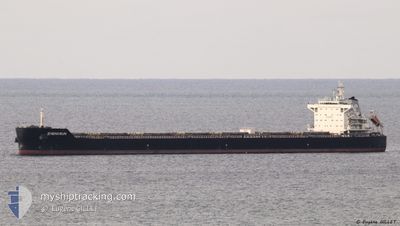
ZHENG RUN
Cargo
Current Trip
| Time Travelled | 11 days |
|---|---|
| Remaining Time | --- |
| Distance Travelled | 603.42 nm |
| Remaining Distance | --- |
| AVG Speed | 7.5 Knots |
| MAX Speed | 7.5 Knots |
| AVG Wind | 10.3 knots |
| MAX Wind | 29.4 knots |
| MIN Temp | 8.6°C / 47.48°F |
| MAX Temp | 19.4°C / 66.92°F |
| Dybgang | 7.7 m |
| Position Modtaget | 4 d siden |
Current Position
| Longitude | 29.25419° |
|---|---|
| Latitude | 41.49648° |
| Status | Under way using engine |
| Fart | 11.3 Knots |
| Kurs | 8.5° |
| Område | Black Sea |
| Station | T-AIS |
| Position Modtaget | 4 d siden |
Info
Information
The current position of ZHENG RUN is in Black Sea with coordinates 41.49648° / 29.25419° as reported on 2024-04-21 01:59 by AIS to our vessel tracker app. The vessel's current speed is 11.3 Knots and is heading at the port of SULINA. The estimated time of arrival as calculated by MyShipTracking vessel tracking app is 2024-04-21 18:00 LT
The vessel ZHENG RUN (IMO: 9593816, MMSI: 356680000) is a Cargo It's sailing under the flag of [PA] Panama.
In this page you can find informations about the vessels current position, last detected port calls, and current voyage information. If the vessels is not in coverage by AIS you will find the latest position.
The current position of ZHENG RUN is detected by our AIS receivers and we are not responsible for the reliability of the data. The last position was recorded while the vessel was in Coverage by the Ais receivers of our vessel tracking app.
The current draught of ZHENG RUN as reported by AIS is 7.7 meters
Weather
| Temperature | 14.3°C / 57.74°F |
|---|---|
| Wind Speed | 4 knots |
| Direction | 121° ESE |
| Pressure | 1004.4 hPa |
| Humidity | 78.5 % |
| Cloud Coverage | 100 % |
Featured Company
Last Trips
Events
| Tid | Hændelsen | Detaljer | Position / Dest | Info |
|---|---|---|---|---|
| 2024-04-23 22:31 | STOP Sejllads |
44.94939 / 30.16824
SULINA
|
Fart: 0.2 kn Kurs: 127° |
|
| 2024-04-23 22:16 | START Sejllads |
44.93540 / 30.18274
SULINA
|
Fart: 35.6 kn Kurs: 177° |
|
| 2024-04-23 18:53 | STOP Sejllads |
44.94807 / 30.16857
SULINA
|
Fart: Kurs: 115° |
|
| 2024-04-23 18:37 | START Sejllads |
44.94886 / 30.16845
SULINA
|
Fart: 9.8 kn Kurs: 146° |
|
| 2024-04-21 18:59 | STOP Sejllads |
44.94681 / 30.16989
SULINA
|
Fart: 0.2 kn Kurs: 21° |
|
| 2024-04-21 01:59 | Udenfor Dækning |
41.49648 / 29.25419
Black Sea
SULINA
|
Fart: 11.3 kn Kurs: 8.5° |
|
| 2024-04-21 00:35 | Ændre havområde | Turkish part of the Black Sea Turkish part of the Sea of Marmara |
41.23358 / 29.14606
Black Sea
SULINA
|
Fart: 11.6 kn Kurs: 37.9° |
| 2024-04-20 21:26 | START Sejllads | 8.32 nm, South of YESILKOY |
40.81710 / 28.81145
SULINA
|
Fart: 3.2 kn Kurs: 28° |
| 2024-04-20 20:43 | STOP Sejllads | 8.44 nm, South of YESILKOY |
40.81472 / 28.81770
SULINA
|
Fart: 0.3 kn Kurs: 19° |
| 2024-04-20 15:17 | Status er ændret | Under way using engine Default |
40.64297 / 28.86585
SULINA
|
Fart: 3.4 kn Kurs: 252° |