
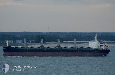
YANGTZE BRIGHTNESS
Bulk Carrier
Current Trip
| Time Travelled | 9 days |
|---|---|
| Remaining Time | --- |
| Distance Travelled | 724.75 nm |
| Remaining Distance | --- |
| AVG Speed | 11.2 Knots |
| MAX Speed | 13.2 Knots |
| AVG Wind | 8.1 knots |
| MAX Wind | 24 knots |
| MIN Temp | 7.4°C / 45.32°F |
| MAX Temp | 19.3°C / 66.74°F |
| Dybgang | 12.1 m |
| Position Modtaget | 20 d siden |
Current Position
| Longitude | 118.79835° |
|---|---|
| Latitude | 38.79053° |
| Status | Under way using engine |
| Fart | 12.6 Knots |
| Kurs | 90.3° |
| Område | Yellow Sea |
| Station | T-AIS |
| Position Modtaget | 20 d siden |
Info
Information
The current position of YANGTZE BRIGHTNESS is in Yellow Sea with coordinates 38.79053° / 118.79835° as reported on 2024-04-04 03:29 by AIS to our vessel tracker app. The vessel's current speed is 12.6 Knots and is heading at the port of YEOSU.
The vessel YANGTZE BRIGHTNESS (IMO: 9492402, MMSI: 538008543) is a Bulk Carrier that was built in 2010 ( 14 år gamle ). It's sailing under the flag of [MH] Marshall Is.
In this page you can find informations about the vessels current position, last detected port calls, and current voyage information. If the vessels is not in coverage by AIS you will find the latest position.
The current position of YANGTZE BRIGHTNESS is detected by our AIS receivers and we are not responsible for the reliability of the data. The last position was recorded while the vessel was in Coverage by the Ais receivers of our vessel tracking app.
The current draught of YANGTZE BRIGHTNESS as reported by AIS is 12.1 meters
Weather
| Temperature | 16.1°C / 60.98°F |
|---|---|
| Wind Speed | 11 knots |
| Direction | 135° SE |
| Pressure | 1011.4 hPa |
| Humidity | 65.7 % |
| Cloud Coverage | 96 % |
Featured Company
Last Port Calls
| Port | Arrival | Departure | Time In Port |
|---|---|---|---|
| 2024-04-13 05:14 | 2024-04-15 23:07 | 2 d | |
| 2024-04-10 07:05 | 2024-04-12 08:04 | 2 d | |
| 2024-03-31 16:28 | 2024-04-04 01:37 | 3 d | |
| 2024-03-12 07:46 | 2024-03-17 16:33 | 5 d | |
| 2024-02-11 04:35 | 2024-02-13 12:13 | 2 d |
Last Trips
| Origin | Departure | Destination | Arrival | Distance | |
|---|---|---|---|---|---|
| 2024-04-12 16:04 | 2024-04-13 13:14 | 172.43 nm | |||
| 2024-04-04 09:37 | 2024-04-10 15:05 | 97.15 nm | |||
| 2024-03-18 02:33 | 2024-04-01 00:28 | 1362.71 nm | |||
| 2024-02-13 17:43 | 2024-03-12 17:46 | 5087.10 nm | |||
| 2024-01-14 17:27 | 2024-02-11 10:05 | 4624.01 nm |
Events
| Tid | Hændelsen | Detaljer | Position / Dest | Info |
|---|---|---|---|---|
| 2024-04-21 19:08 | STOP Sejllads | 13.55 nm, South East of TAICANG |
31.49939 / 121.37756
KR YOS
|
Fart: 0.1 kn Kurs: 302° |
| 2024-04-21 09:08 | START Sejllads |
31.25571 / 122.66995
KR YOS
|
Fart: 7.9 kn Kurs: 248° |
|
| 2024-04-18 03:11 | STOP Sejllads |
31.26167 / 122.68500
KR YOS
|
Fart: Kurs: -1° |
|
| 2024-04-15 23:07 | Afsejlet fra sidste havn |
|
40.29372 / 122.02362
KR YOS
|
Fart: 8.5 kn Kurs: 278° |
| 2024-04-15 22:30 | START Sejllads |
40.26325 / 122.08735
[CN] BAYUQUAN
|
Fart: 4.9 kn Kurs: 17° |