
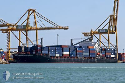
X-PRESS MACHU PICCHU
Container Ship
Current Trip
CUMAR
| Time Travelled | 1 day |
|---|---|
| Remaining Time | --- |
| Distance Travelled | 388.82 nm |
| Remaining Distance | --- |
| AVG Speed | 13.4 Knots |
| MAX Speed | 15.5 Knots |
| AVG Wind | 14.8 knots |
| MAX Wind | 19.6 knots |
| MIN Temp | 25.5°C / 77.9°F |
| MAX Temp | 28.1°C / 82.58°F |
| Dybgang | 10 m |
| Position Modtaget | 1 d siden |
Current Position
| Longitude | -83.36497° |
|---|---|
| Latitude | 23.05305° |
| Status | Under way using engine |
| Fart | 14 Knots |
| Kurs | 257° |
| Område | Gulf of Mexico |
| Station | T-AIS |
| Position Modtaget | 1 d siden |
Info
Information
The current position of X-PRESS MACHU PICCHU is in Gulf of Mexico with coordinates 23.05305° / -83.36497° as reported on 2024-04-18 20:50 by AIS to our vessel tracker app. The vessel's current speed is 14 Knots
The vessel X-PRESS MACHU PICCHU (IMO: 9325441, MMSI: 563058900) is a Container Ship that was built in 2006 ( 18 år gamle ). It's sailing under the flag of [SG] Singapore.
In this page you can find informations about the vessels current position, last detected port calls, and current voyage information. If the vessels is not in coverage by AIS you will find the latest position.
The current position of X-PRESS MACHU PICCHU is detected by our AIS receivers and we are not responsible for the reliability of the data. The last position was recorded while the vessel was in Coverage by the Ais receivers of our vessel tracking app.
The current draught of X-PRESS MACHU PICCHU as reported by AIS is 10 meters
Weather
| Temperature | 27.5°C / 81.5°F |
|---|---|
| Wind Speed | 14 knots |
| Direction | 73° ENE |
| Pressure | 1012.8 hPa |
| Humidity | 71.5 % |
| Cloud Coverage | 16 % |
Featured Company
Last Port Calls
| Port | Arrival | Departure | Time In Port |
|---|---|---|---|
| 2024-04-15 17:30 | 2024-04-18 17:05 | 2 d | |
| 2024-04-12 00:42 | 2024-04-12 13:05 | 12 h | |
| 2024-04-09 08:20 | 2024-04-09 23:51 | 15 h | |
| 2024-04-08 01:35 | |||
| 2024-04-01 14:10 | 2024-04-04 15:17 | 3 d | |
| 2024-03-28 15:50 | 2024-03-29 07:44 | 15 h | |
| 2024-03-27 18:51 | 2024-03-28 14:45 | 19 h | |
| 2024-03-26 14:07 | 2024-03-26 22:59 | 8 h | |
| 2024-03-24 23:39 | 2024-03-25 22:39 | 22 h | |
| 2024-03-18 09:23 |
Most Visited Ports (Last year)
| Port | Arrivals | |
|---|---|---|
| 29 | ||
| 24 | ||
| 24 | ||
| 17 | ||
| 1 | ||
| 1 |
Last Trips
| Origin | Departure | Destination | Arrival | Distance | |
|---|---|---|---|---|---|
| 2024-04-12 08:05 | 2024-04-15 13:30 | 1054.29 nm | |||
| 2024-04-09 18:51 | 2024-04-11 19:42 | 281.16 nm | |||
| 2024-04-04 11:17 | 2024-04-09 03:20 | 1004.59 nm | |||
| 2024-04-04 11:17 | 2024-04-07 20:35 | 1003.89 nm | |||
| 2024-03-29 02:44 | 2024-04-01 10:10 | 1056.50 nm | |||
| 2024-03-28 09:45 | 2024-03-28 10:50 | 2.60 nm | |||
| 2024-03-26 17:59 | 2024-03-27 13:51 | 277.86 nm | |||
| 2024-03-25 17:39 | 2024-03-26 09:07 | 16.04 nm | |||
| 2024-03-15 04:31 | 2024-03-18 05:23 | 1015.84 nm | |||
| 2024-03-08 15:02 | 2024-03-14 06:36 | 289.51 nm |
Events
| Tid | Hændelsen | Detaljer | Position / Dest | Info |
|---|---|---|---|---|
| 2024-04-18 20:59 | Status er ændret | Default Under way using engine |
23.04497 / -83.40325
CUMAR
|
Fart: 14 kn Kurs: 257° |
| 2024-04-18 20:50 | Udenfor Dækning |
23.05305 / -83.36497
Gulf of Mexico
|
Fart: 14 kn Kurs: 257° |
|
| 2024-04-18 20:28 | Fundet i havområde | Cuban part of the Gulf of Mexico |
23.07510 / -83.27802
Gulf of Mexico
|
Fart: 13.9 kn Kurs: 266° |
| 2024-04-18 20:28 | Status er ændret | Under way using engine Default |
23.07510 / -83.27802
CUMAR
|
Fart: 13.8 kn Kurs: 264° |
| 2024-04-18 20:28 | Indenfor Dækning |
23.07510 / -83.27802
Gulf of Mexico
|
Fart: 13.9 kn Kurs: 266° |
|
| 2024-04-18 17:21 | START Sejllads | 1.84 nm, North of MARIEL |
23.03375 / -82.75872
CUMAR
|
Fart: 5.9 kn Kurs: 339° |
| 2024-04-18 17:05 | Afsejlet fra sidste havn |
|
23.03375 / -82.75872
CUMAR
|
Fart: Kurs: 238° |
| 2024-04-16 13:22 | Status er ændret | Default Moored |
23.00705 / -82.76075
[CU] MARIEL
|
Fart: Kurs: 238° |
| 2024-04-16 13:16 | Status er ændret | Moored Default |
23.00707 / -82.76073
[CU] MARIEL
|
Fart: Kurs: 238° |
| 2024-04-16 13:16 | Udenfor Dækning |
23.00707 / -82.76073
Caribbean Sea
[CU] MARIEL
|
Fart: Kurs: 228° |