
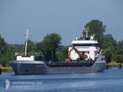
WESTBORG
General Cargo
Current Trip
| Time Travelled | 15 h, 34 mins |
|---|---|
| Remaining Time | --- |
| Distance Travelled | 124.46 nm |
| Remaining Distance | 0.72 nm |
| AVG Speed | 10 Knots |
| MAX Speed | 12.1 Knots |
| AVG Wind | 10.6 knots |
| MAX Wind | 13.5 knots |
| MIN Temp | -2°C / 28.4°F |
| MAX Temp | 1.4°C / 34.52°F |
| Dybgang | 4.2 m |
| Position Modtaget | 2 m siden |
Current Position
| Longitude | 22.28997° |
|---|---|
| Latitude | 60.28276° |
| Status | Moored |
| Fart | |
| Kurs | 45° |
| Område | Gulf of Bothnia |
| Station | T-AIS |
| Position Modtaget | 2 m siden |
Info
Information
The current position of WESTBORG is in Gulf of Bothnia with coordinates 60.28276° / 22.28997° as reported on 2024-04-20 04:38 by AIS to our vessel tracker app. The vessel's current speed is 0 Knots and is heading at the port of PARGAS. The estimated time of arrival as calculated by MyShipTracking vessel tracking app is 2024-04-20 01:00 LT
The vessel WESTBORG (IMO: 9196187, MMSI: 246457000) is a General Cargo that was built in 2000 ( 24 år gamle ). It's sailing under the flag of [NL] Netherlands.
In this page you can find informations about the vessels current position, last detected port calls, and current voyage information. If the vessels is not in coverage by AIS you will find the latest position.
The current position of WESTBORG is detected by our AIS receivers and we are not responsible for the reliability of the data. The last position was recorded while the vessel was in Coverage by the Ais receivers of our vessel tracking app.
The current draught of WESTBORG as reported by AIS is 4.2 meters
Weather
| Temperature | -1.4°C / 29.48°F |
|---|---|
| Wind Speed | 10 knots |
| Direction | 341° NNW |
| Pressure | 1004.3 hPa |
| Humidity | 87.4 % |
| Cloud Coverage | 100 % |
Featured Company
Last Port Calls
| Port | Arrival | Departure | Time In Port |
|---|---|---|---|
| 2024-04-19 05:56 | 2024-04-19 13:07 | 7 h | |
| 2024-04-14 09:27 | 2024-04-16 09:14 | 1 d | |
| 2024-04-13 23:41 | 2024-04-14 00:23 | 42 m | |
| 2024-04-13 01:48 | 2024-04-13 17:14 | 15 h | |
| 2024-04-12 18:45 | 2024-04-12 19:09 | 23 m | |
| 2024-04-11 17:10 | 2024-04-12 09:14 | 16 h | |
| 2024-04-11 16:54 | 2024-04-11 16:58 | 4 m | |
| 2024-04-10 05:56 | 2024-04-10 14:13 | 8 h | |
| 2024-04-05 16:23 | 2024-04-06 14:25 | 22 h | |
| 2024-04-03 05:36 | 2024-04-04 22:40 | 1 d |
Last Trips
| Origin | Departure | Destination | Arrival | Distance | |
|---|---|---|---|---|---|
| 2024-04-16 11:14 | 2024-04-19 08:56 | 334.04 nm | |||
| 2024-04-14 02:23 | 2024-04-14 11:27 | 90.49 nm | |||
| 2024-04-13 19:14 | 2024-04-14 01:41 | 64.66 nm | |||
| 2024-04-12 21:09 | 2024-04-13 03:48 | 65.23 nm | |||
| 2024-04-12 11:14 | 2024-04-12 20:45 | 92.09 nm | |||
| 2024-04-11 18:58 | 2024-04-11 19:10 | 0.19 nm | |||
| 2024-04-10 17:13 | 2024-04-11 18:54 | 230.43 nm | |||
| 2024-04-06 16:25 | 2024-04-10 08:56 | 331.47 nm | |||
| 2024-04-05 01:40 | 2024-04-05 18:23 | 190.66 nm | |||
| 2024-03-27 16:16 | 2024-04-03 08:36 | 854.60 nm |
Events
| Tid | Hændelsen | Detaljer | Position / Dest | Info |
|---|---|---|---|---|
| 2024-04-20 00:17 | Status er ændret | Moored Under way using engine |
60.28277 / 22.28994
FIPAR
|
Fart: Kurs: 47° |
| 2024-04-20 00:05 | STOP Sejllads | 0.91 nm, South of PARGAS |
60.28243 / 22.29112
FIPAR
|
Fart: 0.3 kn Kurs: 21° |
| 2024-04-19 19:01 | Ændre havområde | Finnish part of the Gulf of Bothnia Finnish part of the Baltic Sea |
59.79859 / 22.86695
Gulf of Bothnia
FIPAR
|
Fart: 11.8 kn Kurs: 320.3° |
| 2024-04-19 18:52 | Ændre havområde | Finnish part of the Baltic Sea Finnish part of the Gulf of Finland |
59.78199 / 22.91361
Baltic Sea
FIPAR
|
Fart: 12 kn Kurs: 278.9° |
| 2024-04-19 16:55 | Fundet i havområde | Finnish part of the Gulf of Finland |
59.67944 / 23.62008
Gulf of Finland
FIPAR
|
Fart: 11.8 kn Kurs: 276.8° |
| 2024-04-19 16:55 | Status er ændret | Under way using engine Default |
59.67944 / 23.62008
FIPAR
|
Fart: 11.8 kn Kurs: 277° |
| 2024-04-19 16:36 | Indenfor Dækning |
59.67944 / 23.62008
Gulf of Finland
FIPAR
|
Fart: 11.8 kn Kurs: 276.8° |
|
| 2024-04-19 15:51 | Status er ændret | Default Under way using engine |
59.66103 / 24.03549
FIPAR
|
Fart: 11.9 kn Kurs: 276.2° |
| 2024-04-19 15:10 | Udenfor Dækning |
59.65112 / 24.30256
Gulf of Finland
FIPAR
|
Fart: 11.9 kn Kurs: 276.2° |
|
| 2024-04-19 13:07 | Afsejlet fra sidste havn |
|
59.50592 / 24.95984
FIPAR
|
Fart: 9.2 kn Kurs: 32° |