
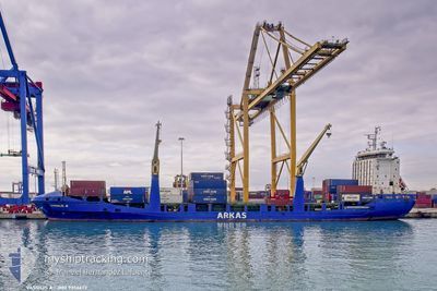
VASSILIS A
Container Ship
Current Trip
| Time Travelled | 13 h, 1 mins |
|---|---|
| Remaining Time | --- |
| Distance Travelled | 140.25 nm |
| Remaining Distance | --- |
| AVG Speed | 11.6 Knots |
| MAX Speed | 15.2 Knots |
| AVG Wind | 11.4 knots |
| MAX Wind | 20 knots |
| MIN Temp | 4.8°C / 40.64°F |
| MAX Temp | 10.6°C / 51.08°F |
| Dybgang | 8.8 m |
| Position Modtaget | 38 m siden |
Current Position
| Longitude | --- |
|---|---|
| Latitude | --- |
| Status | Under way using engine |
| Fart | 11.4 Knots |
| Kurs | 263.8° |
| Område | Aegean Sea |
| Station | T-AIS |
| Position Modtaget | 38 m siden |
Info
Information
The current position of VASSILIS A is in Aegean Sea with coordinates 40.01865° / 26.13661° as reported on 2025-12-09 05:47 by AIS to our vessel tracker app. The vessel's current speed is 11.4 Knots and is heading at the port of ALGER. The estimated time of arrival as calculated by MyShipTracking vessel tracking app is 2025-12-14 20:00 LT
The vessel VASSILIS A (IMO: 9356672, MMSI: 271050951) is a Container Ship that was built in 2009 ( 16 år gamle ). It's sailing under the flag of [TR] Turkey.
In this page you can find informations about the vessels current position, last detected port calls, and current voyage information. If the vessels is not in coverage by AIS you will find the latest position.
The current position of VASSILIS A is detected by our AIS receivers and we are not responsible for the reliability of the data. The last position was recorded while the vessel was in Coverage by the Ais receivers of our vessel tracking app.
The current draught of VASSILIS A as reported by AIS is 8.8 meters
Weather
| Temperature | 10.6°C / 51.08°F |
|---|---|
| Wind Speed | 20 knots |
| Direction | 51° NE |
| Pressure | 1024.5 hPa |
| Humidity | 74.1 % |
| Cloud Coverage | 32 % |
Featured Company
Last Port Calls
| Port | Arrival | Departure | Time In Port |
|---|---|---|---|
| 2025-12-08 08:45 | 2025-12-08 20:24 | 11 h | |
| 2025-12-07 04:15 | 2025-12-08 02:37 | 22 h | |
| 2025-11-24 14:21 | 2025-11-30 14:53 | 6 d | |
| 2025-11-13 18:21 | 2025-11-14 08:31 | 14 h | |
| 2025-11-12 15:53 | 2025-11-13 12:43 | 20 h | |
| 2025-11-08 14:20 | 2025-11-11 07:15 | 2 d | |
| 2025-11-04 19:57 | 2025-11-05 23:08 | 1 d | |
| 2025-10-31 16:29 | 2025-11-02 00:06 | 1 d | |
| 2025-10-26 18:27 | 2025-10-27 04:38 | 10 h | |
| 2025-10-25 17:06 | 2025-10-26 09:09 | 16 h |
Last Trips
| Origin | Departure | Destination | Arrival | Distance | |
|---|---|---|---|---|---|
| 2025-12-08 02:37 | 2025-12-08 08:45 | 57.06 nm | |||
| 2025-11-30 14:53 | 2025-12-07 04:15 | 1494.36 nm | |||
| 2025-11-14 08:31 | 2025-11-24 14:21 | 1804.63 nm | |||
| 2025-11-13 12:43 | 2025-11-13 18:21 | 58.18 nm | |||
| 2025-11-11 07:15 | 2025-11-12 15:53 | 312.29 nm | |||
| 2025-11-05 23:08 | 2025-11-08 14:20 | 565.13 nm | |||
| 2025-11-02 00:06 | 2025-11-04 19:57 | 247.95 nm | |||
| 2025-10-27 04:38 | 2025-10-31 16:29 | 877.78 nm | |||
| 2025-10-26 09:09 | 2025-10-26 18:27 | 55.89 nm | |||
| 2025-10-24 10:02 | 2025-10-25 17:06 | 69.99 nm |
Events
| Tid | Hændelsen | Detaljer | Position / Dest | Info |
|---|---|---|---|---|
| 2025-12-09 05:50 | Status er ændret | Default Under way using engine |
40.01774 / 26.12568
DZALG
|
Fart: 11.4 kn Kurs: 263.8° |
| 2025-12-09 05:40 | Ændre havområde | Turkish part of the Aegean Sea Turkish part of the Sea of Marmara |
40.02323 / 26.16776
Aegean Sea
DZALG
|
Fart: 15 kn Kurs: 260° |
| 2025-12-09 05:39 | Status er ændret | Under way using engine Default |
40.02370 / 26.17087
DZALG
|
Fart: 15.2 kn Kurs: 245° |
| 2025-12-09 05:36 | Status er ændret | Default Under way using engine |
40.02947 / 26.18965
DZALG
|
Fart: 15.1 kn Kurs: 244.7° |
| 2025-12-09 03:45 | Status er ændret | Under way using engine Default |
40.30109 / 26.57208
DZALG
|
Fart: 14.4 kn Kurs: 218° |
| 2025-12-09 03:45 | Indenfor Dækning |
40.29898 / 26.56897
Sea of Marmara
DZALG
|
Fart: 14.2 kn Kurs: 228.1° |
|
| 2025-12-08 23:49 | Status er ændret | Default Under way using engine |
40.74068 / 27.55978
DZALG
|
Fart: 9.7 kn Kurs: 246.6° |
| 2025-12-08 23:41 | Udenfor Dækning |
40.74930 / 27.58644
Sea of Marmara
DZALG
|
Fart: 9.7 kn Kurs: 246.6° |
|
| 2025-12-08 18:44 | ETA er ændret | 2025/12/14 19:00 2025/12/14 05:45 |
40.89979 / 28.60723
DZALG
|
Fart: 9.5 kn Kurs: 244° |
| 2025-12-08 18:11 | START Sejllads | 2.03 nm, South East of AMBARLI |
40.93172 / 28.69951
DZALG
|
Fart: 3.1 kn Kurs: 163° |