
ULTRA TATIO
Cargo
Current Trip
| Time Travelled | 39 days |
|---|---|
| Remaining Time | --- |
| Distance Travelled | 6557.74 nm |
| Remaining Distance | --- |
| AVG Speed | 10.8 Knots |
| MAX Speed | 14 Knots |
| AVG Wind | 9.4 knots |
| MAX Wind | 36.7 knots |
| MIN Temp | 11.2°C / 52.16°F |
| MAX Temp | 29.1°C / 84.38°F |
| Dybgang | 10.1 m |
| Position Modtaget | 2 d siden |
Current Position
| Longitude | 0.28751° |
|---|---|
| Latitude | 36.72703° |
| Status | Under way using engine |
| Fart | 11.7 Knots |
| Kurs | 77.9° |
| Område | Mediterranean Sea - Western Basin |
| Station | T-AIS |
| Position Modtaget | 2 d siden |
Info
Information
The current position of ULTRA TATIO is in Mediterranean Sea - Western Basin with coordinates 36.72703° / 0.28751° as reported on 2024-04-22 01:33 by AIS to our vessel tracker app. The vessel's current speed is 11.7 Knots
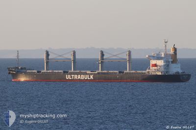
The vessel ULTRA TATIO (IMO: 9782986, MMSI: 538007122) is a Cargo It's sailing under the flag of [MH] Marshall Is.
In this page you can find informations about the vessels current position, last detected port calls, and current voyage information. If the vessels is not in coverage by AIS you will find the latest position.
The current position of ULTRA TATIO is detected by our AIS receivers and we are not responsible for the reliability of the data. The last position was recorded while the vessel was in Coverage by the Ais receivers of our vessel tracking app.
The current draught of ULTRA TATIO as reported by AIS is 10.1 meters
Weather
| Temperature | 14°C / 57.2°F |
|---|---|
| Wind Speed | 13 knots |
| Direction | 340° NNW |
| Pressure | 1017.5 hPa |
| Humidity | 51.7 % |
| Cloud Coverage | 16 % |
Featured Company
Last Port Calls
| Port | Arrival | Departure | Time In Port |
|---|---|---|---|
| 2024-03-13 15:36 | 2024-03-15 14:08 | 1 d | |
| 2024-03-02 02:43 | 2024-03-10 08:15 | 8 d | |
| 2024-02-08 15:03 |
Most Visited Ports (Last year)
| Port | Arrivals | |
|---|---|---|
| 2 | ||
| 2 | ||
| 1 | ||
| 1 | ||
| 1 | ||
| 1 |
Last Trips
| Origin | Departure | Destination | Arrival | Distance | |
|---|---|---|---|---|---|
| 2024-03-10 05:15 | 2024-03-13 12:36 | 620.99 nm | |||
| 2024-02-08 16:03 | 2024-03-01 23:43 | 5785.02 nm |
Events
| Tid | Hændelsen | Detaljer | Position / Dest | Info |
|---|---|---|---|---|
| 2024-04-23 07:13 | STOP Sejllads | 1.06 nm, North of SKIKDA |
36.90707 / 6.93025
DZ SKI
|
Fart: 0.1 kn Kurs: 30° |
| 2024-04-22 01:47 | Status er ændret | Default Under way using engine |
36.74554 / .40670
DZ SKI
|
Fart: 11.7 kn Kurs: 77.9° |
| 2024-04-22 01:33 | Udenfor Dækning |
36.72703 / .28751
Mediterranean Sea - Western Basin
DZ SKI
|
Fart: 11.7 kn Kurs: 77.9° |
|
| 2024-04-21 19:27 | Ændre havområde | Algerian part of the Mediterranean Sea - Western Basin Spanish part of the Mediterranean Sea - Western Basin |
36.52113 / -1.12084
Mediterranean Sea - Western Basin
DZ SKI
|
Fart: 10.9 kn Kurs: 81.1° |
| 2024-04-21 16:31 | Fundet i havområde | Spanish part of the Mediterranean Sea - Western Basin |
36.41551 / -1.79467
Mediterranean Sea - Western Basin
DZ SKI
|
Fart: 12.5 kn Kurs: 77° |
| 2024-04-21 16:31 | Status er ændret | Under way using engine Default |
36.41551 / -1.79467
DZ SKI
|
Fart: 12.6 kn Kurs: 77° |
| 2024-04-21 16:31 | Indenfor Dækning |
36.41551 / -1.79467
Mediterranean Sea - Western Basin
DZ SKI
|
Fart: 12.5 kn Kurs: 77° |
|
| 2024-04-21 15:44 | Status er ændret | Default Under way using engine |
36.38819 / -1.95310
DZ SKI
|
Fart: 12.5 kn Kurs: 81.7° |
| 2024-04-21 15:18 | Udenfor Dækning |
36.37479 / -2.08289
Alboran Sea
DZ SKI
|
Fart: 12.5 kn Kurs: 81.7° |
|
| 2024-04-21 14:17 | Status er ændret | Under way using engine Default |
36.33715 / -2.35166
DZ SKI
|
Fart: 11.8 kn Kurs: 80° |