
TITAN
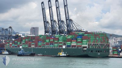
Cargo
Current Trip
| Time Travelled | 3 days |
|---|---|
| Remaining Time | --- |
| Distance Travelled | 489.80 nm |
| Remaining Distance | --- |
| AVG Speed | 11.3 Knots |
| MAX Speed | 16.5 Knots |
| AVG Wind | 13.1 knots |
| MAX Wind | 24.9 knots |
| MIN Temp | 10.7°C / 51.26°F |
| MAX Temp | 16.4°C / 61.52°F |
| Dybgang | 12.4 m |
| Position Modtaget | 16 h, 16 m siden |
Current Position
| Longitude | -75.59371° |
|---|---|
| Latitude | 36.72017° |
| Status | At anchor |
| Fart | |
| Kurs | 199° |
| Område | North Atlantic Ocean |
| Station | T-AIS |
| Position Modtaget | 16 h, 16 m siden |
Info
Information
The current position of TITAN is in North Atlantic Ocean with coordinates 36.72017° / -75.59371° as reported on 2024-04-25 03:48 by AIS to our vessel tracker app. The vessel's current speed is 0 Knots
The vessel TITAN (IMO: 9728928, MMSI: 249558000) is a Cargo It's sailing under the flag of [MT] Malta.
In this page you can find informations about the vessels current position, last detected port calls, and current voyage information. If the vessels is not in coverage by AIS you will find the latest position.
The current position of TITAN is detected by our AIS receivers and we are not responsible for the reliability of the data. The last position was recorded while the vessel was in Coverage by the Ais receivers of our vessel tracking app.
The current draught of TITAN as reported by AIS is 12.4 meters
Weather
| Temperature | 10.9°C / 51.62°F |
|---|---|
| Wind Speed | 20 knots |
| Direction | 36° NE |
| Pressure | 1023 hPa |
| Humidity | 91.5 % |
| Cloud Coverage | 8 % |
Featured Company
Last Port Calls
| Port | Arrival | Departure | Time In Port |
|---|---|---|---|
| 2024-04-20 09:07 | 2024-04-22 00:07 | 1 d | |
| 2024-04-11 22:25 | 2024-04-13 13:01 | 1 d | |
| 2024-04-06 08:47 | 2024-04-07 07:27 | 22 h | |
| 2024-03-10 07:12 | 2024-03-11 15:02 | 1 d | |
| 2024-03-09 00:58 | 2024-03-10 02:32 | 1 d | |
| 2024-03-05 12:44 | 2024-03-07 21:18 | 2 d | |
| 2024-02-21 05:11 | 2024-02-21 23:59 | 18 h |
Last Trips
| Origin | Departure | Destination | Arrival | Distance | |
|---|---|---|---|---|---|
| 2024-04-13 08:01 | 2024-04-20 05:07 | 1582.95 nm | |||
| 2024-04-07 01:27 | 2024-04-11 17:25 | 1662.81 nm | |||
| 2024-03-11 23:02 | 2024-04-06 02:47 | 7882.26 nm | |||
| 2024-03-10 10:32 | 2024-03-10 15:12 | 59.66 nm | |||
| 2024-03-08 05:18 | 2024-03-09 08:58 | 355.30 nm | |||
| 2024-02-22 07:59 | 2024-03-05 20:44 | 2438.17 nm | |||
| 2024-01-17 22:09 | 2024-02-21 13:11 | 12379.59 nm |
Events
| Tid | Hændelsen | Detaljer | Position / Dest | Info |
|---|---|---|---|---|
| 2024-04-25 03:54 | Status er ændret | Default At anchor |
36.72010 / -75.59366
NORFOLK
|
Fart: Kurs: 199° |
| 2024-04-25 03:48 | Status er ændret | At anchor Default |
36.72017 / -75.59371
NORFOLK
|
Fart: Kurs: 199° |
| 2024-04-25 03:48 | Udenfor Dækning |
36.72017 / -75.59371
North Atlantic Ocean
|
Fart: Kurs: 247.5° |
|
| 2024-04-25 03:21 | Status er ændret | Default At anchor |
36.72033 / -75.59395
NORFOLK
|
Fart: Kurs: 192° |
| 2024-04-25 03:15 | Status er ændret | At anchor Default |
36.72031 / -75.59395
NORFOLK
|
Fart: Kurs: 190° |
| 2024-04-25 02:48 | Status er ændret | Default At anchor |
36.72042 / -75.59438
NORFOLK
|
Fart: Kurs: 184° |
| 2024-04-25 02:18 | Status er ændret | At anchor Default |
36.72030 / -75.59457
NORFOLK
|
Fart: Kurs: 168° |
| 2024-04-25 02:09 | Status er ændret | Default At anchor |
36.72032 / -75.59473
NORFOLK
|
Fart: Kurs: 174° |
| 2024-04-25 02:03 | Status er ændret | At anchor Default |
36.72029 / -75.59478
NORFOLK
|
Fart: Kurs: 179° |
| 2024-04-25 01:48 | Status er ændret | Default At anchor |
36.72033 / -75.59450
NORFOLK
|
Fart: Kurs: 181° |