
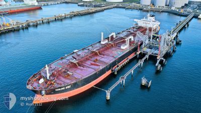
TIANLONG SPIRIT
Crude Oil Tanker
Current Trip
FOR ORDERS
| Time Travelled | --- |
|---|---|
| Remaining Time | --- |
| Distance Travelled | 7280.65 nm |
| Remaining Distance | --- |
| AVG Speed | 9.6 Knots |
| MAX Speed | 14.5 Knots |
| AVG Wind | 12.7 knots |
| MAX Wind | 33 knots |
| MIN Temp | 15.6°C / 60.08°F |
| MAX Temp | 29.6°C / 85.28°F |
| Dybgang | 9.2 m |
| Position Modtaget | 12 d siden |
Current Position
| Longitude | -43.35153° |
|---|---|
| Latitude | -23.55724° |
| Status | Under way using engine |
| Fart | 10.1 Knots |
| Kurs | 200.3° |
| Område | South Atlantic Ocean |
| Station | T-AIS |
| Position Modtaget | 12 d siden |
Info
Information
The current position of TIANLONG SPIRIT is in South Atlantic Ocean with coordinates -23.55724° / -43.35153° as reported on 2024-04-12 14:57 by AIS to our vessel tracker app. The vessel's current speed is 10.1 Knots
The vessel TIANLONG SPIRIT (IMO: 9378369, MMSI: 309686000) is a Crude Oil Tanker that was built in 2009 ( 15 år gamle ). It's sailing under the flag of [BS] Bahamas.
In this page you can find informations about the vessels current position, last detected port calls, and current voyage information. If the vessels is not in coverage by AIS you will find the latest position.
The current position of TIANLONG SPIRIT is detected by our AIS receivers and we are not responsible for the reliability of the data. The last position was recorded while the vessel was in Coverage by the Ais receivers of our vessel tracking app.
The current draught of TIANLONG SPIRIT as reported by AIS is 9.2 meters
Weather
| Temperature | 16.6°C / 61.88°F |
|---|---|
| Wind Speed | 11 knots |
| Direction | 37° NE |
| Pressure | 1018.4 hPa |
| Humidity | 67.7 % |
| Cloud Coverage | 1 % |
Featured Company
Last Port Calls
| Port | Arrival | Departure | Time In Port |
|---|---|---|---|
| 2024-02-02 22:51 | 2024-02-05 05:52 | 2 d | |
| 2024-02-02 20:43 |
Most Visited Ports (Last year)
| Port | Arrivals | |
|---|---|---|
| 1 | ||
| 1 | ||
| 1 | ||
| 1 | ||
| 1 | ||
| 1 |
Last Trips
| Origin | Departure | Destination | Arrival | Distance | |
|---|---|---|---|---|---|
| 2024-02-02 21:43 | 2024-02-02 23:51 | 17.63 nm |
Events
| Tid | Hændelsen | Detaljer | Position / Dest | Info |
|---|---|---|---|---|
| 2024-04-25 09:32 | START Sejllads | 18.89 nm, South East of LA PALOMA |
-34.84333 / -53.84167
FOR ORDERS
|
Fart: 4 kn Kurs: -1° |
| 2024-04-25 08:47 | STOP Sejllads | 18.18 nm, South East of LA PALOMA |
-34.84167 / -53.85833
FOR ORDERS
|
Fart: Kurs: -1° |
| 2024-04-25 07:59 | START Sejllads | 17.28 nm, South East of LA PALOMA |
-34.81986 / -53.86102
FOR ORDERS
|
Fart: 3.1 kn Kurs: 166° |
| 2024-04-25 05:44 | STOP Sejllads | 17.31 nm, South East of LA PALOMA |
-34.84500 / -53.88500
FOR ORDERS
|
Fart: Kurs: -1° |
| 2024-04-23 12:27 | START Sejllads |
-35.34508 / -52.52139
FOR ORDERS
|
Fart: 3.1 kn Kurs: 40° |
|
| 2024-04-23 03:53 | STOP Sejllads |
-35.19333 / -52.59167
FOR ORDERS
|
Fart: Kurs: -1° |
|
| 2024-04-22 16:08 | START Sejllads |
-34.95811 / -51.82721
FOR ORDERS
|
Fart: 5.1 kn Kurs: 257° |
|
| 2024-04-21 11:29 | STOP Sejllads |
-35.00500 / -51.36666
FOR ORDERS
|
Fart: Kurs: -1° |
|
| 2024-04-17 21:29 | START Sejllads |
-34.87170 / -50.79908
FOR ORDERS
|
Fart: 3.1 kn Kurs: 249° |
|
| 2024-04-17 12:32 | STOP Sejllads |
-34.90167 / -50.87667
FOR ORDERS
|
Fart: Kurs: -1° |