
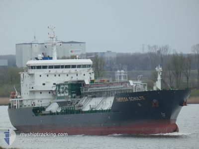
THERESA SCHULTE
Tanker C
Current Trip
| Trip Time | 55 days |
|---|---|
| Trip Distance | 11672.43 nm |
| AVG Speed | 11 Knots |
| MAX Speed | 15.4 Knots |
| Dybgang | 7 m |
| AVG Wind | 15.3 knots |
| MAX Wind | 33 knots |
| MIN Temp | 6.9°C / 44.42°F |
| MAX Temp | 29.6°C / 85.28°F |
| Position Modtaget | 1 m siden |
Current Position
| Longitude | 3.76779° |
|---|---|
| Latitude | 51.34546° |
| Status | Moored |
| Fart | 0.1 Knots |
| Kurs | 176° |
| Område | North Sea |
| Station | T-AIS |
| Position Modtaget | 1 m siden |
Info
Information
The current position of THERESA SCHULTE is in North Sea with coordinates 51.34546° / 3.76779° as reported on 2024-04-25 20:18 by AIS to our vessel tracker app. The vessel's current speed is 0.1 Knots and is currently inside the port of TERNEUZEN.
The vessel THERESA SCHULTE (IMO: 9553622, MMSI: 563087500) is a Tanker C It's sailing under the flag of [SG] Singapore.
In this page you can find informations about the vessels current position, last detected port calls, and current voyage information. If the vessels is not in coverage by AIS you will find the latest position.
The current position of THERESA SCHULTE is detected by our AIS receivers and we are not responsible for the reliability of the data. The last position was recorded while the vessel was in Coverage by the Ais receivers of our vessel tracking app.
The current draught of THERESA SCHULTE as reported by AIS is 7 meters
Weather
| Temperature | 7.6°C / 45.68°F |
|---|---|
| Wind Speed | 13 knots |
| Direction | 243° WSW |
| Pressure | 1002.2 hPa |
| Humidity | 88.9 % |
| Cloud Coverage | 100 % |
Featured Company
Events
| Tid | Hændelsen | Detaljer | Position / Dest | Info |
|---|---|---|---|---|
| 2024-04-25 20:15 | Status er ændret | Moored Under way using engine |
51.34547 / 3.76779
[NL] TERNEUZEN
|
Fart: 0.1 kn Kurs: 176° |
| 2024-04-25 19:39 | STOP Sejllads |
51.34548 / 3.76753
[NL] TERNEUZEN
|
Fart: 0.3 kn Kurs: 175° |
|
| 2024-04-25 19:32 | Skibe i havn |
|
51.34941 / 3.76681
[NL] TERNEUZEN
|
Fart: 5.4 kn Kurs: 179.7° |
| 2024-04-25 17:04 | Ændre havområde | Dutch part of the North Sea Belgian part of the North Sea |
51.40540 / 3.33367
North Sea
|
Fart: 7.2 kn Kurs: 88.1° |
| 2024-04-25 13:58 | Dybgangen er ændret | 7 6.9 |
51.39808 / 2.56612
NLTNZ
|
Fart: 6 kn Kurs: 158.8° |
| 2024-04-25 13:55 | Status er ændret | Under way using engine At anchor |
51.40259 / 2.56340
NLTNZ
|
Fart: 5.9 kn Kurs: 161.8° |
| 2024-04-25 13:36 | START Sejllads | 18.25 nm, North West of OOSTENDE |
51.42534 / 2.57627
NLTNZ
|
Fart: 3.5 kn Kurs: 221° |
| 2024-04-24 23:49 | Status er ændret | At anchor Default |
51.42336 / 2.57867
NLTNZ
|
Fart: 0.4 kn Kurs: 327° |
| 2024-04-24 23:43 | Status er ændret | Default At anchor |
51.42322 / 2.57812
NLTNZ
|
Fart: 0.4 kn Kurs: 327° |
| 2024-04-24 19:34 | Status er ændret | At anchor Under way using engine |
51.42316 / 2.57643
NLTNZ
|
Fart: Kurs: 0° |