
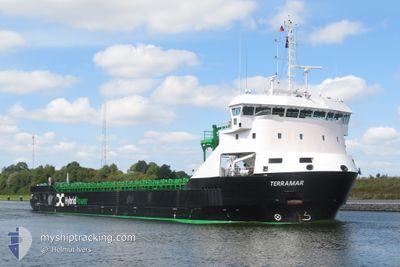
TERRAMAR
Cargo
Current Trip
| Time Travelled | 2 days |
|---|---|
| Remaining Time | 8 days |
| Distance Travelled | 370.25 nm |
| Remaining Distance | 770.36 nm |
| AVG Speed | 8 Knots |
| MAX Speed | 12.1 Knots |
| AVG Wind | 20 knots |
| MAX Wind | 32.2 knots |
| MIN Temp | 3.2°C / 37.76°F |
| MAX Temp | 13.1°C / 55.58°F |
| Dybgang | 4.6 m |
| Position Modtaget | 3 m siden |
Current Position
| Longitude | --- |
|---|---|
| Latitude | --- |
| Status | Under way using engine |
| Fart | 5 Knots |
| Kurs | 215.7° |
| Område | English Channel |
| Station | T-AIS |
| Position Modtaget | 3 m siden |
Info
Information
The current position of TERRAMAR is in English Channel with coordinates 50.60281° / 0.61395° as reported on 2025-12-07 21:55 by AIS to our vessel tracker app. The vessel's current speed is 5 Knots and is heading at the port of VIANA DO CASTELO. The estimated time of arrival as calculated by MyShipTracking vessel tracking app is 2025-12-16 02:35 LT
The vessel TERRAMAR (IMO: 9951874, MMSI: 210695000) is a Cargo It's sailing under the flag of [CY] Cyprus.
In this page you can find informations about the vessels current position, last detected port calls, and current voyage information. If the vessels is not in coverage by AIS you will find the latest position.
The current position of TERRAMAR is detected by our AIS receivers and we are not responsible for the reliability of the data. The last position was recorded while the vessel was in Coverage by the Ais receivers of our vessel tracking app.
The current draught of TERRAMAR as reported by AIS is 4.6 meters
Weather
| Temperature | 13°C / 55.4°F |
|---|---|
| Wind Speed | 24 knots |
| Direction | 256° WSW |
| Pressure | 1007.1 hPa |
| Humidity | 84.1 % |
| Cloud Coverage | 77 % |
Featured Company
Last Port Calls
| Port | Arrival | Departure | Time In Port |
|---|---|---|---|
| 2025-12-05 11:21 | 2025-12-05 22:58 | 11 h | |
| 2025-11-17 13:07 | 2025-11-20 01:07 | 2 d | |
| 2025-11-10 10:14 | 2025-11-12 08:24 | 1 d | |
| 2025-11-05 04:36 | |||
| 2025-10-25 11:14 | 2025-11-01 17:01 | 7 d | |
| 2025-10-16 05:04 | 2025-10-17 00:21 | 19 h | |
| 2025-10-15 22:40 | 2025-10-15 23:20 | 40 m | |
| 2025-10-15 20:36 | 2025-10-15 21:16 | 39 m | |
| 2025-10-13 16:47 | 2025-10-15 19:19 | 2 d | |
| 2025-10-13 14:28 | 2025-10-13 15:45 | 1 h |
Last Trips
| Origin | Departure | Destination | Arrival | Distance | |
|---|---|---|---|---|---|
| 2025-11-12 08:24 | 2025-11-17 13:07 | 1101.74 nm | |||
| 2025-11-01 17:01 | 2025-11-05 04:36 | 748.21 nm | |||
| 2025-10-17 00:21 | 2025-10-25 11:14 | 1314.95 nm | |||
| 2025-10-15 23:20 | 2025-10-16 05:04 | 41.93 nm | |||
| 2025-10-15 21:16 | 2025-10-15 22:40 | 11.61 nm | |||
| 2025-10-15 19:19 | 2025-10-15 20:36 | 10.13 nm | |||
| 2025-10-13 15:45 | 2025-10-13 16:47 | 7.13 nm | |||
| 2025-10-08 08:53 | 2025-10-13 14:28 | 331.25 nm | |||
| 2025-09-30 20:31 | 2025-10-08 06:11 | 854.98 nm |
Events
| Tid | Hændelsen | Detaljer | Position / Dest | Info |
|---|---|---|---|---|
| 2025-12-07 19:20 | Indenfor Dækning |
50.70094 / .82678
English Channel
PTVDC
|
Fart: 5.2 kn Kurs: 239.5° |
|
| 2025-12-07 13:57 | Udenfor Dækning |
50.97345 / 1.36715
English Channel
PTVDC
|
Fart: 5.1 kn Kurs: 220.8° |
|
| 2025-12-07 12:37 | Ændre havområde | United Kingdom part of the English Channel United Kingdom part of the North Sea |
51.06316 / 1.48976
English Channel
PTVDC
|
Fart: 6.1 kn Kurs: 218.1° |
| 2025-12-07 09:49 | ETA er ændret | 2025/12/15 08:00 2025/12/11 18:00 |
51.39517 / 1.91707
PTVDC
|
Fart: 12 kn Kurs: 210.4° |
| 2025-12-07 06:40 | Fundet i havområde | United Kingdom part of the North Sea |
51.82930 / 2.50151
North Sea
PTVDC
|
Fart: 9.3 kn Kurs: 219.9° |
| 2025-12-07 06:25 | Fundet i havområde | Belgian part of the North Sea |
51.85838 / 2.54096
North Sea
PTVDC
|
Fart: 9 kn Kurs: 220.4° |
| 2025-12-07 04:05 | Indenfor Dækning |
52.09292 / 2.85394
North Sea
PTVDC
|
Fart: 6.8 kn Kurs: 219.3° |
|
| 2025-12-06 17:58 | Udenfor Dækning |
53.04920 / 4.15891
North Sea
PTVDC
|
Fart: 6.2 kn Kurs: 227.6° |
|
| 2025-12-06 06:26 | Fundet i havområde | Dutch part of the North Sea |
53.79745 / 6.24465
North Sea
PTVDC
|
Fart: 8 kn Kurs: 255° |
| 2025-12-06 05:29 | Indenfor Dækning |
53.83287 / 6.46115
North Sea
PTVDC
|
Fart: 8.7 kn Kurs: 255.2° |