
TAI SUMMIT
Cargo
Current Trip
| Trip Time | 2 days |
|---|---|
| Trip Distance | 737.32 nm |
| AVG Speed | 10.7 Knots |
| MAX Speed | 13.4 Knots |
| Dybgang | 9.4 m |
| AVG Wind | 14 knots |
| MAX Wind | 21.5 knots |
| MIN Temp | 4°C / 39.2°F |
| MAX Temp | 10.7°C / 51.26°F |
| Position Modtaget | Nu |
Current Position
| Longitude | 9.73589° |
|---|---|
| Latitude | 55.55468° |
| Status | Under way sailing |
| Fart | 0.5 Knots |
| Kurs | 217° |
| Område | Kattegat |
| Station | T-AIS |
| Position Modtaget | Nu |
Info
Information
The current position of TAI SUMMIT is in Kattegat with coordinates 55.55468° / 9.73589° as reported on 2024-04-19 03:40 by AIS to our vessel tracker app. The vessel's current speed is 0.5 Knots and is currently inside the port of FREDERICIA.
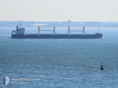
The vessel TAI SUMMIT (IMO: 9727144, MMSI: 374458000) is a Cargo It's sailing under the flag of [PA] Panama.
In this page you can find informations about the vessels current position, last detected port calls, and current voyage information. If the vessels is not in coverage by AIS you will find the latest position.
The current position of TAI SUMMIT is detected by our AIS receivers and we are not responsible for the reliability of the data. The last position was recorded while the vessel was in Coverage by the Ais receivers of our vessel tracking app.
The current draught of TAI SUMMIT as reported by AIS is 9.4 meters
Weather
| Temperature | 4.6°C / 40.28°F |
|---|---|
| Wind Speed | 12 knots |
| Direction | 176° S |
| Pressure | 1003.6 hPa |
| Humidity | 95.9 % |
| Cloud Coverage | 100 % |
Featured Company
Last Port Calls
| Port | Arrival | Departure | Time In Port |
|---|---|---|---|
| 2024-04-19 03:23 | |||
| 2024-04-12 21:16 | 2024-04-16 11:54 | 3 d | |
| 2024-04-08 13:47 | 2024-04-09 17:23 | 1 d | |
| 2024-03-19 04:56 | |||
| 2024-02-17 19:35 | |||
| 2024-02-05 19:19 | 2024-02-08 19:45 | 3 d |
Last Trips
| Origin | Departure | Destination | Arrival | Distance | |
|---|---|---|---|---|---|
| 2024-04-16 13:54 | 2024-04-19 05:23 | 737.32 nm | |||
| 2024-04-09 19:23 | 2024-04-12 23:16 | 758.00 nm | |||
| 2024-03-19 06:56 | 2024-04-08 15:47 | 5539.88 nm | |||
| 2024-02-09 01:15 | 2024-02-18 01:05 | 664.65 nm | |||
| 2023-11-15 21:16 | 2024-02-06 00:49 | 7760.50 nm |
Events
| Tid | Hændelsen | Detaljer | Position / Dest | Info |
|---|---|---|---|---|
| 2024-04-19 03:23 | Skibe i havn |
|
55.55530 / 9.75509
[DK] FREDERICIA
|
Fart: 3.3 kn Kurs: 275° |
| 2024-04-18 14:41 | Ændre havområde | Danish part of the Kattegat Swedish part of the Kattegat |
57.25198 / 11.55435
Kattegat
DK FRC
|
Fart: 12.6 kn Kurs: 163.4° |
| 2024-04-18 13:14 | Ændre havområde | Swedish part of the Kattegat Danish part of the Kattegat |
57.52412 / 11.33209
Kattegat
DK FRC
|
Fart: 12.5 kn Kurs: 130.6° |
| 2024-04-18 11:28 | Ændre havområde | Danish part of the Kattegat Danish part of the Skaggerak |
57.77967 / 10.85595
Kattegat
DK FRC
|
Fart: 11.7 kn Kurs: 129.4° |
| 2024-04-18 03:44 | Fundet i havområde | Danish part of the Skaggerak |
57.29717 / 8.30924
Skaggerak
DK FRC
|
Fart: 12.7 kn Kurs: 34.6° |
| 2024-04-17 20:10 | ETA er ændret | 2024/04/19 03:00 2024/04/19 07:00 |
55.97142 / 6.71005
DK FRC
|
Fart: 12.4 kn Kurs: 37.1° |
| 2024-04-17 19:19 | Status er ændret | Under way sailing Default |
55.83857 / 6.51056
DK FRC
|
Fart: 12 kn Kurs: 20° |
| 2024-04-17 18:54 | Status er ændret | Default Under way sailing |
55.77007 / 6.43143
DK FRC
|
Fart: 11.9 kn Kurs: 23.7° |
| 2024-04-17 18:28 | Fundet i havområde | Danish part of the North Sea |
55.69278 / 6.37085
North Sea
DK FRC
|
Fart: 11.9 kn Kurs: 23.7° |
| 2024-04-17 18:28 | Status er ændret | Under way sailing Default |
55.69278 / 6.37085
DK FRC
|
Fart: 12.1 kn Kurs: 23° |