
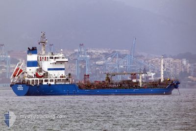
SYMI
Tanker
Current Trip
| Time Travelled | 22 h, 29 mins |
|---|---|
| Remaining Time | --- |
| Distance Travelled | 38.45 nm |
| Remaining Distance | 4.50 nm |
| AVG Speed | 7.1 Knots |
| MAX Speed | 11 Knots |
| AVG Wind | 7.3 knots |
| MAX Wind | 11.4 knots |
| MIN Temp | 9.9°C / 49.82°F |
| MAX Temp | 19.3°C / 66.74°F |
| Dybgang | 4.9 m |
| Position Modtaget | 6 m siden |
Current Position
| Longitude | -5.59413° |
|---|---|
| Latitude | 35.85671° |
| Status | At anchor |
| Fart | 0.2 Knots |
| Kurs | 291° |
| Område | Strait of Gibraltar |
| Station | T-AIS |
| Position Modtaget | 6 m siden |
Info
Information
The current position of SYMI is in Strait of Gibraltar with coordinates 35.85671° / -5.59413° as reported on 2024-04-24 18:18 by AIS to our vessel tracker app. The vessel's current speed is 0.2 Knots and is heading at the port of TANGER MED. The estimated time of arrival as calculated by MyShipTracking vessel tracking app is 2024-04-24 10:00 LT
The vessel SYMI (IMO: 9418016, MMSI: 236717000) is a Tanker It's sailing under the flag of [GI] Gibraltar.
In this page you can find informations about the vessels current position, last detected port calls, and current voyage information. If the vessels is not in coverage by AIS you will find the latest position.
The current position of SYMI is detected by our AIS receivers and we are not responsible for the reliability of the data. The last position was recorded while the vessel was in Coverage by the Ais receivers of our vessel tracking app.
The current draught of SYMI as reported by AIS is 4.9 meters
Weather
| Temperature | 16.2°C / 61.16°F |
|---|---|
| Wind Speed | 5 knots |
| Direction | 82° E |
| Pressure | 1015.1 hPa |
| Humidity | 75.4 % |
| Cloud Coverage | 100 % |
Featured Company
Last Port Calls
| Port | Arrival | Departure | Time In Port |
|---|---|---|---|
| 2024-04-23 16:19 | 2024-04-23 19:55 | 3 h | |
| 2024-04-20 21:47 | 2024-04-21 03:32 | 5 h | |
| 2024-04-17 12:19 | 2024-04-18 00:33 | 12 h | |
| 2024-04-17 00:21 | 2024-04-17 04:30 | 4 h | |
| 2024-04-15 02:05 | 2024-04-15 16:11 | 14 h | |
| 2024-04-14 10:35 | 2024-04-14 18:26 | 7 h | |
| 2024-04-13 11:12 | 2024-04-13 18:51 | 7 h | |
| 2024-04-12 20:51 | 2024-04-13 08:17 | 11 h | |
| 2024-04-12 03:45 | 2024-04-12 13:34 | 9 h | |
| 2024-04-11 09:18 | 2024-04-11 15:14 | 5 h |
Most Visited Ports (Last year)
| Port | Arrivals | |
|---|---|---|
| 159 | ||
| 107 | ||
| 6 | ||
| 5 | ||
| 1 |
Last Trips
| Origin | Departure | Destination | Arrival | Distance | |
|---|---|---|---|---|---|
| 2024-04-21 04:32 | 2024-04-23 18:19 | 143.56 nm | |||
| 2024-04-18 01:33 | 2024-04-20 22:47 | 103.15 nm | |||
| 2024-04-17 06:30 | 2024-04-17 13:19 | 23.81 nm | |||
| 2024-04-15 18:11 | 2024-04-17 02:21 | 20.76 nm | |||
| 2024-04-14 19:26 | 2024-04-15 04:05 | 19.33 nm | |||
| 2024-04-13 18:51 | 2024-04-14 11:35 | 35.69 nm | |||
| 2024-04-13 10:17 | 2024-04-13 11:12 | 24.05 nm | |||
| 2024-04-12 15:34 | 2024-04-12 22:51 | 2.32 nm | |||
| 2024-04-11 17:14 | 2024-04-12 05:45 | 8.46 nm | |||
| 2024-04-11 07:21 | 2024-04-11 11:18 | 17.50 nm |
Events
| Tid | Hændelsen | Detaljer | Position / Dest | Info |
|---|---|---|---|---|
| 2024-04-24 18:06 | Status er ændret | At anchor Default |
35.85612 / -5.59426
TANGER MED
|
Fart: Kurs: 255° |
| 2024-04-24 17:48 | Status er ændret | Default At anchor |
35.85635 / -5.59401
TANGER MED
|
Fart: 0.1 kn Kurs: 244° |
| 2024-04-24 17:36 | Status er ændret | At anchor Default |
35.85636 / -5.59419
TANGER MED
|
Fart: 0.1 kn Kurs: 246° |
| 2024-04-24 17:28 | Status er ændret | Default At anchor |
35.85500 / -5.59333
TANGER MED
|
Fart: 0.5 kn Kurs: 228° |
| 2024-04-24 17:24 | Status er ændret | At anchor Under way using engine |
35.85718 / -5.59501
TANGER MED
|
Fart: 0.4 kn Kurs: 232° |
| 2024-04-24 17:22 | STOP Sejllads | 1.41 nm, North West of KSAR SEGHIR |
35.85738 / -5.59504
TANGER MED
|
Fart: 0.3 kn Kurs: 246° |
| 2024-04-24 16:28 | START Sejllads | 1.4 nm, South West of TANGER MED |
35.86392 / -5.53924
TANGER MED
|
Fart: 3.5 kn Kurs: 257° |
| 2024-04-24 16:23 | Status er ændret | Under way using engine Default |
35.86501 / -5.53796
TANGER MED
|
Fart: Kurs: 219° |
| 2024-04-24 16:08 | Indenfor Dækning |
35.86490 / -5.53827
Strait of Gibraltar
|
Fart: 0.8 kn Kurs: 228.9° |
|
| 2024-04-24 13:02 | Udenfor Dækning |
35.86499 / -5.53780
Strait of Gibraltar
TANGER MED
|
Fart: Kurs: 249.3° |