
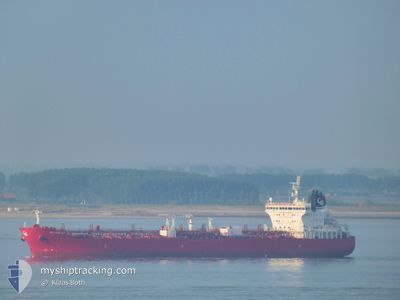
STI PIMLICO
Tanker
Current Trip
| Time Travelled | 3 days |
|---|---|
| Remaining Time | --- |
| Distance Travelled | 722.96 nm |
| Remaining Distance | --- |
| AVG Speed | 11.6 Knots |
| MAX Speed | 13.3 Knots |
| AVG Wind | 13.4 knots |
| MAX Wind | 32.8 knots |
| MIN Temp | 16.3°C / 61.34°F |
| MAX Temp | 20.5°C / 68.9°F |
| Dybgang | 8.5 m |
| Position Modtaget | 1 m siden |
Current Position
| Longitude | 26.40699° |
|---|---|
| Latitude | 40.20637° |
| Status | Under way using engine |
| Fart | 13.1 Knots |
| Kurs | 58.9° |
| Område | Sea of Marmara |
| Station | T-AIS |
| Position Modtaget | 1 m siden |
Info
Information
The current position of STI PIMLICO is in Sea of Marmara with coordinates 40.20637° / 26.40699° as reported on 2024-04-25 17:05 by AIS to our vessel tracker app. The vessel's current speed is 13.1 Knots and is heading at the port of POTI. The estimated time of arrival as calculated by MyShipTracking vessel tracking app is 2024-04-26 07:30 LT
The vessel STI PIMLICO (IMO: 9686871, MMSI: 538005398) is a Tanker It's sailing under the flag of [MH] Marshall Is.
In this page you can find informations about the vessels current position, last detected port calls, and current voyage information. If the vessels is not in coverage by AIS you will find the latest position.
The current position of STI PIMLICO is detected by our AIS receivers and we are not responsible for the reliability of the data. The last position was recorded while the vessel was in Coverage by the Ais receivers of our vessel tracking app.
The current draught of STI PIMLICO as reported by AIS is 8.5 meters
Weather
| Temperature | 16.5°C / 61.7°F |
|---|---|
| Wind Speed | 11 knots |
| Direction | 218° SW |
| Pressure | 1005.1 hPa |
| Humidity | 66.3 % |
| Cloud Coverage | 1 % |
Featured Company
Last Port Calls
| Port | Arrival | Departure | Time In Port |
|---|---|---|---|
| 2024-04-20 06:57 | 2024-04-22 05:08 | 1 d | |
| 2024-04-18 04:45 | 2024-04-19 06:40 | 1 d | |
| 2024-04-05 09:44 | 2024-04-07 08:14 | 1 d | |
| 2024-03-22 08:53 | 2024-03-23 05:04 | 20 h | |
| 2024-03-12 20:11 | 2024-03-14 14:29 | 1 d | |
| 2024-02-27 12:37 | |||
| 2024-02-27 08:55 | |||
| 2024-02-15 09:41 | 2024-02-15 10:29 | 47 m | |
| 2024-02-07 14:29 | 2024-02-15 08:44 | 7 d | |
| 2024-02-07 12:47 | 2024-02-07 13:32 | 45 m |
Last Trips
| Origin | Departure | Destination | Arrival | Distance | |
|---|---|---|---|---|---|
| 2024-04-19 08:40 | 2024-04-20 08:57 | 14.19 nm | |||
| 2024-04-07 10:14 | 2024-04-18 06:45 | 1180.05 nm | |||
| 2024-03-23 07:04 | 2024-04-05 11:44 | 2073.49 nm | |||
| 2024-03-14 15:29 | 2024-03-22 10:53 | 1574.60 nm | |||
| 2024-02-27 13:37 | 2024-03-12 21:11 | 1732.86 nm | |||
| 2024-02-15 09:44 | 2024-02-15 10:41 | 4.27 nm | |||
| 2024-02-07 14:32 | 2024-02-07 15:29 | 6.27 nm | |||
| 2024-02-05 12:58 | 2024-02-07 13:47 | 168.79 nm | |||
| 2024-02-03 07:51 | 2024-02-03 08:38 | 5.56 nm | |||
| 2024-01-28 19:55 | 2024-02-03 07:03 | 1377.67 nm |
Events
| Tid | Hændelsen | Detaljer | Position / Dest | Info |
|---|---|---|---|---|
| 2024-04-25 15:44 | Ændre havområde | Turkish part of the Sea of Marmara Turkish part of the Aegean Sea |
40.01633 / 26.19220
Sea of Marmara
MTMAR=>GEPTI
|
Fart: 5.8 kn Kurs: 75.8° |
| 2024-04-25 15:30 | Dybgangen er ændret | 8.5 8.6 |
40.00889 / 26.16112
MTMAR=>GEPTI
|
Fart: 7.7 kn Kurs: 71.7° |
| 2024-04-25 15:09 | Status er ændret | Under way using engine Default |
39.99181 / 26.10627
MTMAR=>GEPTI
|
Fart: 7.6 kn Kurs: 62° |
| 2024-04-25 14:50 | Status er ændret | Default Under way using engine |
39.97256 / 26.05798
MTMAR=>GEPTI
|
Fart: 7.6 kn Kurs: 61.6° |
| 2024-04-25 14:45 | Status er ændret | Under way using engine Default |
39.96788 / 26.04662
MTMAR=>GEPTI
|
Fart: 7.4 kn Kurs: 30° |
| 2024-04-25 14:45 | Indenfor Dækning |
39.96788 / 26.04662
Aegean Sea
MTMAR=>GEPTI
|
Fart: 7.6 kn Kurs: 61.6° |
|
| 2024-04-25 14:07 | START Sejllads | 3.96 nm, North West of BOZCAADA |
39.89100 / 26.03027
MTMAR=>GEPTI
|
Fart: 8.3 kn Kurs: 354° |
| 2024-04-24 18:18 | STOP Sejllads | 3.11 nm, North West of BOZCAADA |
39.87540 / 26.03341
MTMAR=>GEPTI
|
Fart: 0.2 kn Kurs: 136° |
| 2024-04-24 17:42 | Status er ændret | Default Under way using engine |
39.89014 / 25.98120
MTMAR=>GEPTI
|
Fart: 12.7 kn Kurs: 54° |
| 2024-04-24 17:28 | Udenfor Dækning |
39.87624 / 25.92607
Aegean Sea
MTMAR=>GEPTI
|
Fart: 12.7 kn Kurs: 54° |